Severe storm threat Thursday
COLUMBUS, Mississippi (WCBI) – Showers and storms are likely Thursday before colder weather returns Friday.
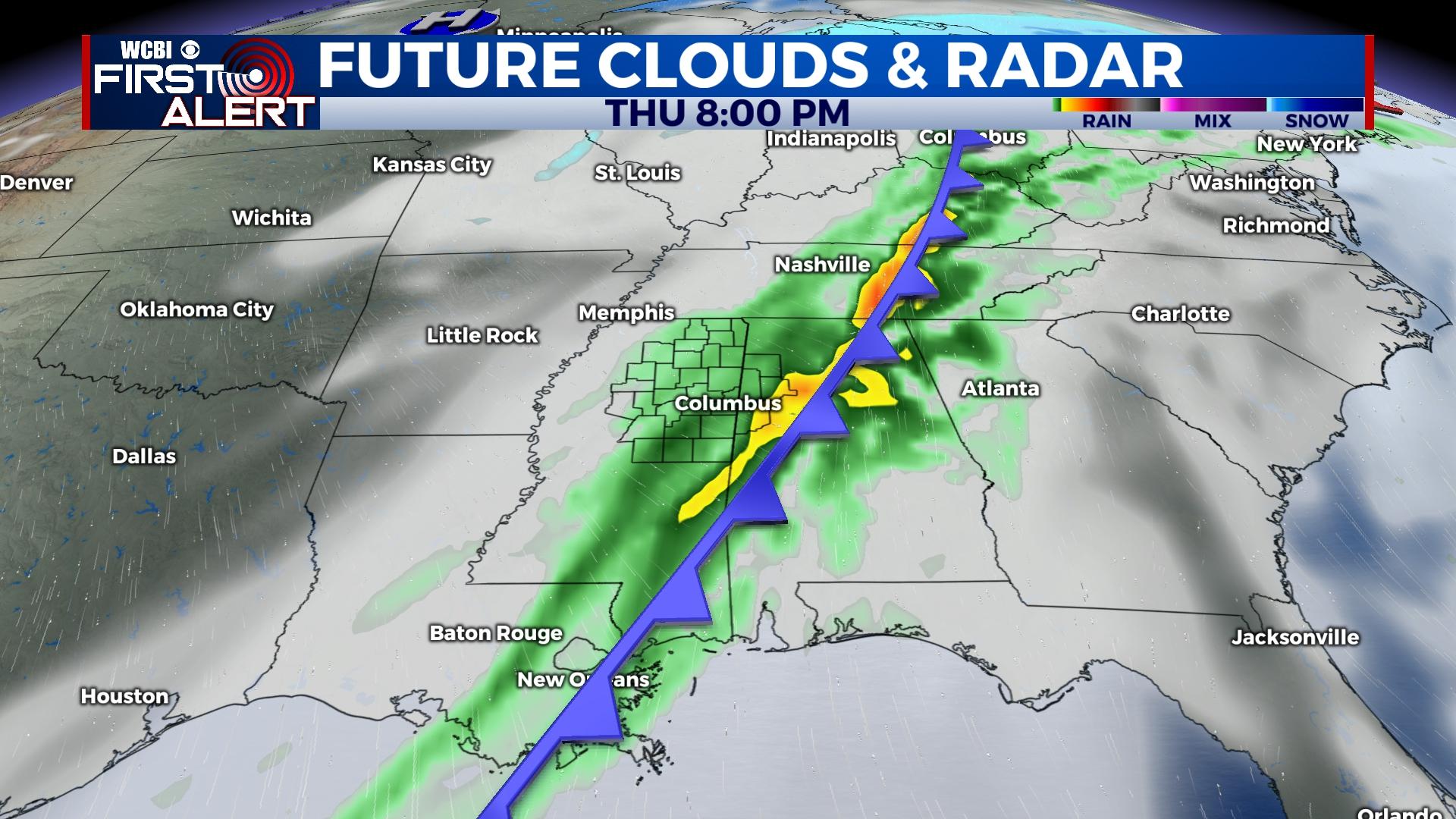
THURSDAY: Ahead of a strong cold front, showers and scattered strong to severe storms are expected to develop from late morning through mid to late afternoon, roughly from 11a-5p. If supercell storms indeed form, a significant risk of large hail, damaging wind, and potentially tornadoes will be possible. There is also the chance of a stronger type tornado. Most if not all storms should exit the region by 6 PM.
THURSDAY NIGHT: Widespread and locally heavy showers will continue behind the storms into the evening hours. Temperatures will drop quickly through the 50s and 40s, reaching the 30s by daybreak Friday.
FRIDAY/WEEKEND: Plenty of sun is in store all three days, but it will remain quite chilly Friday and Saturday morning. It becomes more pleasant Sunday afternoon with highs in the 60s.
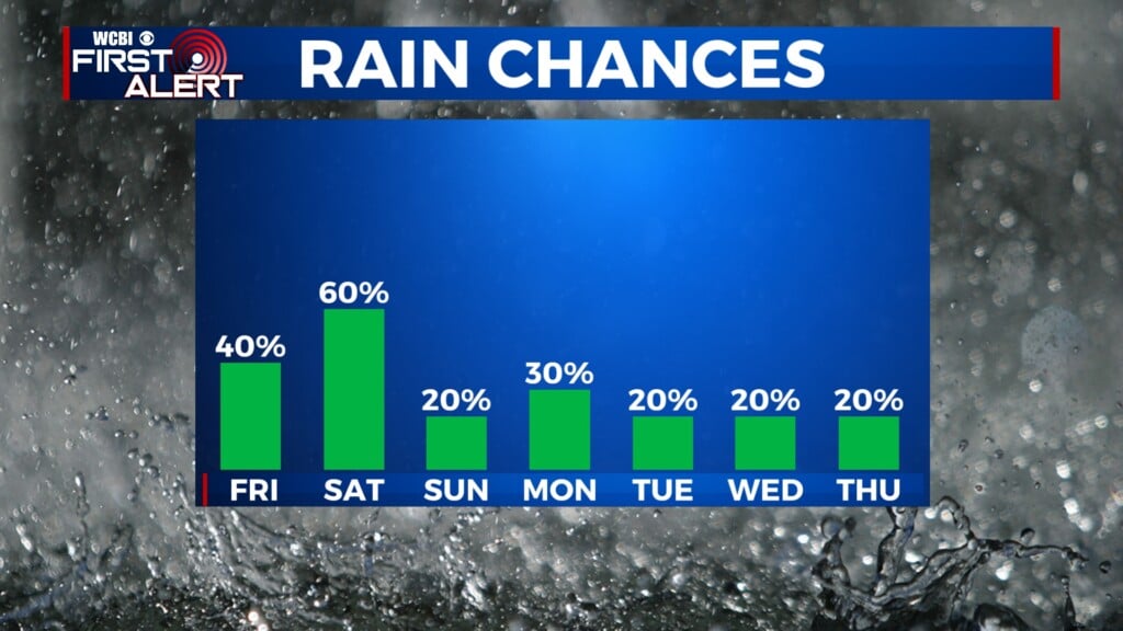
NEXT WEEK: Warmer weather quickly returns ahead of the next storm system. The next rain chance returns Tuesday into Wednesday.