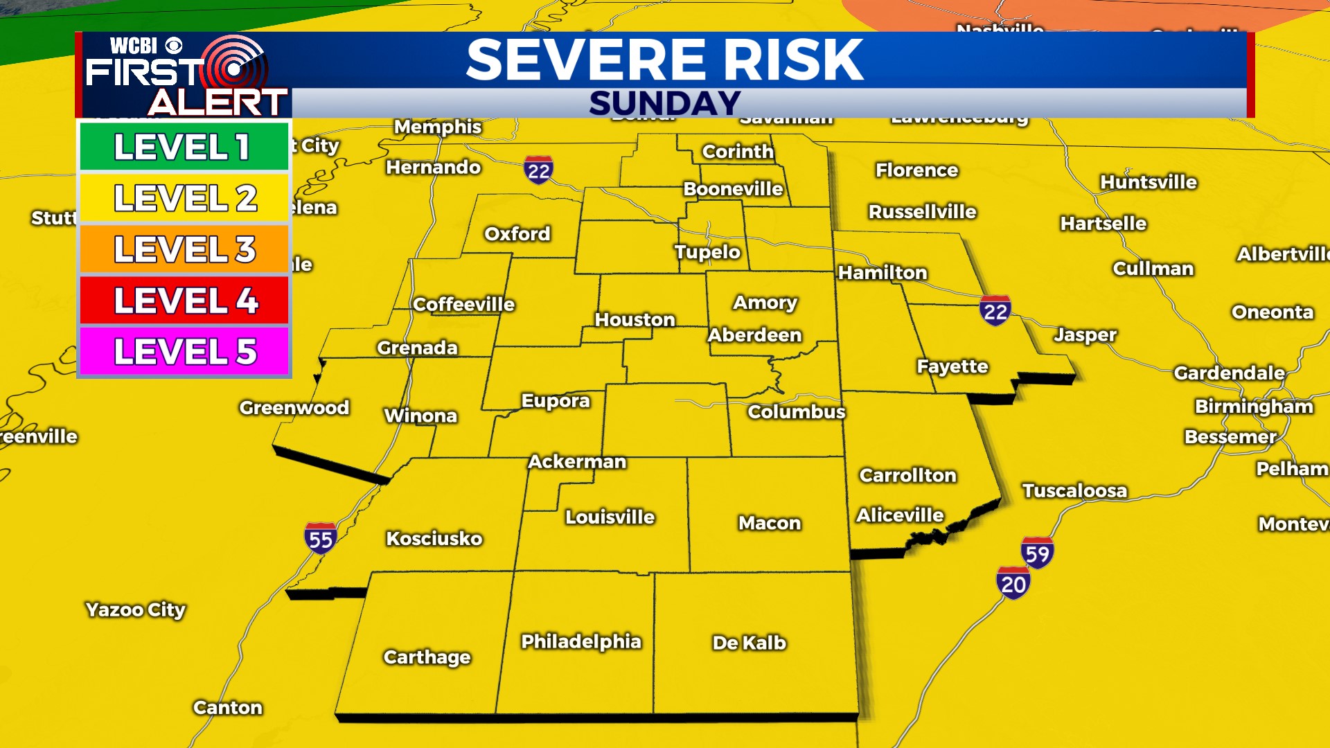
Severe Storms Likely Sunday Evening
COLUMBUS, Mississippi (WCBI) – Stay alert Sunday evening; severe storms are possible across the area.
TONIGHT: Mostly clear and muggy. Low near 71°. Overall, good weather for your Saturday night plans.
SUNDAY: High near 93°. It’ll be hot again, with a few storms possible in the afternoon. However, our main severe weather risk comes *in the evening*. A large, fast-moving complex of severe storms will roll through with the potential for damaging wind gusts and hail. Timing is 5 PM – 11 PM. The entire area is currently in a level 2 risk. Keep checking back for updates online and on social media. Chance of rain: 70%.
MONDAY: Lingering clouds and rain will be around Monday morning, but things should gradually clear up throughout the day. High near 92°.
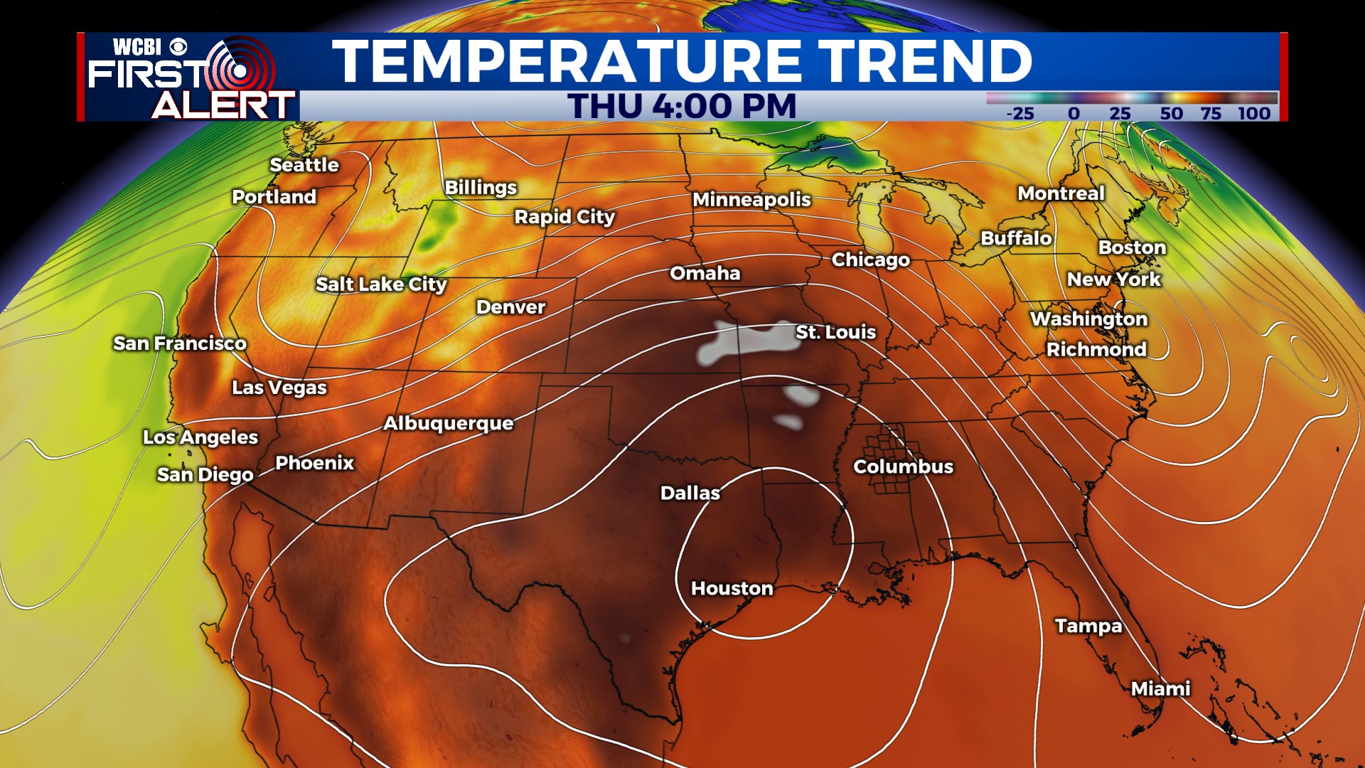
NEXT WEEK: Tuesday is dry and hot, with highs in the low to mid-90s. A few showers or a storm is possible on Wednesday. After that, it looks like our first real summer heat wave will begin late next week. The ridge that’s been over Texas will shift eastward and sit over us for a few days. Dangerous heat is possible, and I’m currently forecasting high temperatures near 100° on Thurs, Fri, and Sat!