Severe storms overnight into Saturday morning
COLUMBUS, Mississippi (WCBI) – Near record temperatures today will lead to a chance of severe storms overnight into Saturday morning.
FRIDAY: Expect a cloudy, warm, and breezy day with occasional and scattered showers developing. Highs will reach the upper 70s with southerly wind gusts over 20 mph. Tupelo’s record of 75 and Columbus’ record of 78 degrees, respectively, should be either beaten or tied. The storm threat during the day remains low.
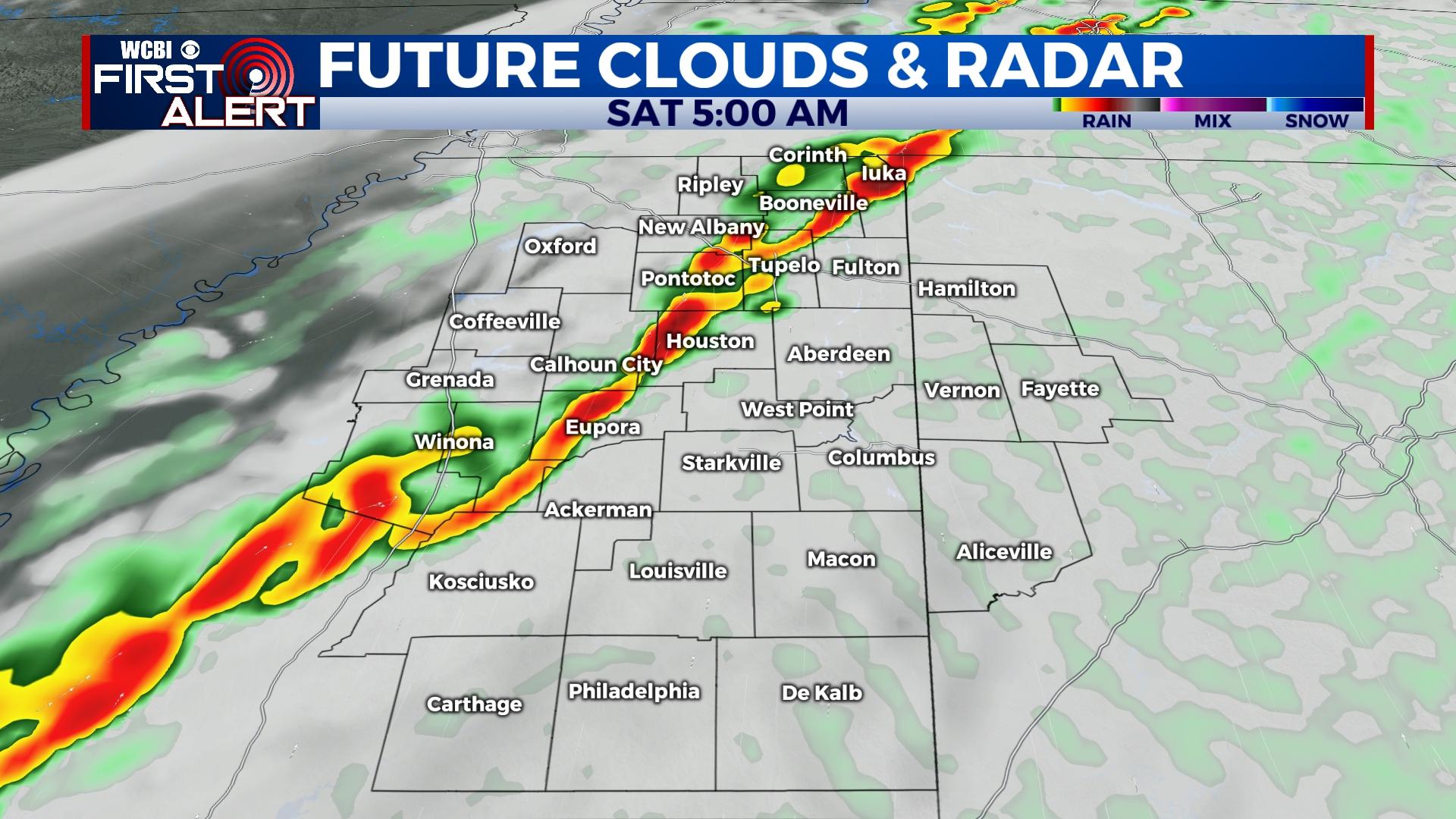
FRIDAY NIGHT/SATURDAY MORNING: Most of the evening should be quiet, but a few storms could develop northwest of the Trace. These will need to be watched for severe potential. Otherwise, severe storm chances increase after midnight as storms develop into the region. A broken line of supercells and/or a squall line will move through the region, bringing the chance of for damaging winds and tornadoes from midnight-8a Saturday. A stronger (EF2+) tornado is not out of the question.
SATURDAY AFTERNOON: With storms exiting before lunch, clouds will linger through the afternoon along with isolated showers. Temperatures will fall into the 50s as northwesterly winds pick up through the day. Temperatures will fall into the 30s Saturday night.
SUNDAY: Gorgeous weather is on tap with lots of sun and highs in the 50s.
NEXT WEEK: Another warming trend will be upon us. Highs will begin the week in the 60s on Monday but moderate into the 70s by Tue-Thu. Rain chances look to remain out of the picture until at least next Friday.