Severe storms Wednesday ahead of major weekend cold front
COLUMBUS, Mississippi (WCBI) – Severe storms are possible Wednesday before another round of storms this weekend.
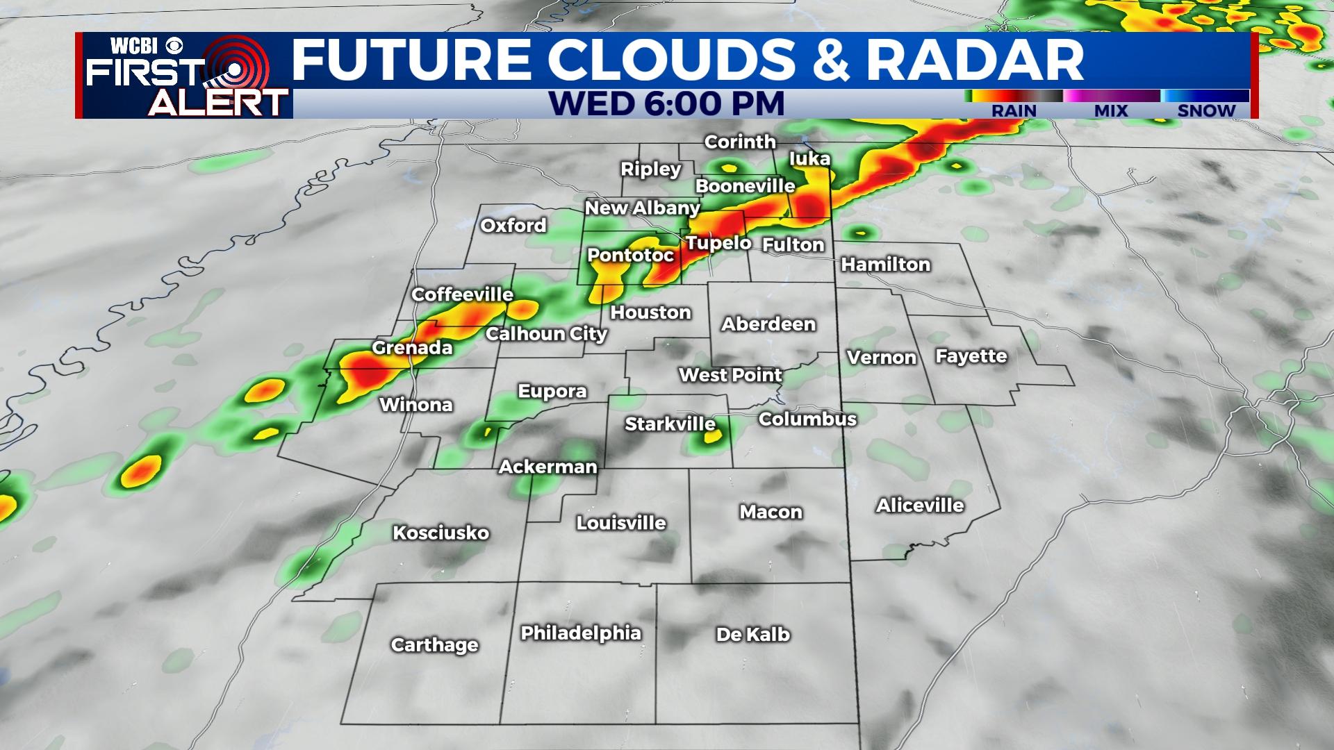
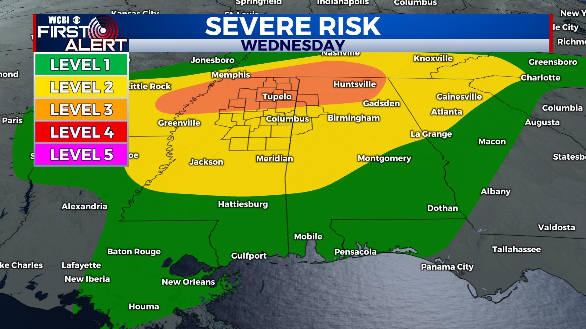
WEDNESDAY: Showers and storms are expected to develop into north/northeast Mississippi toward midday and the afternoon/evening hours. Favorable shear and instability will promote a threat for all modes of severe weather (hail, wind, tornado) in the strongest storms. Since storm mode will be scattered, not everyone will see adverse weather, and the threat window will be larger than usual. Make sure to stay weather aware from around lunchtime through midnight, and have multiple ways to receive watches and warnings.
THURSDAY: The threat for storms will have shifted out of the area, but a mostly cloudy sky will linger along with a chance for isolated showers. Highs will be in the low 70s.
FRIDAY: Another surge of warm, humid air is expected, and accordingly scattered showers and storms become possible in the afternoon and evening hours. Most of this activity is expected to remain below severe limits, though a few storms could produce hail or gusty wind.
SATURDAY: Another strong cold front will bring more showers and storms to the region. While severe weather is possible again, some ingredients appear out of phase and may not allow for a significant threat. Otherwise, the weather stays very warm and humid with highs in the upper 70s.
SUNDAY: Saturday’s front should pass through early Sunday morning, ushering in much, MUCH colder air. Temperatures may not get out of the 30s during the day with a slowly clearing sky. Temperatures will bottom out in the low 20s Sunday night.
NEXT WEEK: While it will be a chilly start, temperatures will moderate into the 40s Monday and into the low 50s Tuesday. This will be ahead of another front by mid-week.


