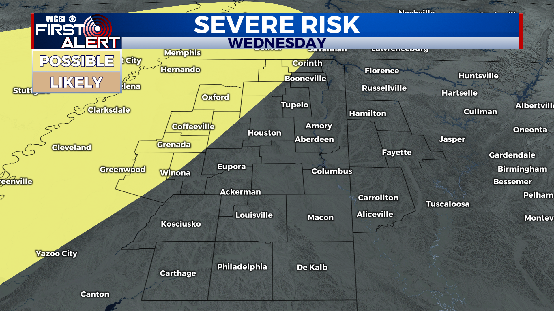
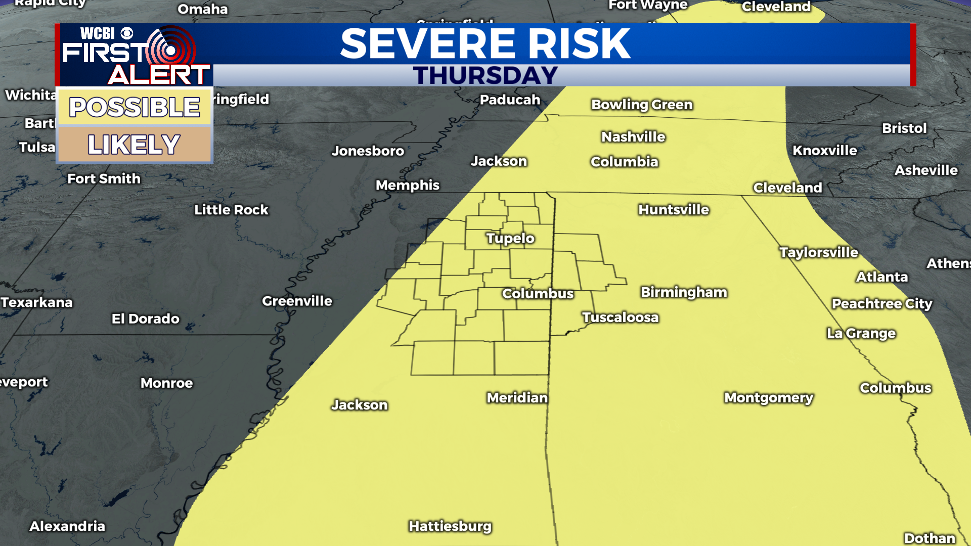
Severe threat midweek marks beginning of cooldown
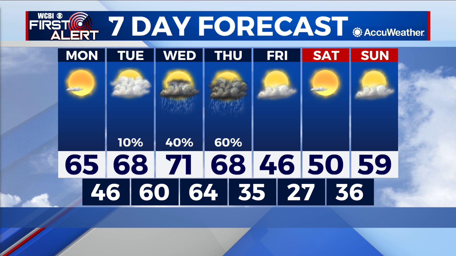
COLUMBUS – SUMMARY: Highs climb into the low 70s before a cold front knocks us back into the 40s. Storm chances Wednesday into Thursday bring the potential for severe weather.
MONDAY: Highs climb into the mid 60s as plentiful sunshine contributes to additional warming. Lows drop into the mid to upper 40s overnight. No rain is expected Monday.
TUESDAY: Further warming will put highs into the upper 60s by Tuesday afternoon. Clouds roll in and bring along the chance for the isolated shower. Lows drop close to 60 overnight.
NEXT WEEK: The Storm Prediction Center has a 15% risk for severe weather Wednesday into Thursday. The primary threat to our viewing area comes mostly on Thursday although some activity in far western portions of our viewing area is possible Wednesday. We will continue to update you on the situation as it evolves. Rest assured, the remainder of the week after Thursday will be calm. Highs climb into the low 70s Wednesday before a cold front Thursday will bring us down into the mid to upper 40s by Friday. Lows take a similar drop from the mid 60s overnight Wednesday into the upper 20s by overnight Friday.