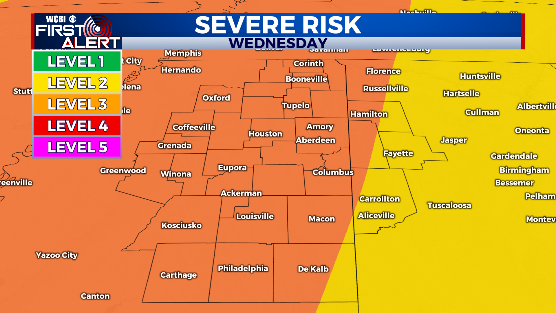
Severe threat Wednesday highlights stormy week
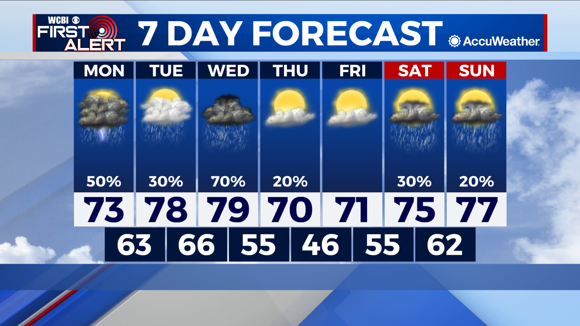
COLUMBUS – SUMMARY: Major rain chances remain throughout most of this week. Highs stick in the upper 70s before a cold front Thursday takes things down a notch. Lows start in the upper 60s and take a slight dip into the upper 40s mid-week.
MONDAY: A comfortable start despite the rain chances, highs reach into the low 70s. Scattered thunderstorms are a real possibility in the afternoon on an otherwise nice day outside. Plentiful cloud cover will also be present.
TUESDAY: Highs make a slight increase into the upper 70s as rain chances take a slight dip Tuesday. The overcast skies continue but will not affect overall temperatures all that much. Lows will increase only slightly into the upper 60s.
REST OF THE WEEK: The big rain chance being assessed this week is the possibility for some severe weather on Wednesday. The Storm Prediction Center (SPC) has issued an enhanced risk at the moment, which could change as more data about the setup Wednesday becomes available. For now, it is important to understand that the primary threat will likely be damaging winds and some potentially strong tornadoes. We will continue to keep you updated on the situation as it evolves. As for the rest of the week, a cold front Thursday will crank the temperatures down into the low 70s, before a gradual rebound back into the high 70s by the end of the week. Some more sunshine later in the week will disappear once again as rain chances intensify over the weekend.