Severe Thunderstorms Possible Monday
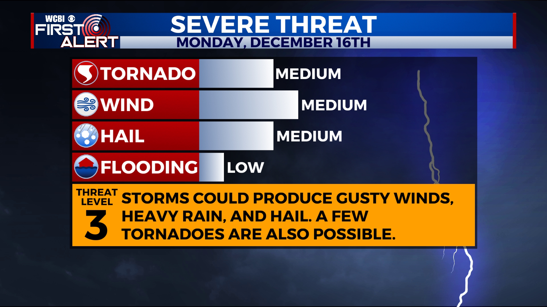
Strong to severe storms are likely on Monday. The main threats are damaging wind gusts and hail, but a few isolated tornadoes are also possible.
SUNDAY NIGHT: Variably cloudy and mild. An isolated shower is possible. Lows in the upper 50s.
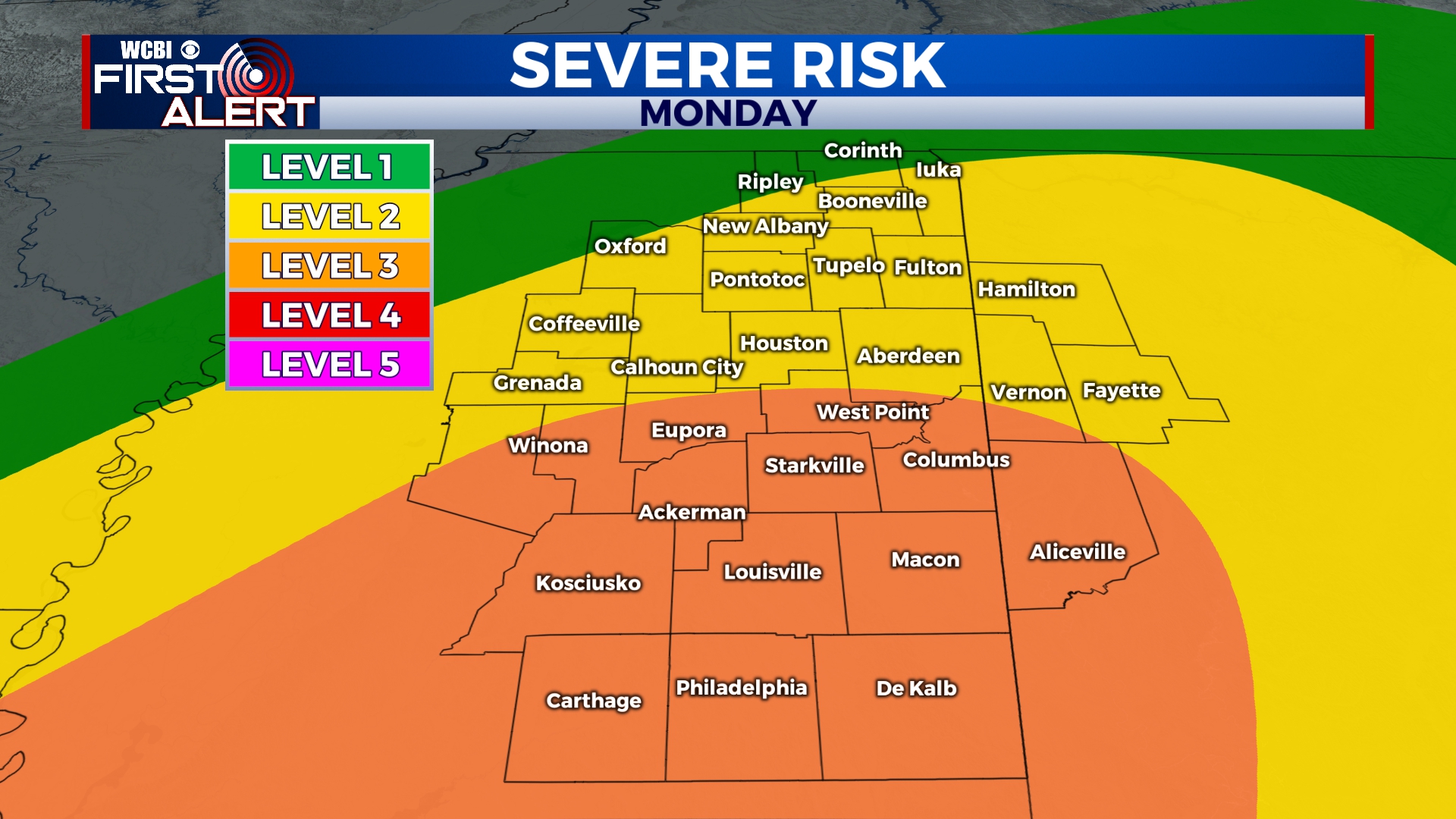
MONDAY: Temperatures will be unseasonably warm with highs in the 70s. Showers are possible through the morning with storm activity developing into the afternoon and evening. The worst of the weather is likely between 12pm and 11pm. We’ll be mostly cloudy through the day, but any sunshine early in the morning will help to add energy to the storms. Storms could produce damaging winds, hail, and a few isolated tornadoes. Portions of the area has been included in a level 3 out of 5 risk for severe weather, but strong storms are possible across the entire area. For the most up-to-date information, follow WCBI Weather on Facebook, Twitter, and Instagram, and download the WCBI News app.
TUESDAY-THURSDAY: Clouds will linger through much of the day on Tuesday but we should see a good deal of sunshine on Wednesday and Thursday. Temperatures will be much cooler with highs in the mid to upper 40s on Tuesday and Wednesday and back into the mid 50s on Thursday. Morning lows will be in the upper 20s.
FRIDAY-SUNDAY: Some clouds will filter in as we get closer to Saturday and Sunday. There looks to be a potential for some rain through the weekend, but it’s a bit too early to pin down specific timing. We’ll go with a 30%-40% chance for showers on Friday, Saturday, and Sunday.


Leave a Reply