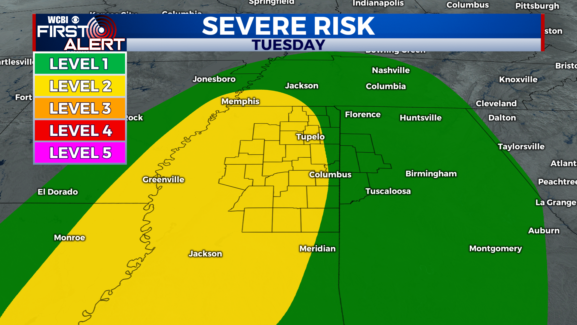
Severe weather eyes return off back of Tuesday cold front
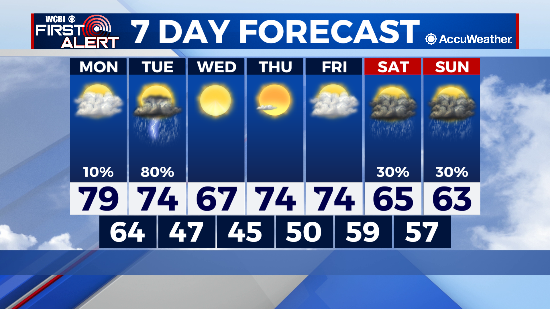
COLUMBUS – SUMMARY: A severe weather risk off the back of a cold front Tuesday brings a turbulent start to the week. Highs drop from the upper 70s into the upper 60s by Wednesday. Lows drop back into the 40s by overnight Tuesday.
MONDAY: A high in the upper 70s is accompanied by plentiful cloud cover and the chance for the stray shower during the day. Lows bottom out in the mid to low 60s overnight.
TUESDAY: A cold front brings not only a cooling effect a significant rain and severe weather chance. Much of Northern and Central Mississippi is caught in the bullseye of Tuesday’s severe threat, which to this point appears to be an afternoon affair. We will have more updates for you on timing and impacts as we get closer to the date of the severe weather event. Highs will hit the mid 70s and lows will drop into the upper 40s overnight Tuesday.
REST OF THE WEEK: Afternoon temperatures will fall into the upper 60s in the aftermath of Tuesday’s cold front, before quickly climbing back into the mid 70s. Lows will also bottom out in the mid 40s before climbing back into the upper 50s by overnight Friday. Two more chances for scattered showers and thunderstorms appear over the weekend.