Severe Weather Likely Today
A severe weather outbreak is likely across the Southeast on Sunday, with the worst of the weather expected through Mississippi and Alabama. These storms will be capable of producing strong, long-track tornadoes, damaging wind gusts, large hail, and heavy rain.
There is currently a Level 4 out of 5 risk in effect for the entire WCBI viewing area.
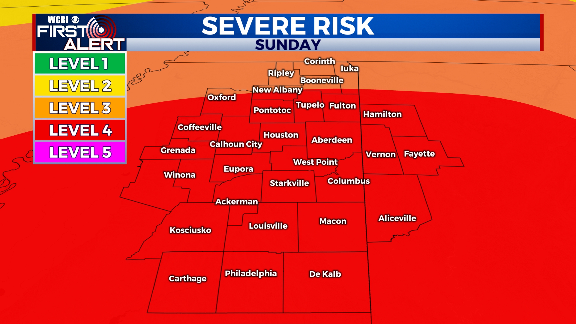
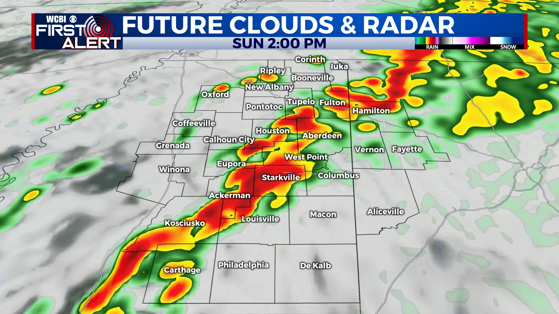
SUNDAY: We’ll wake up to some rain and thunder that will last through the late morning, but the worst of the weather will hold off until after noon. We may get a brief break in between rounds. Severe storms will develop by noon and move across the area. This round of storms will be capable of producing violent tornadoes, damaging wind gusts, hail, and heavy rain. We’ll have a few more strong to severe storms move through after sunset before everything moves out by midnight. Overall, the timeframe for the worst of the weather is 12pm to 10pm. Remain weather aware and stay with WCBI Weather for the latest updates.
SEVERE WEATHER SAFETY: Take time before the storms to prepare. Know where your tornado safe place is and be sure you can get there quickly. If you live in a mobile home, make plans to spend the day at a friend’s home or in a community storm shelter. Have multiple ways to receive weather alerts, including TV, weather radio, and the free WCBI News app. Charge your cell phone and have a flashlight nearby. In the event of a Tornado Warning, you can watch our live stream on TV, on the WCBI News app, or at wcbi.com/live.
SUNDAY NIGHT: Rain and storms will clear after midnight, leaving us mostly cloudy with lows in the mid 50s.
MONDAY-SATURDAY: Aside from a sprinkle or two, the upcoming week looks dry with a mix of sun and clouds. Temperatures will be cooler with highs only in the 60s for the first half of the week. We’ll get back into the 70s by Friday and Saturday. Overnight lows will be as low as the upper 30s on Wednesday and Thursday.


Leave a Reply