Severe Weather Possible Monday
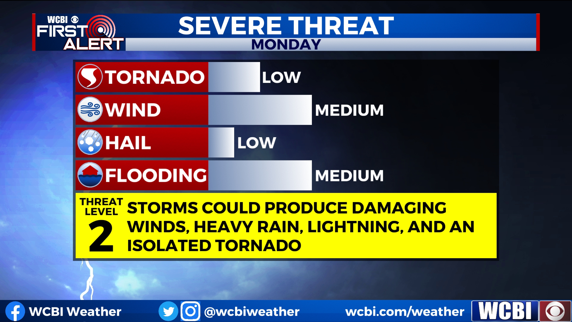
Strong to severe storms are likely through the day on Monday. Some storms could contain damaging winds, heavy rain, and lightning. There is also the potential for an isolated tornado or two.
SUNDAY: A few showers are possible through the day on Sunday. However, most of us will be dry and partly cloudy with highs in the upper 70s to near 80.
MONDAY: An approaching cold front will bring showers and storms to the area through the day on Monday. Some of these storms could produce damaging winds, heavy rain, and lightning. An isolated tornado or two also can’t be ruled out. Storms will likely start by lunchtime and exit the area by 8pm or 9pm. Keep a close eye on the weather and have a way to get severe weather alerts through the day on Monday.
Strong to severe storms are possible on Monday.
SEVERE WEATHER SAFETY: While we’re not expecting this to be a major severe weather event, we are getting into our second severe weather season of the year. It wouldn’t be a bad idea to brush up on severe weather safety tips, check on your weather radio, and download the WCBI Mobile App. Once you download the app and add your location, we’ll send you a notification any time a severe weather alert is issued for your county. And of course, stay connected with the WCBI Weather team for the most up-to-date weather forecasts and information.
TUESDAY-THURSDAY: Once the cold front passes, we’ll be in for some nice weather for the middle of the week. Temperatures will return to the upper 60s and low 70s with plenty of sunshine.
FRIDAY-SATURDAY: Yet another cold front looks to approach the area by the end of the week which will increase storm chances for Friday. Rain should exit the area late Friday and we should be dry for Saturday apart from a few leftover sprinkles.


Leave a Reply