More Severe Weather Possible Sunday Night
TONIGHT: Clouds will build in, but we remain fairly mild with temperatures in the mid 50s overnight. Winds will remain fairly light but will shift from West to Northeast.
 SUNDAY: A warm front will stall out just to our south, and that may spark some shower development just to our south. Throughout the afternoon, that front will slowly pull north and could bring some rain to our area. Overall we will remain fairly cloudy with temperatures in the upper 60s.
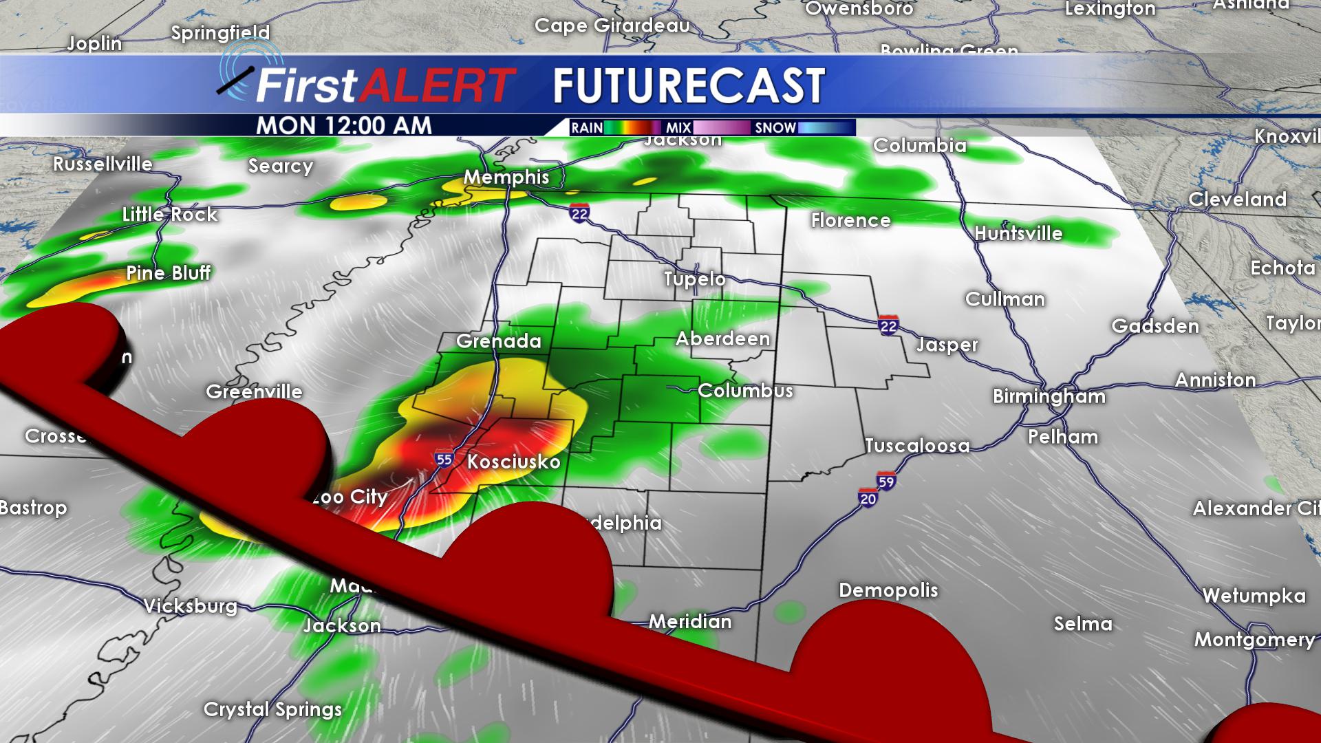
SUNDAY NIGHT/MONDAY AM: As that warm front lifts north,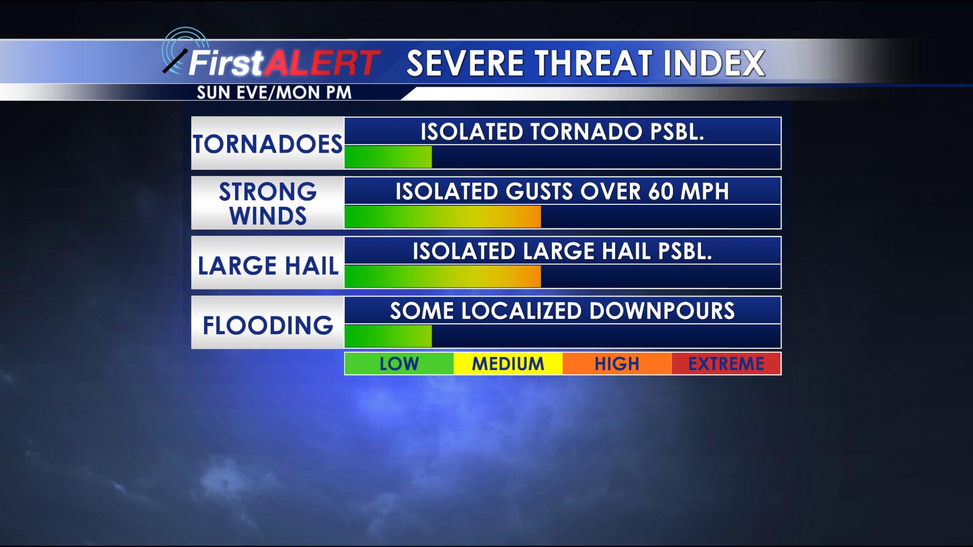 it will interact with a boundary that will allow some stronger storms to develop. The biggest threat with these storms are severe winds and some large hail. Tornadoes are not likely, but are still possible through the overnight hours. This first batch of storms should wrap up by around 6am Monday morning.
MONDAY AFTERNOON: With more instability in the atmosphere, we could see some re-development of those storms by the early afternoon. Once again, the biggest threat will be strong winds and large hail. By the later part of the afternoon, the trailing cold front will clear our area, leading to a calm and cooler Monday night.
MONDAY EVENING AND BEYOND: More stable air will move in Monday night and will limit any thunderstorm potential going forward. Monday night, lows will be in the upper 40s and low 50s with strong northwesterly winds. Tuesday and Wednesday will be much cooler for the start of spring as highs stay in the mid 50s and overnight lows drop to near freezing. By Thursday warmer air will push into the region bringing highs back into the 60s.


Leave a Reply