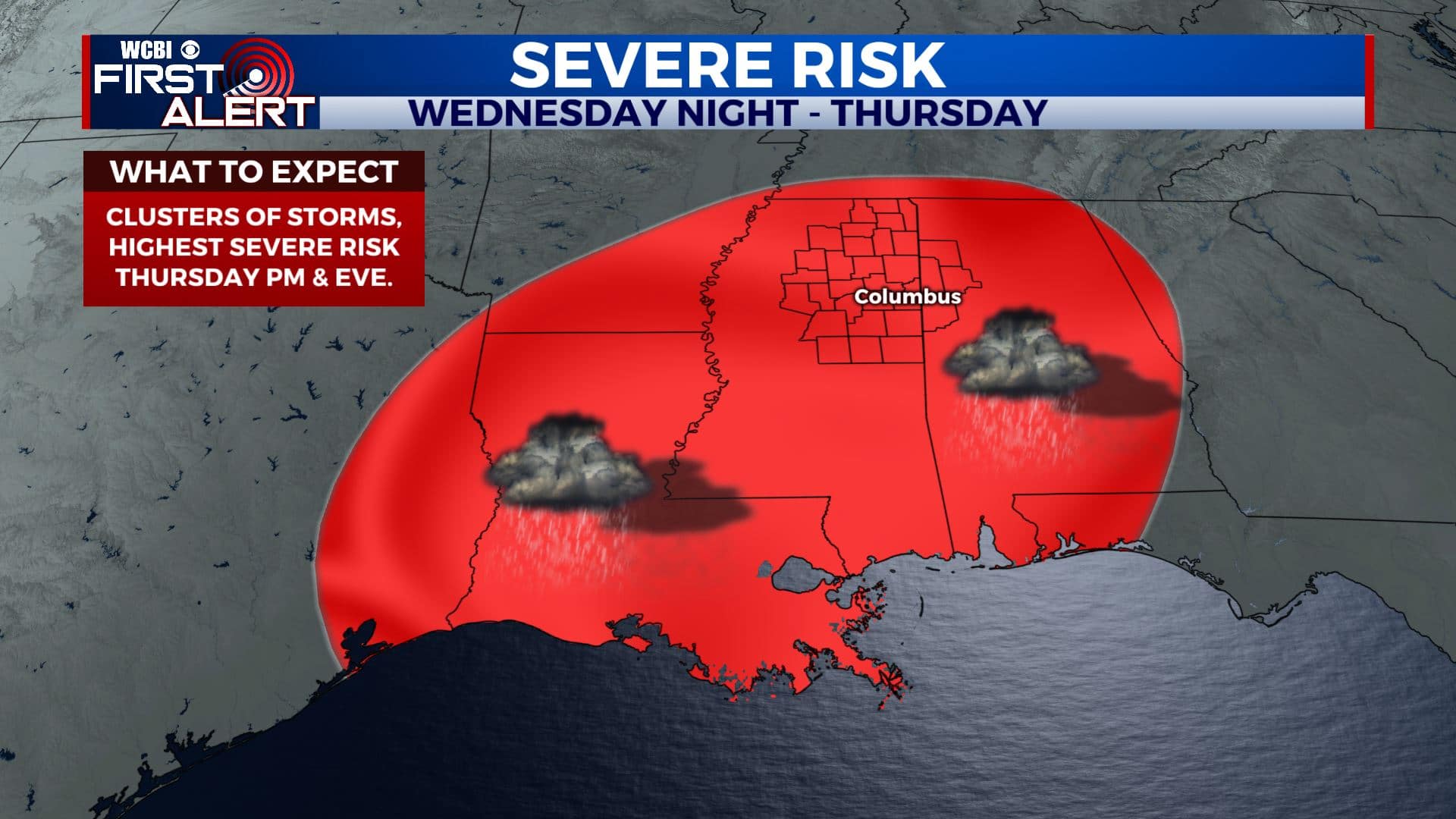
More severe weather possible Wed & Thu
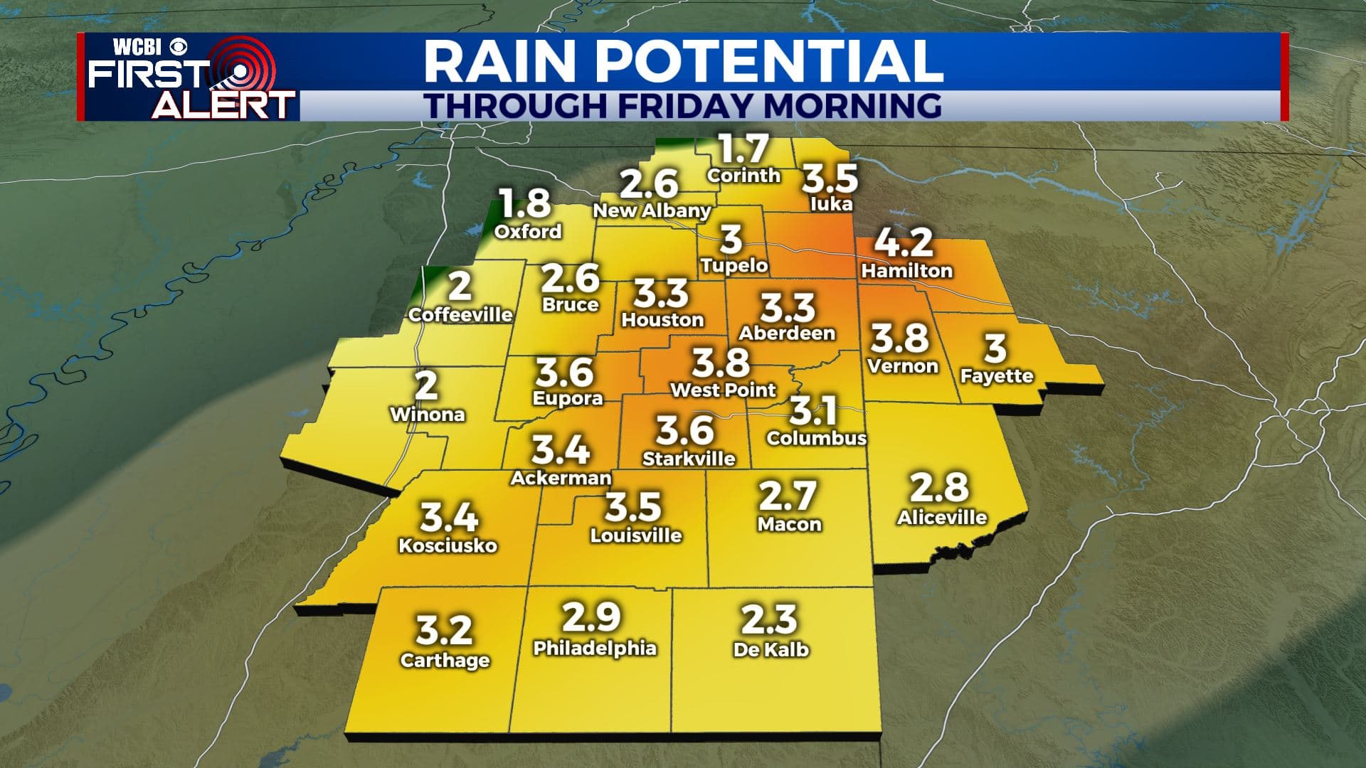
SUMMARY: Active spring weather will continue over the next few days. Rain and storms will return to the region Tuesday but the strongest storms and heaviest rain for us will wait until late Wednesday, Wednesday night, and Thursday. Some significant severe weather is possible Thursday afternoon and evening with all modes possible. Stay tuned for updated information over the coming days.
MONDAY NIGHT: Increasing clouds with some rain possible very late. Lows in the mid 50s. Winds pick up from the SE between 5 and 20 mph.
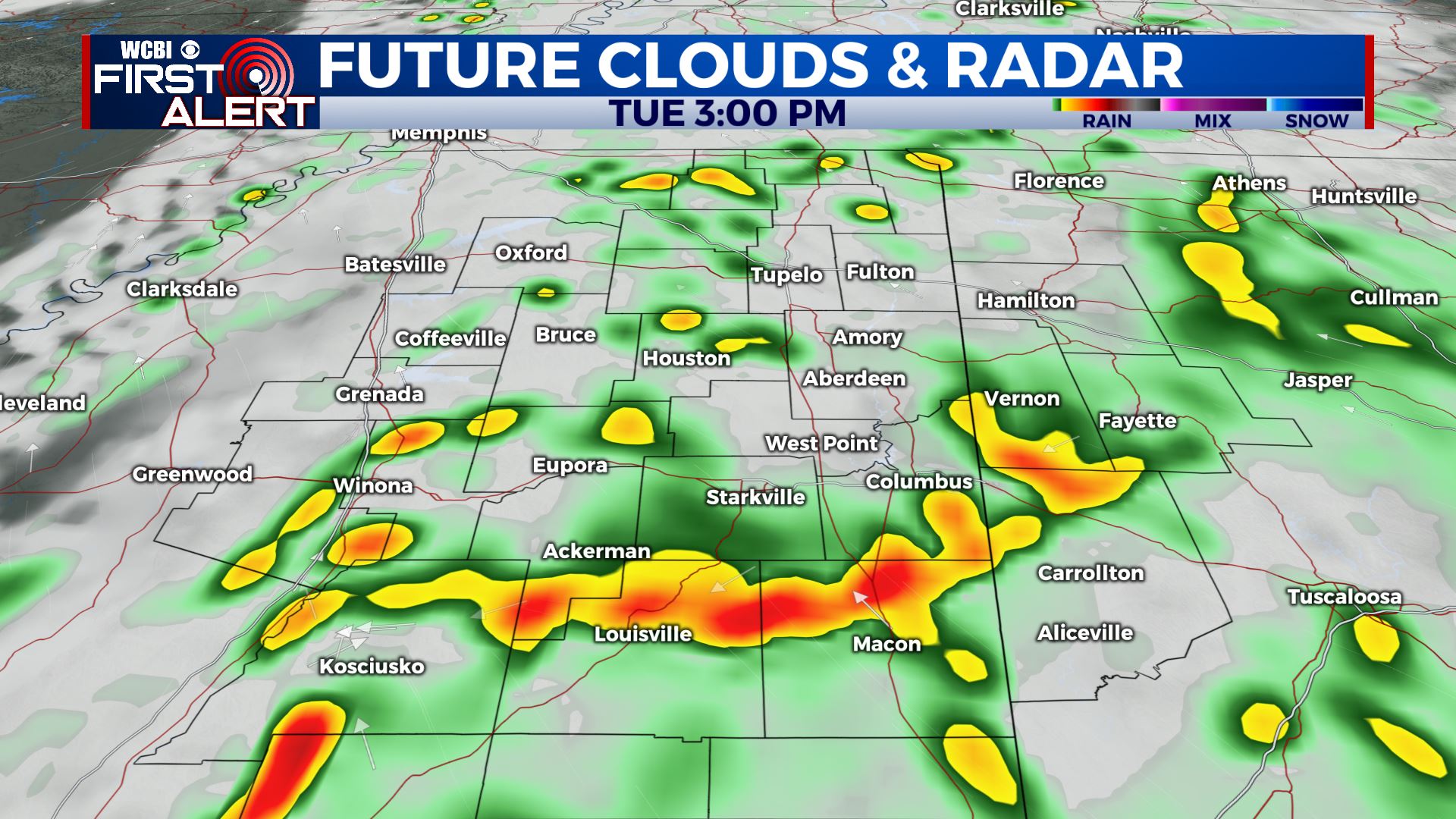
TUESDAY: Mostly cloudy. A 70% chance of rain and storms. While some gusty breezes are possible during the day even outside of any shower or storm, the highest odds of severe weather will be confined to central and southern Mississippi. Winds SE 10-25 mph with gusts over 30 mph possible.
TUESDAY NIGHT: Variably cloudy and quiet. Lows in the mid 50s.
WEDNESDAY: Variably cloudy and seasonably mild for most of the day with highs in the 70s. Odds of rain and storms will go up by late afternoon and evening.
WEDNESDAY NIGHT: Areas of rain and storms. Some severe weather could occur as a warm front pushes from south to north across the region. Locally heavy rain may also develop.
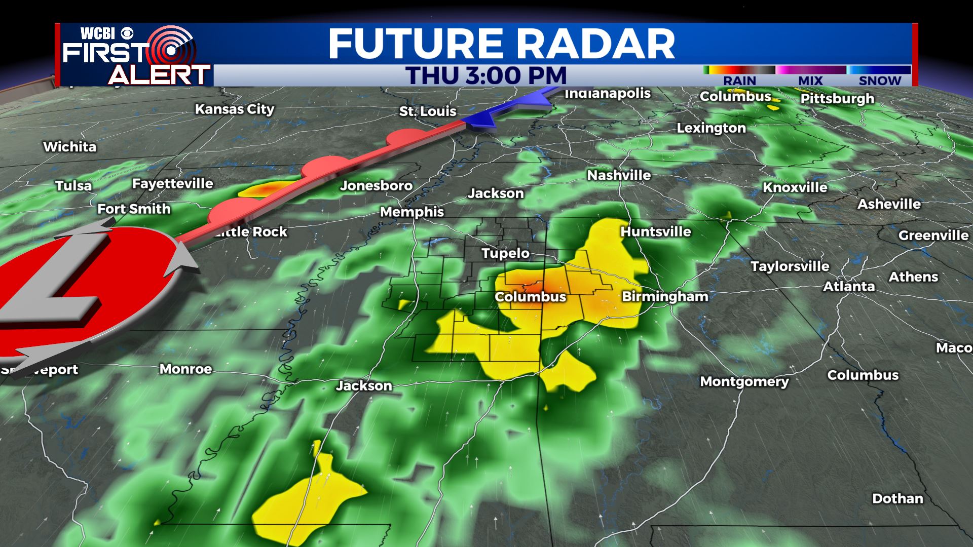
THURSDAY: Warm and humid with a 90% chance of rain and storms during the day. Some storms may become severe with large hail, damaging wind gusts, isolated tornadoes, and heavy rainfall. The heaviest activity looks like it will be during the afternoon and evening hours.
THURSDAY NIGHT: Rain and storms exit by midnight or shortly thereafter. Cooler low 50s settle in by sunrise Friday.
FRIDAY: Partly cloudy. Highs in the low to mid 70s. Low 50s for lows Friday night.
SATURDAY: Warm highs in the mid to upper 70s. More rain and storms could develop during the afternoon and evening hours. Lows around 60 Saturday night.
SUNDAY: Cooler highs in the upper 60s. Some rain and clouds may linger.
Follow @WCBIWEATHER on Facebook, Twitter, Instagram, and the WCBI News App


Leave a Reply