Severe weather risk heading our way
COLUMBUS, Mississippi (WCBI)- Coming off of a weekend with showers, Monday turned out very nicely. However, thunderstorms and severe weather risks are on track to hit Mississippi Tuesday and into Wednesday.
MONDAY NIGHT: Sky conditions are going to stay mostly clear through the night. Overnight low temperatures are going to fall into the middle 40s.
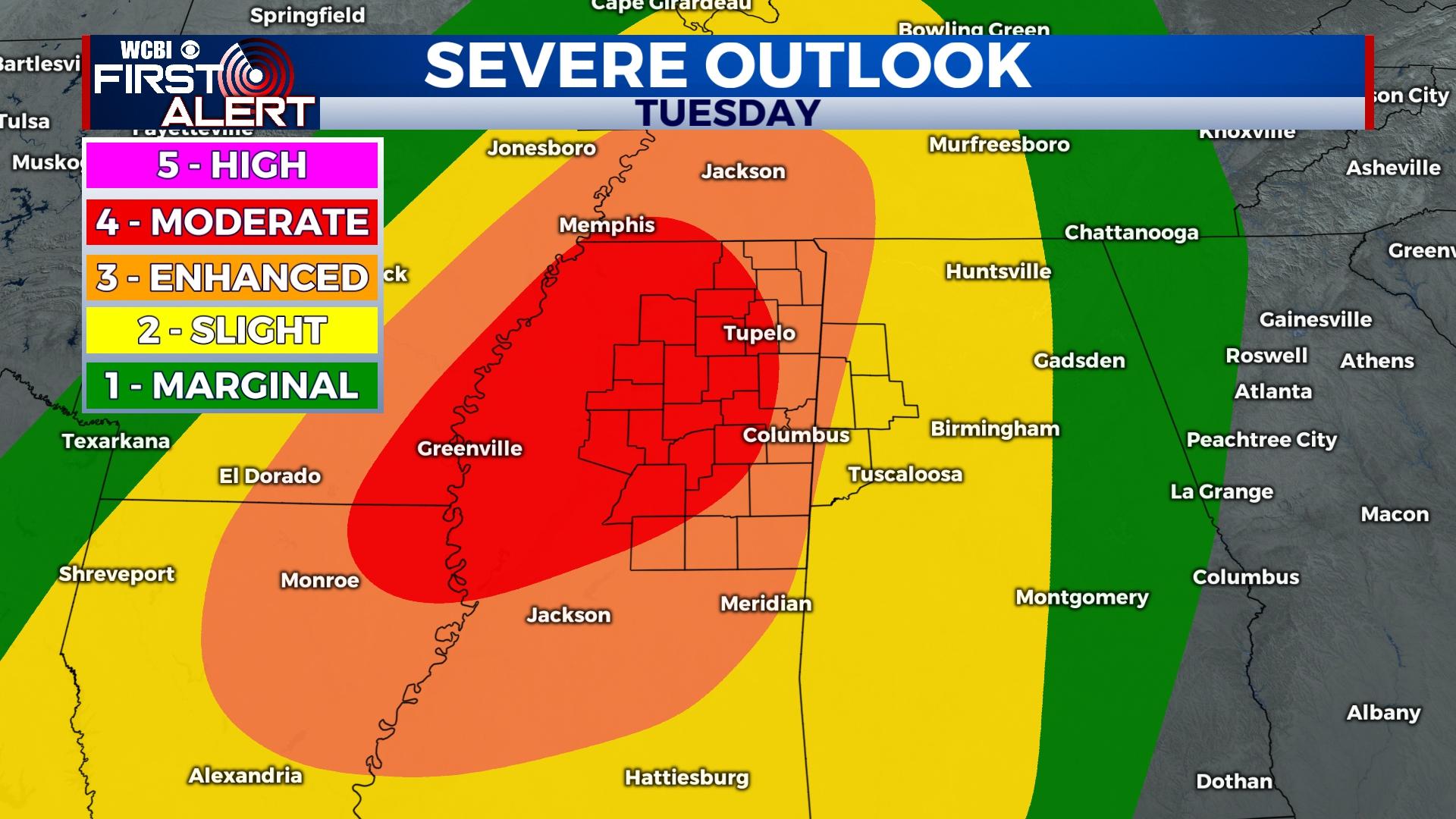
TUESDAY: There is a gulf warm front that is going to bring in moisture, warmer temperatures, and unstable air. Temperatures for our Tuesday are going to reach the lower 70s. Cloud coverage will be building in along with the front. Starting late morning/early afternoon, scattered showers will be taking place across Mississippi. As the evening continues, the risk for severe thunderstorms and other severe risks increases. Currently, most of northern Mississippi is in the Moderate Risk (or level 4/5) for seeing severe weather rolling through. Showers and severe storms are expected to continue through the night. Be weather aware!
WEDNESDAY: A cold front will be following behind the severe weather risk. This will move the system along to the East and bring down our temperatures. There may be some residual showers Wednesday morning. Temperatures will reach the lower 60s and cloud coverage will clear out. Overnight low temperatures fall into the lower 30s and upper 20s.
THURSDAY: Temperatures will be in the middle 50s. Sky conditions will be partly cloudy with a 0% chance of seeing rain showers. Overnight low temperatures will be in the upper 30s to lower 40s.


