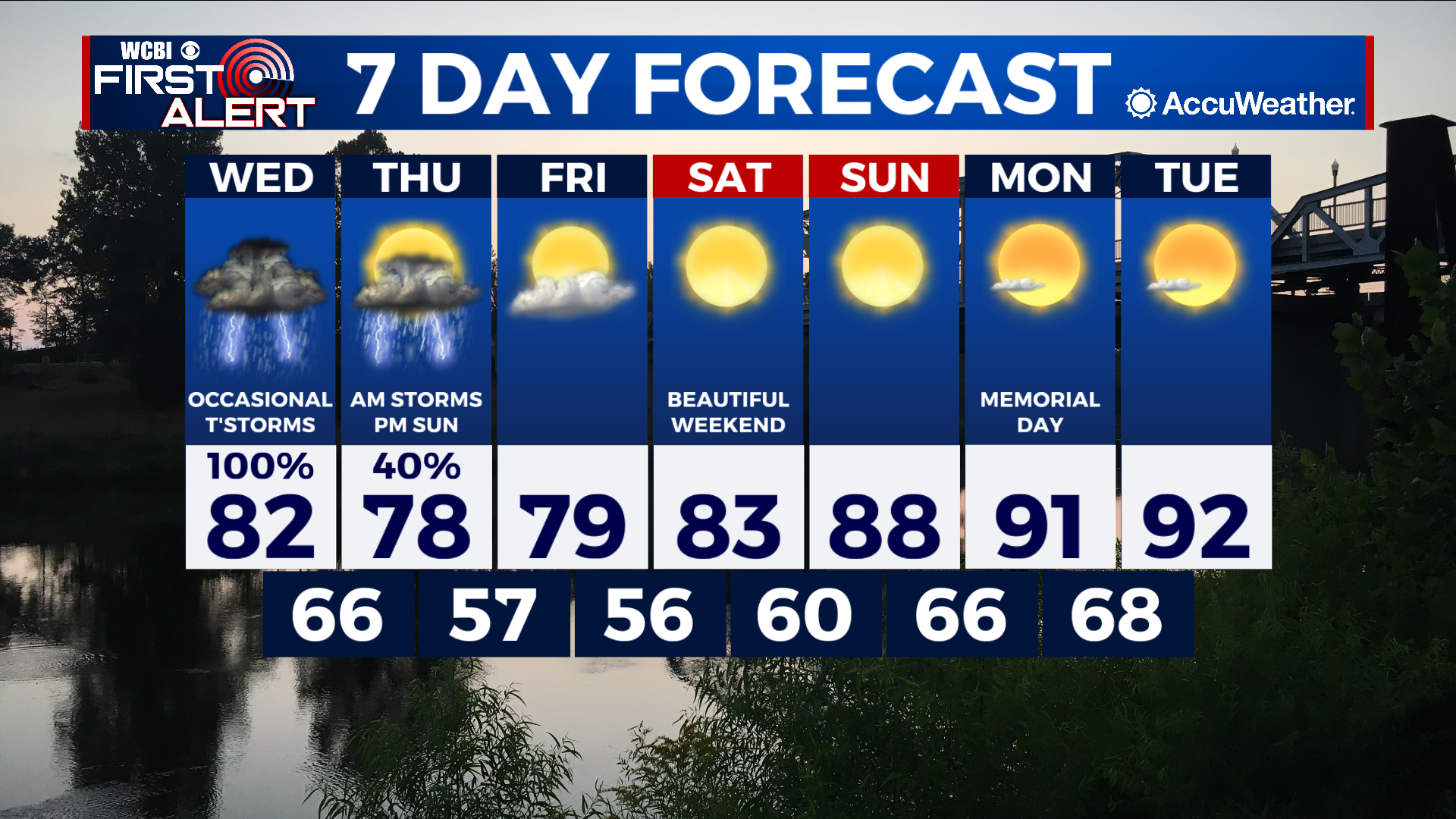
Showers and thunderstorms end tonight, but return tomorrow
COLUMBUS, Mississippi (WCBI) – SUMMARY: Showers and a few thunderstorms moved across the region today. More rain is expected over the next 48 hours, with locally heavy rainfall possible. The good news is we will settle down as rain exits the region by this weekend.
TONIGHT: Scattered showers and thunderstorms before 11pm, then mostly cloudy overnight. Lows in the upper-60s. Chance of rain: 40%. South wind around 5 mph.
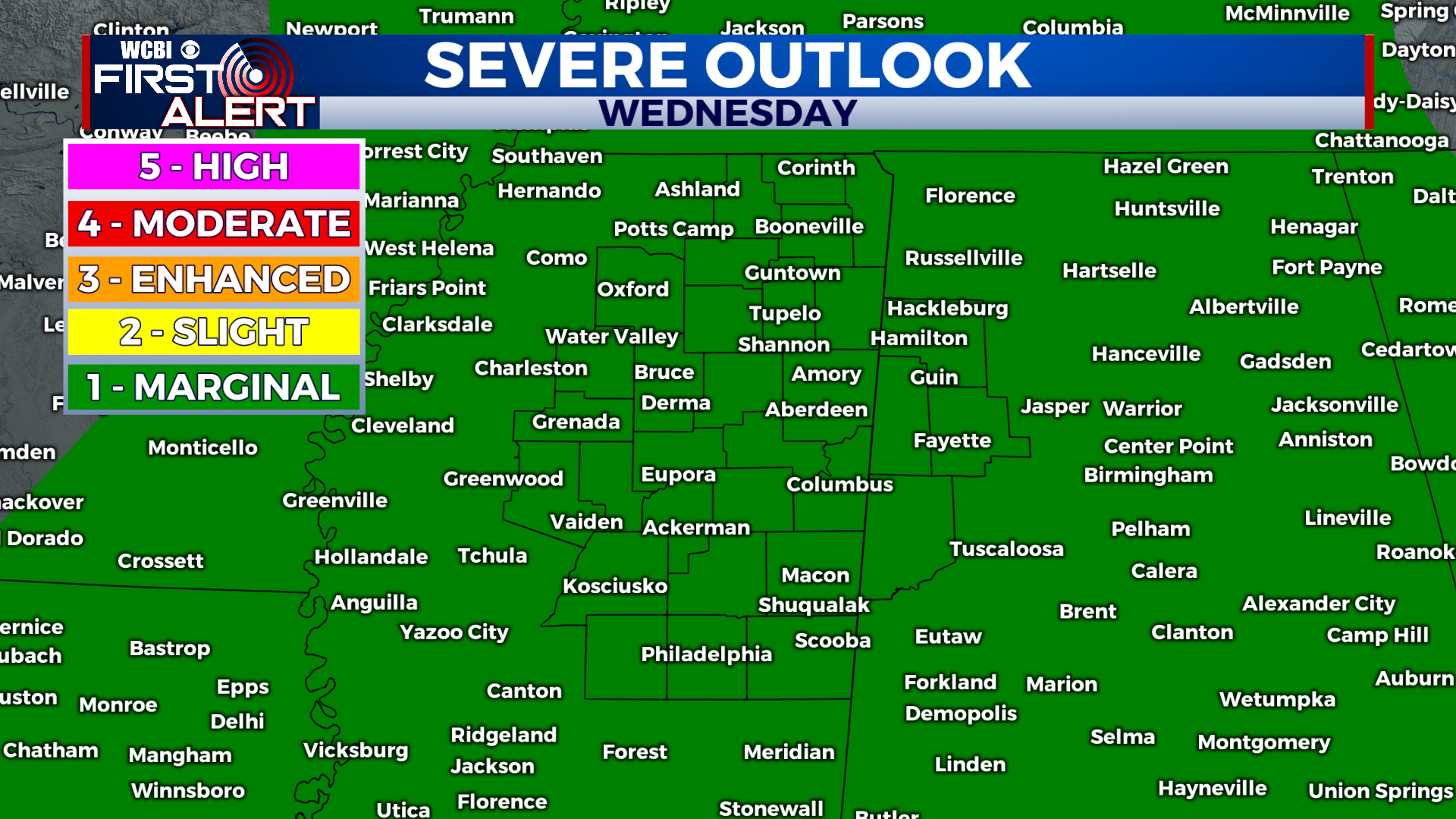
WEDNESDAY: Mostly cloudy to start the day, followed by occasional showers and thunderstorms. Some storms may be strong with frequent lightning, heavy rain, and gusty winds. Highs in the low-80s. South wind 5-10 mph, with gusts up to 25 mph. Chance of rain: 100%.

WEDNESDAY NIGHT: Occasional showers and thunderstorms. Some storms may be strong with frequent lightning, heavy rain, and gusty winds. Lows in the low-60s. South wind 5-10 mph, with gusts up to 25 mph. Chance of rain: 100%.
EXTENDED FORECAST: A cold front will move through and end our rain chances across the region by Thursday afternoon. As we get into the weekend, high pressure will settle into place and temperatures will climb into the middle 80s Saturday then upper 80s Sunday. We’ll also stay dry as we begin next week, with highs in the low-90s on Monday and Tuesday.