A few showers this week, temperatures stay above average
After a few rounds of fall-like weather over the past month or so, warmer weather has returned to the area. Aside from some showers on Tuesday and Wednesday, no major weather is expected over the next seven days.
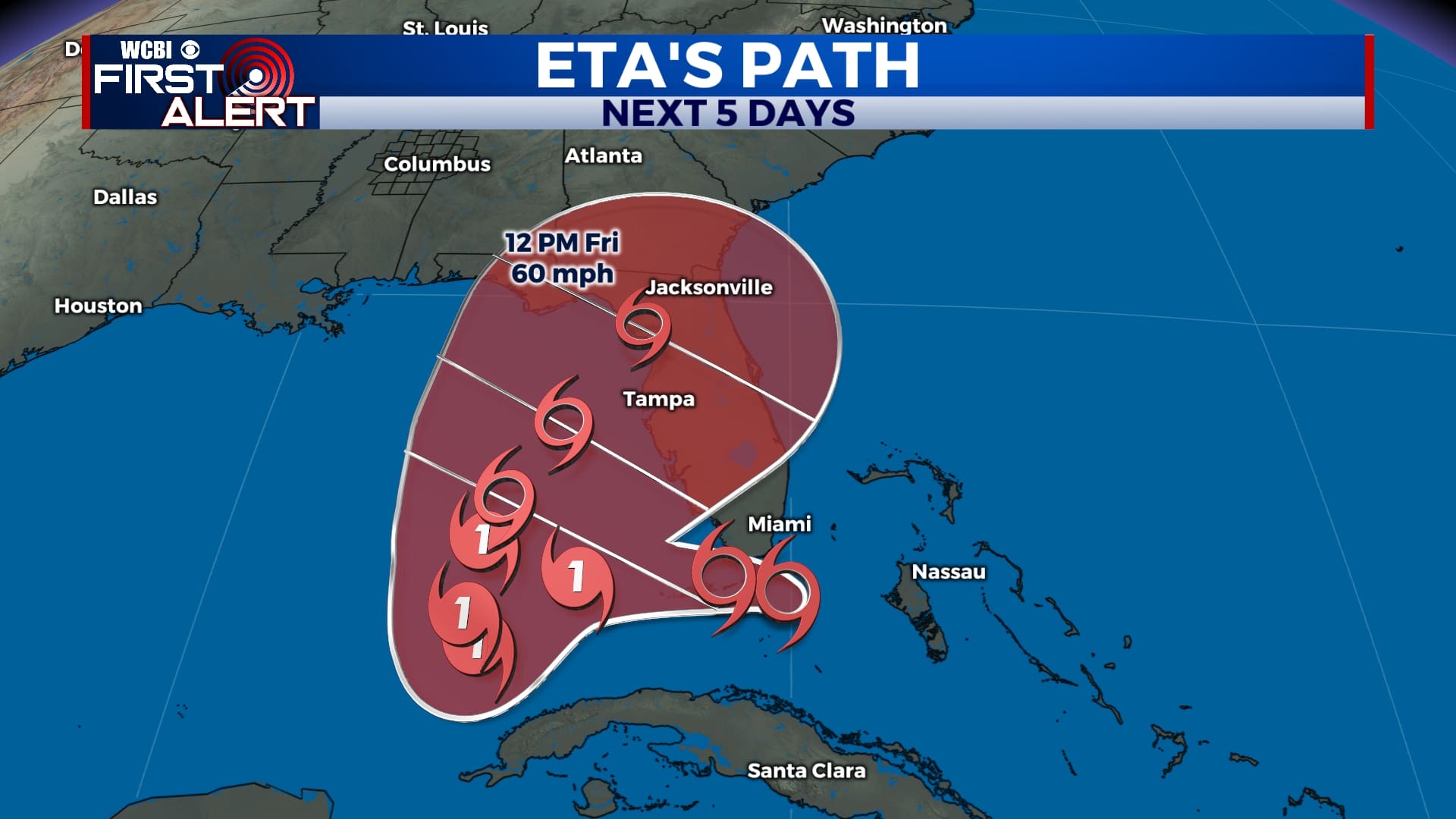
TROPICAL UPDATE: Tropical Storm Eta is currently bringing heavy rain and wind to Southern Florida and the Florida Keys as the storm continues northward. Impacts will be felt from Miami up to Tampa and Orlando early next week in the way of flooding rain and wind. As of now, we’re not expecting anything from Eta in our area.
SUNDAY NIGHT: A few clouds will linger tonight with skies becoming mostly cloudy at times. Lows will be in the low 60s with a light southeasterly wind.
MONDAY: Temperatures will remain warm as we start off the week with highs in the upper 70s and a breezy southeasterly wind. Gusts could be as high as 20 mph as skies remain partly to mostly cloudy.
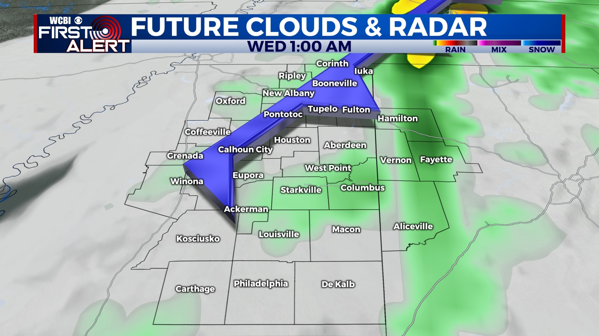
TUESDAY-WEDNESDAY: An approaching cold front will bring us a shot for some showers Tuesday afternoon into Wednesday morning, but not everyone will see rain. This front will also help to keep Tropical Storm Eta to our east, so we’re not expecting any impacts from that here locally. We’ll see a mix of sun and clouds with morning lows in the low 60s and afternoon highs in the mid 70s.
THURSDAY-SUNDAY: Skies will remain partly cloudy for the rest of the week and the weekend with temperatures climbing to the mid 70s each afternoon. Morning lows will be in the low to mid 50s. A shower or two is possible on Saturday and Sunday, but we’re not expecting significant rainfall.
Follow WCBI Weather on Facebook, Twitter, and Instagram
Follow Meteorologist Trevor Birchett on Facebook and Twitter


Leave a Reply