Significant Severe Weather Threat Tonight
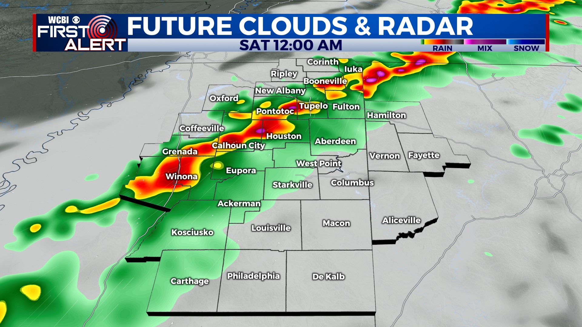
COLUMBUS, Mississippi (WCBI) – A potentially dangerous and significant severe weather event will unfold across the Mid-South Friday night, including northern Mississippi and northwest Alabama.
TONIGHT: Severe storms are likely, mainly along and north of the Highway 82 corridor. Heavy rain, damaging winds, and significant tornadoes (EF-2+ strength) are possible. The worst storms will move through between 8 PM and 2 AM. Have a plan and take action if a warning is issued for your location! Stay safe tonight! Tune in to WCBI for the latest information.
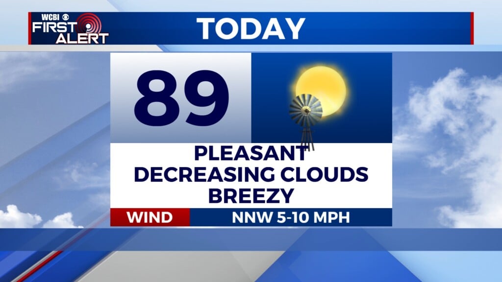
SATURDAY: Rain ends by sunrise. The rest of the day will be warm and windy. Skies will clear and sunshine will warm temperatures up to near 80°.
SUNDAY: Chilly in the morning, but comfortable in the afternoon. High near 73°. Clouds will begin to increase later in the day, and showers are expected to move in overnight.
NEXT WEEK: Multiple rounds of rain and storms are in the forecast next week. Temperatures will be in the 70s on Monday before returning to the 80s on Tuesday and Wednesday.
Stay safe tonight and have a great weekend!