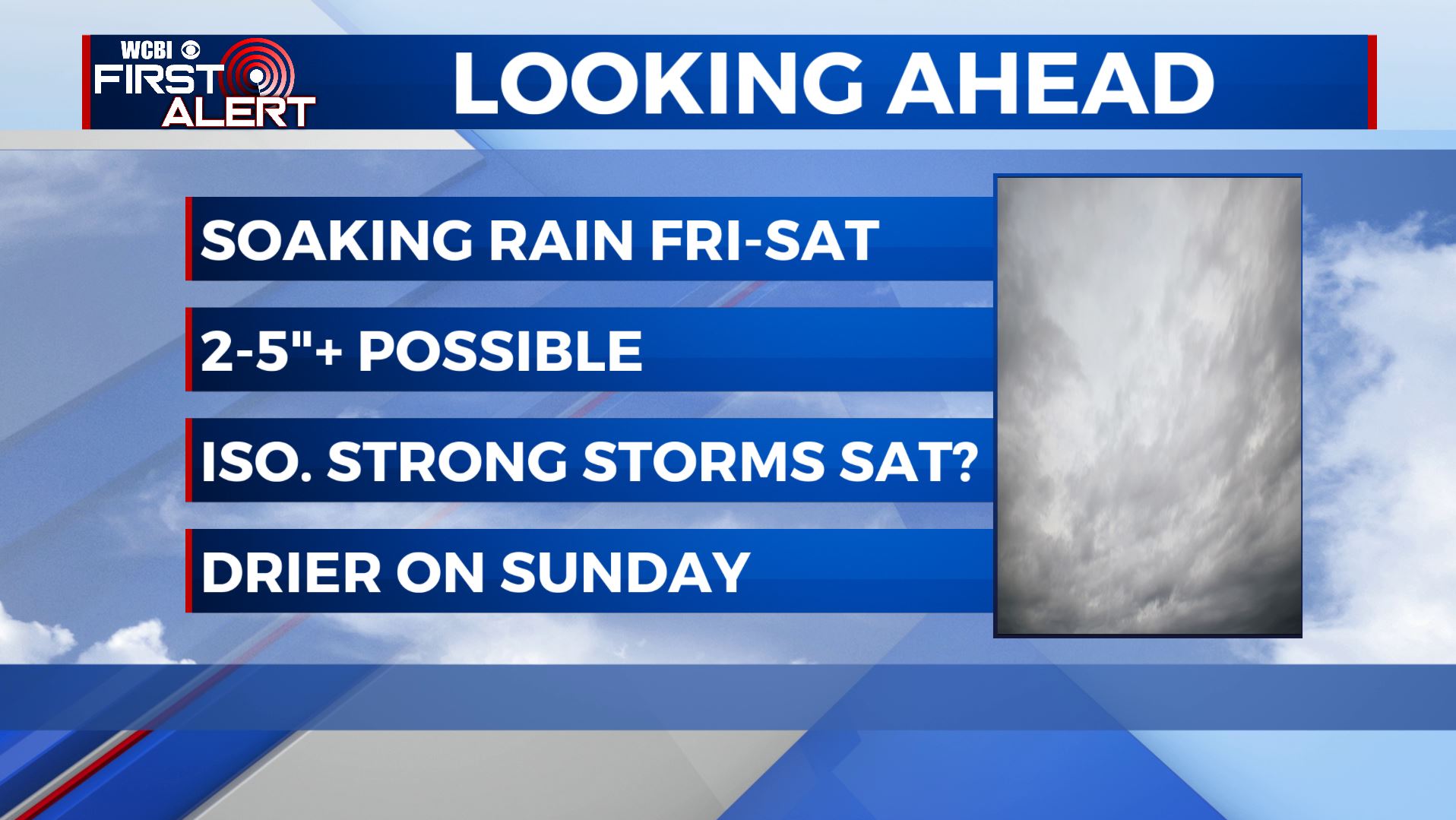
Soaking rain Friday & Saturday
SUMMARY: Widespread rain will develop on Friday and it’ll continue into Friday night. Additional rain and even a few storms will carryover into Saturday. There is still the chance of a few isolated strong to severe storms Saturday if the atmosphere can become unstable enough. The big story overall will be heavy rain with 2-5” or more possible between Friday morning and Sunday morning.
ALERTS: Follow this link for the latest flooding and storm alerts that may arise during the next few days.
THURSDAY NIGHT: Partly cloudy during the evening with temperatures cooling into the 50s. Weather looks great for high school football. Clouds thicken after midnight with showers developing by sunrise.
FRIDAY: A cool and damp day is coming our way with widespread rain expected. Some rumbles of thunder could occur but in general we’re looking at mainly rain, some of which may be heavy at times. Temperatures will warm into the 60s with NE winds 5-15 mph.
FRIDAY NIGHT: Areas of rain with a few embedded storms possible. Gradually rising temperatures as winds become southeasterly.
SATURDAY: More rain is likely along with a few storms. We’re keeping a small chance of a strong/severe storm in the forecast but it’s contingent on the atmosphere becoming unstable. It’s too early to tell if that will be the case but it’s something to keep in mind. Highs should top out around 70.
SATURDAY NIGHT: Mainly cloudy with a few lingering showers. Most of the heavy rain will quickly move to our east. Lows in the low 50s.
SUNDAY: Much drier with a mix of sun and clouds. Highs in the low 70s.
NEXT WEEK: Pretty quiet and seasonably mild weather is on track for Monday & Tuesday. Another strong front may produce heavier rain and storms Wednesday into Thursday. There may be some wet and stormy weather around for Halloween so we’ll keep watching.
Follow @WCBIWEATHER on Facebook, Twitter, and Instagram


Leave a Reply