Soggy start to week ends hot and dry
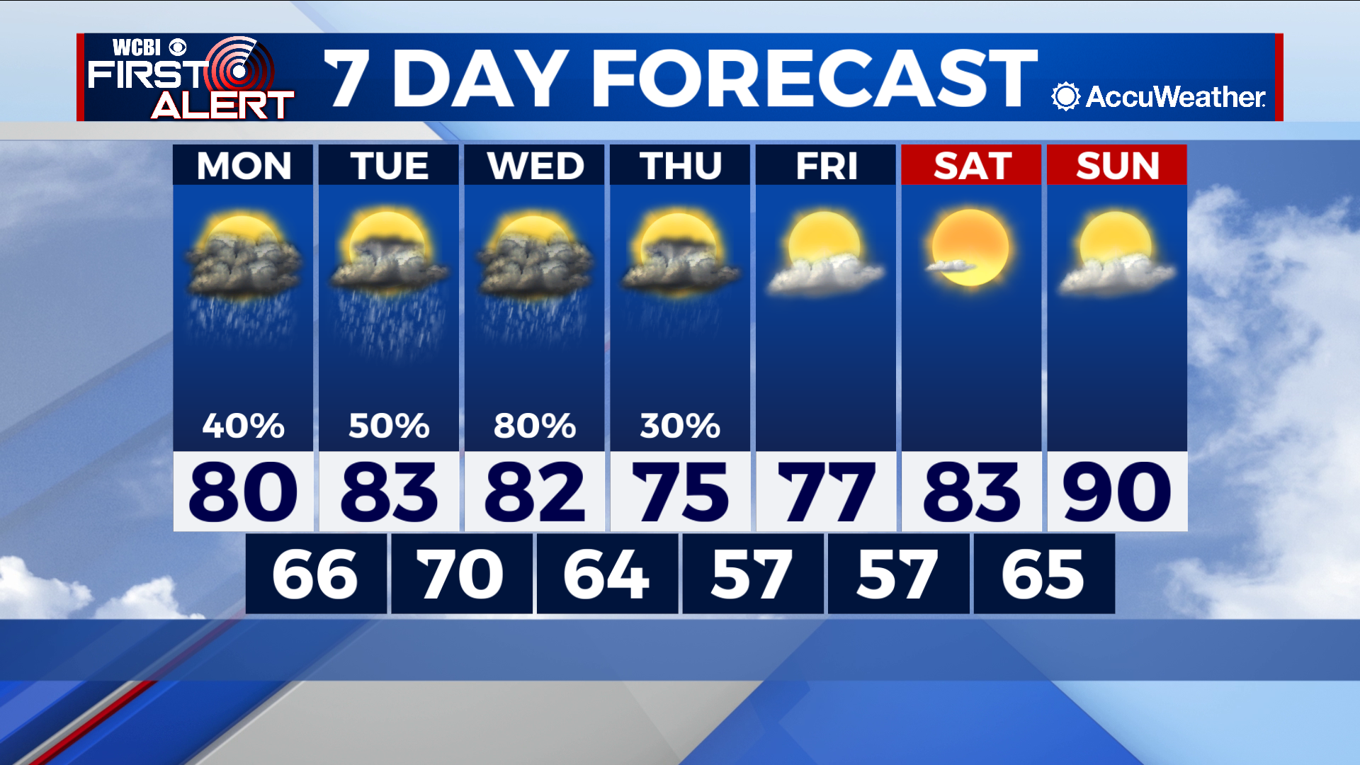
COLUMBUS – SUMMARY: A rainy start to the next week ends with sunshine and highs back in the 90s. Temperatures will steadily drop into the mid 70s by Thursday, before quickly rebounding back into the 90s by Sunday.
MONDAY: Much of the rain this week comes from the interaction of this weekend’s cold front and Invest 90-L in the Gulf of Mexico. The stalling out of the cold front into a stationary front will keep chances for rain in the forecast, including on Monday. Highs will reach into the 80s while lows will reach into the upper 60s overnight.
TUESDAY: The chances for scattered showers and thunderstorms persist into Tuesday. Highs reach into the lower 80s while Lows increase into the 70s. Expect intermittent cloud cover throughout the day.
REST OF THE WEEK: Once our tropical circulation makes its way out of the region skies will clear quickly and temperatures will warm rapidly. Highs get back into the 90s by Sunday and lows into the mid 60s by overnight Saturday. Lows will briefly get into the upper 50s Thursday and Friday making for cooler mornings.