Staying Steamy With Scattered Storms
TUESDAY NIGHT: Mainly clear with muggy air remaining in place. Lows should be in the low to mid 70s with nearly calm wind.
WEDNESDAY: Model data suggest a better chance of scattered storms so we’re going to boost odds up to 50%. Any storm may produce gusty winds, frequent lightning, and torrential downpours. Activity should diminish during the evening with the loss of daytime heating. Highs look to be around 90° before storms start to become widespread.
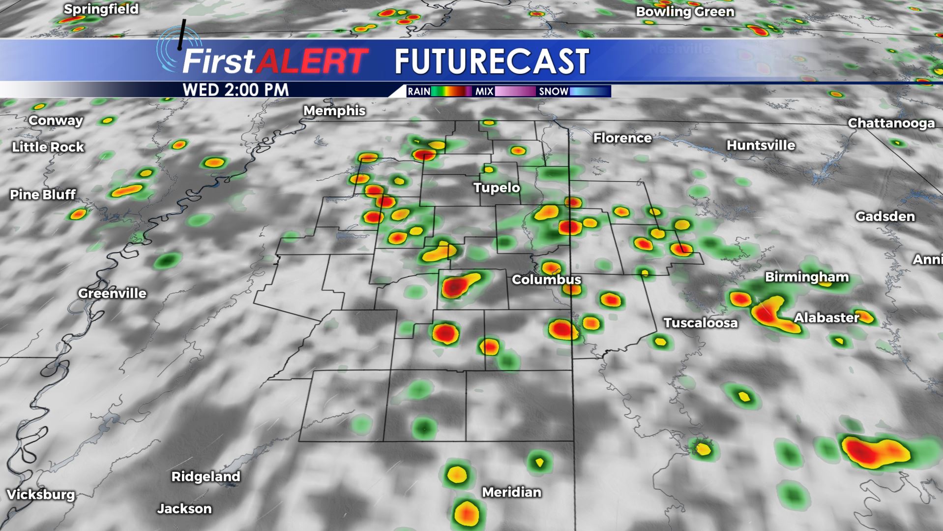
Wednesday 2 p.m. Futurecast
WEDNESDAY NIGHT: Variably cloudy and quiet once any lingering evening storms dissipate. Lows will be in the low 70s.
INDEPENDENCE DAY: Typical summer weather can be expected in our neck of the woods for the 4th of July holiday this year. The first part of the morning will be quiet but pop-up storms are possible from late morning through the afternoon and early evening. The overall chance of rain is 30% and most if not all rain should be over by the time fireworks are ready to go off. Highs stay in the low 90s with heat index values around 100°.
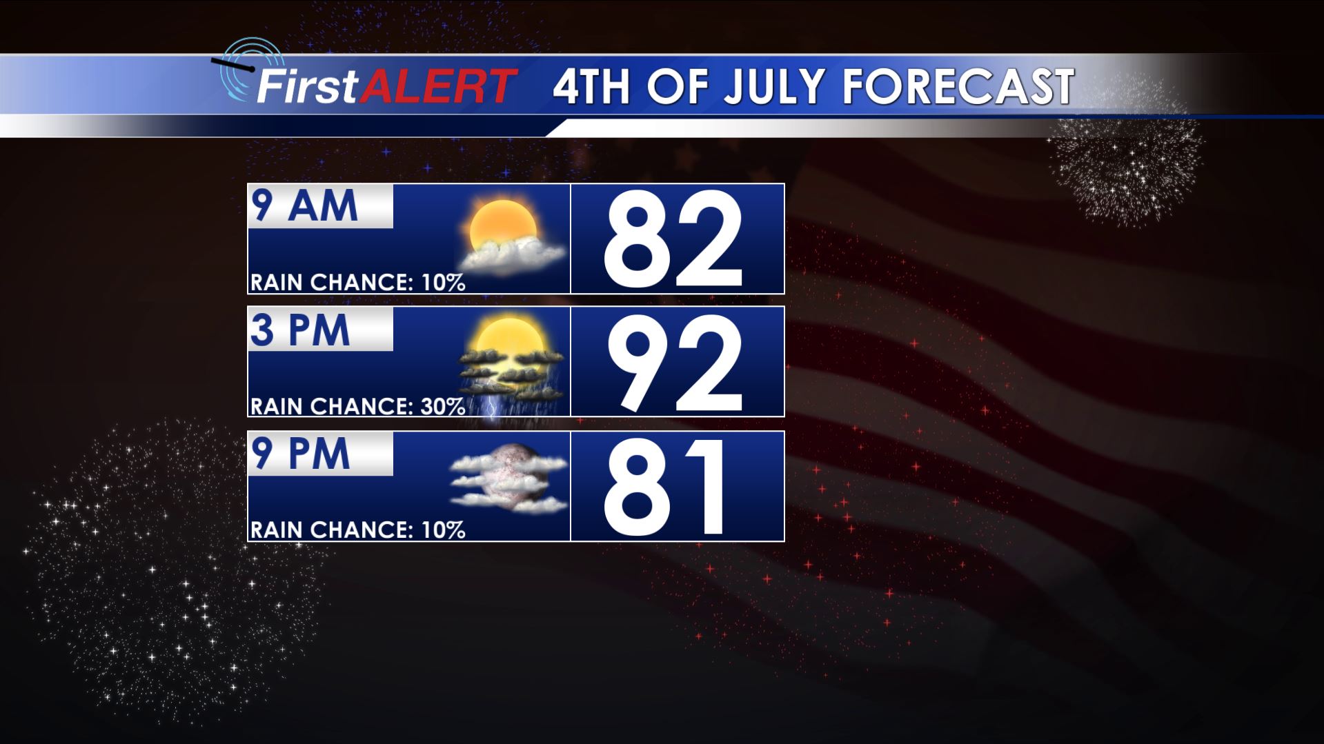
4TH OF JULY FORECAST
FRIDAY-SATURDAY: Rain chances may lower to around 20% and that could allow widespread mid 90s to take hold of the region. Heat index values push back into the low 100s.
SUNDAY-TUESDAY: Odds of scattered storms go up and that should bring temperatures down just a bit… but we’re still looking at highs in the low 90s.
Stay connected with @WCBIWEATHER on Facebook, Twitter, and Instagram


Leave a Reply