Staying warm and humid ahead of storm threat Wednesday
COLUMBUS, Mississippi (WCBI) – Temperatures stay well above average for most of this upcoming week. Strong storms become possible Wednesday.
MONDAY: Variably cloudy and warm with highs in the middle 70s – similar to previous days.
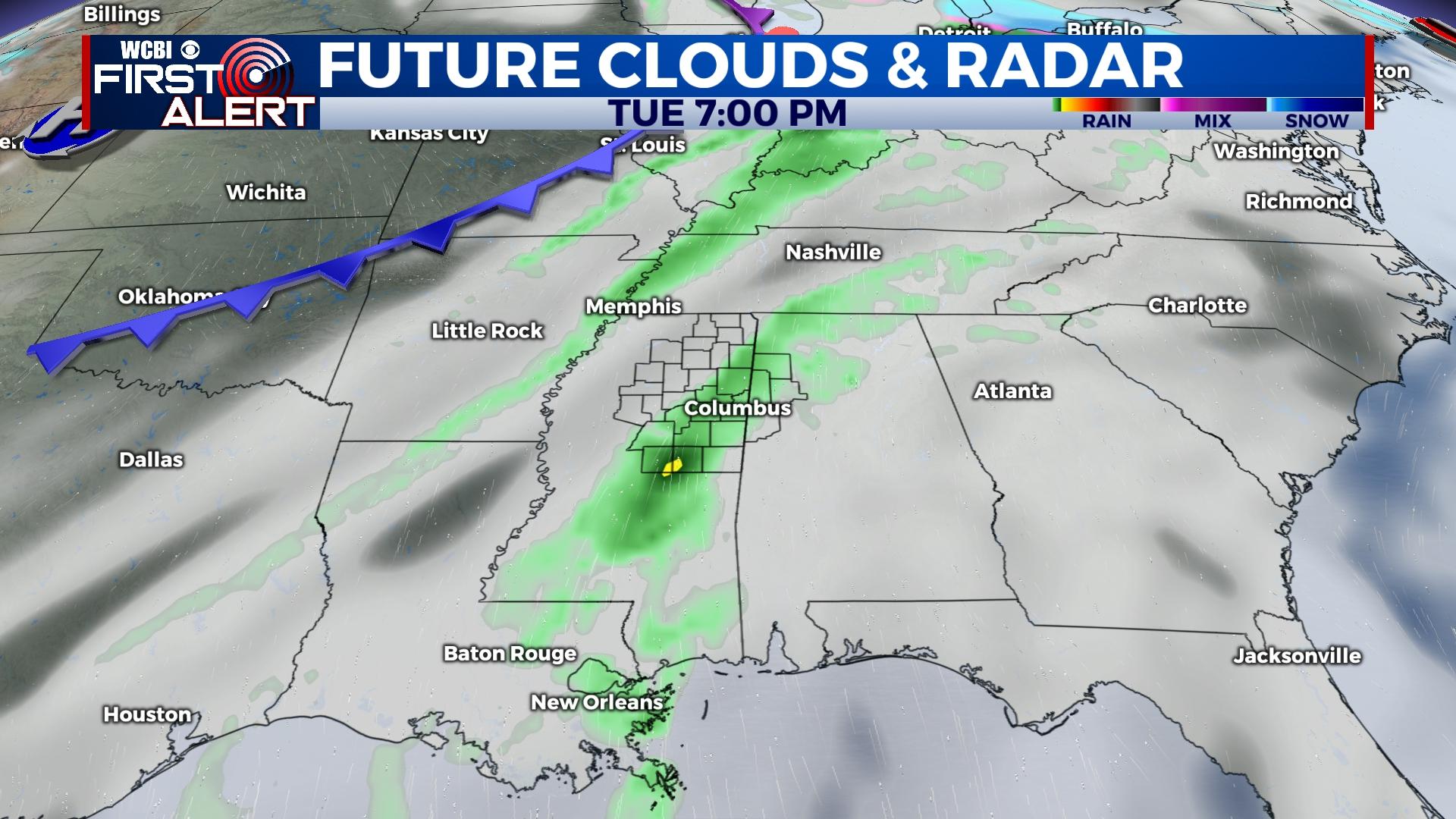
TUESDAY: A notable increase in humidity is expected, and isolated showers are possible through the day. Outside of small rain chances, daytime highs will reach the upper 70s to near 80 degrees.
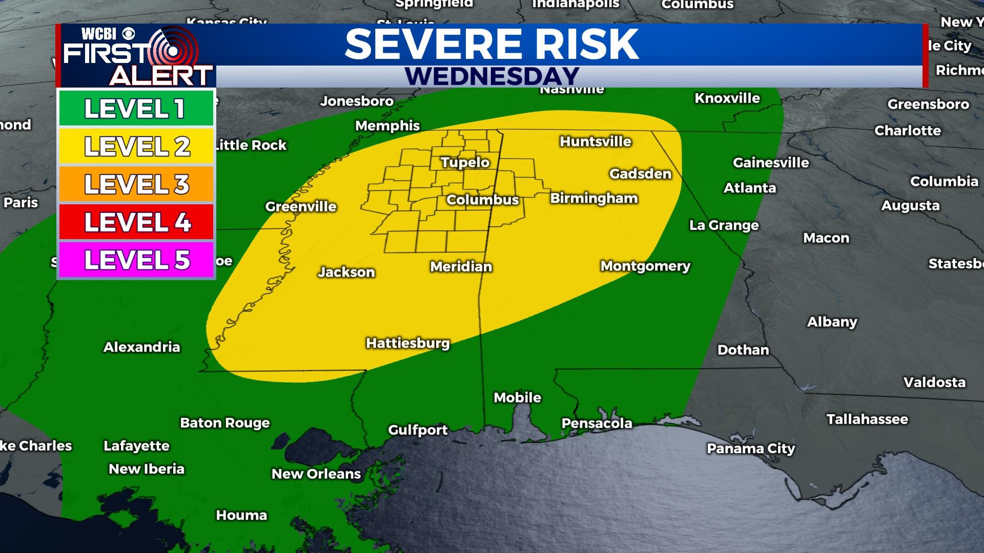
WEDNESDAY: Mostly cloudy, warm, humid, and breezy with highs easily reaching the middle 70s before any storms develop. Isolated to scattered, locally strong to severe storms are possible Wednesday afternoon and Wednesday evening. Plenty of heat, humidity, and wind shear will favor all modes of severe being possible; however, the quality of a forcing mechanism remains a slight question mark. Confidence in this forecast hopefully will increase in the next 24 hours.
END OF WEEK: Following Wednesday’s storm potential, a couple quieter days are expected before the next storm system arrives. Temperatures will stay in the low to mid 70s with a mostly cloudy sky, but rain chances should remain limited to zero.
SATURDAY/SUNDAY: Unfortunately yet another strong system is slated to move through the area over the weekend. Most components of a severe weather threat appear in place, so this system will certainly need to be monitored for additional strong to severe storms…stay tuned!