Staying warm & humid with a few storm chances for Tuesday
SUMMARY: Cristobal has now has now moved into Missouri and the Midwest. Warm, humid and some storm chances will remain in place for our Tuesday. A cold front will push through early Wednesday that will bring us some much better changes to our weather late week into the weekend.
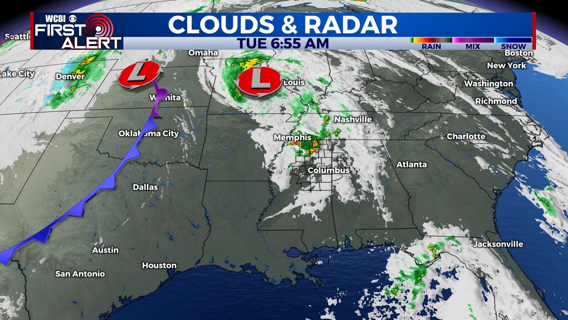
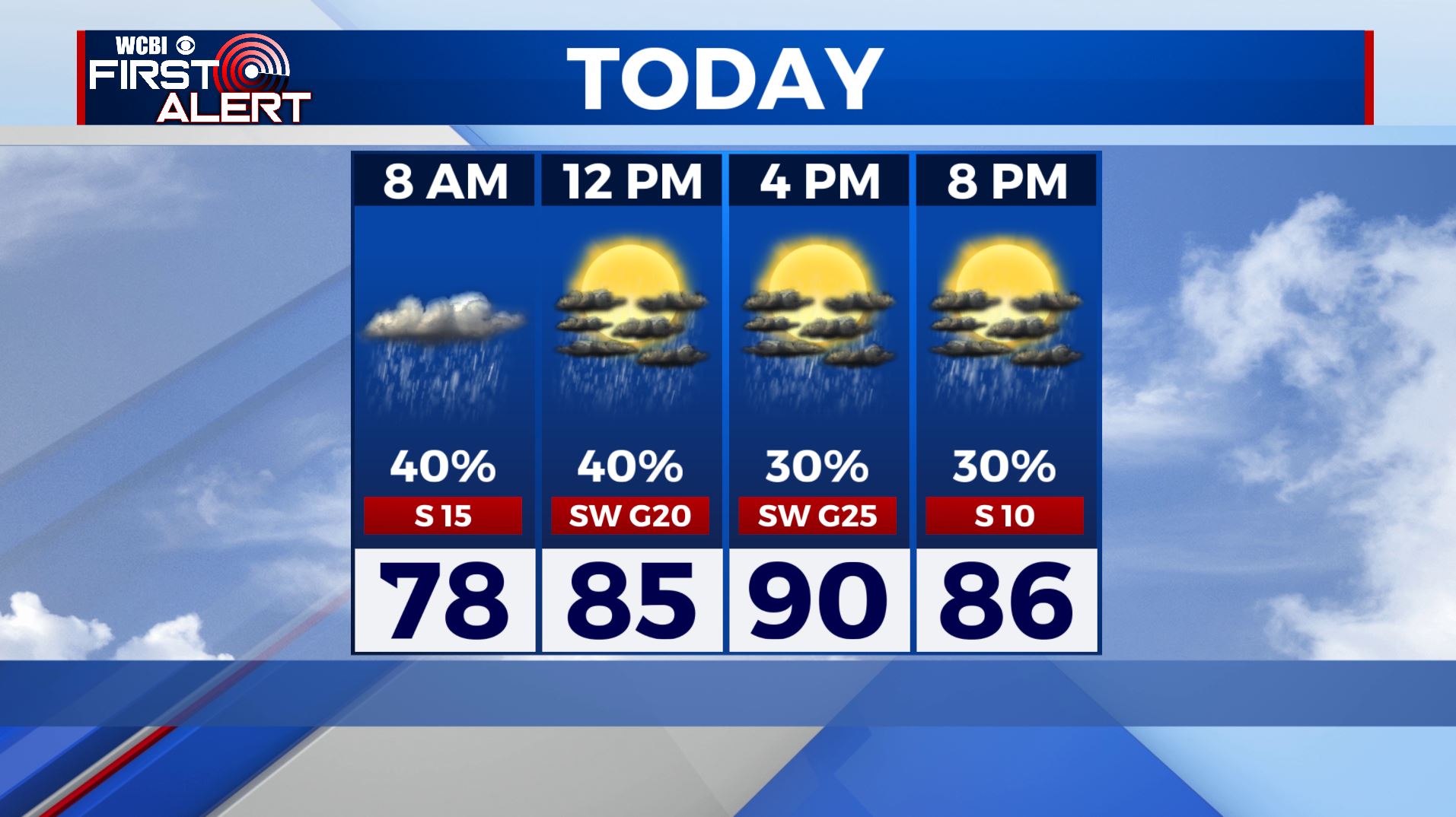
TUESDAY: We have been dealing with a few heavy downpours overnight and early this morning as Cristobal lifts north. A mix of sun & clouds is expected this afternoon along with very warm & humid conditions that could lead to a few afternoon scattered showers and storms. Highs are going to push near 90 degrees with higher heat indices making it feel like the mid to upper 90s so find a way to stay cool. Winds SW 10-20 mph.
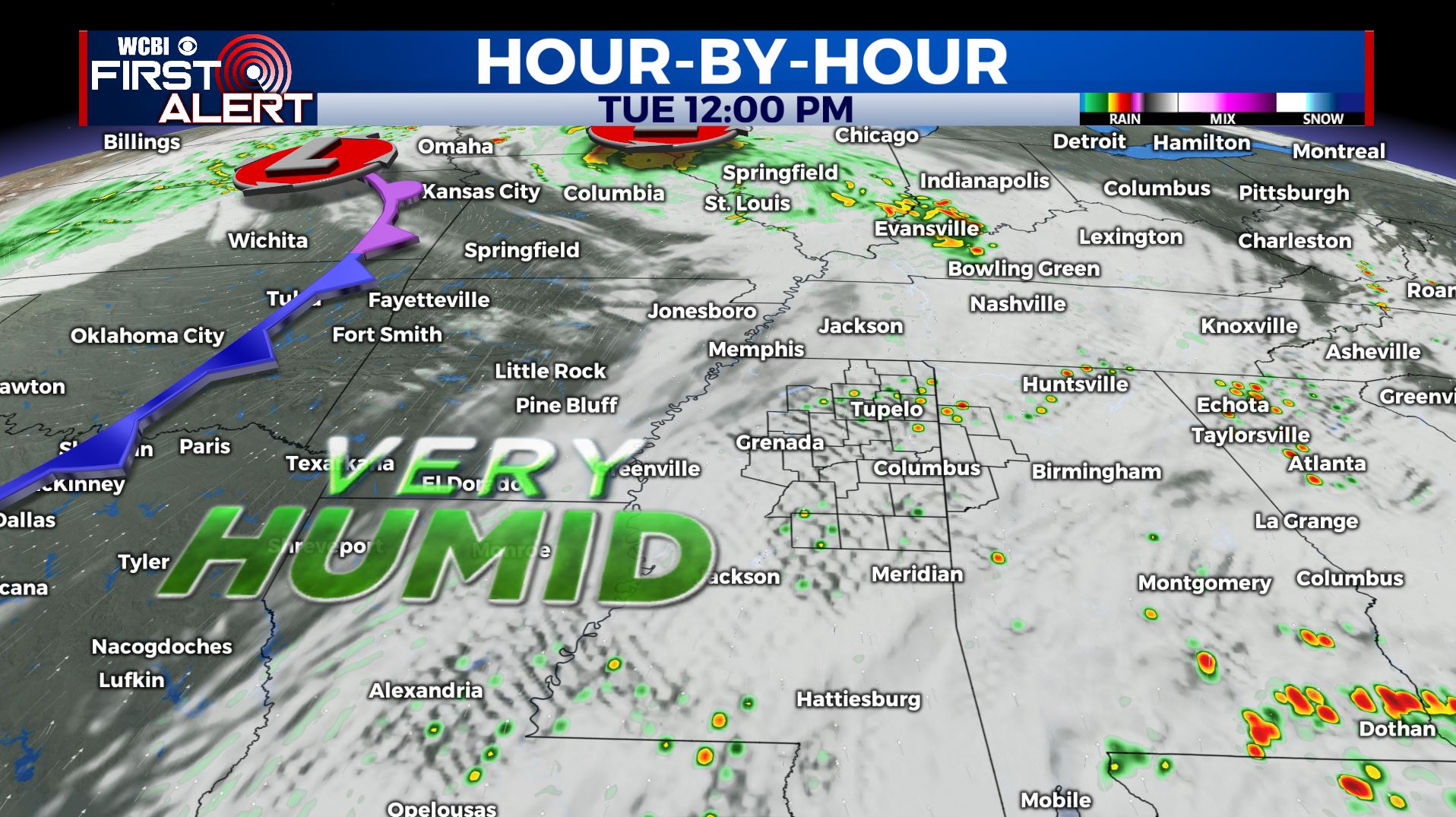
TUESDAY NIGHT: A cold front pushing through overnight may spark a line of showers and storms. Some storms could have some very gusty winds and heavy downpours at times. Overnight lows still warm & muggy in the low to mid 70s.
WEDNESDAY: Any morning rain showers should move out by midday, allowing the sunshine to return and less humid, dry conditions to build in behind the cold front. Highs top out in the mid 80s. West winds 10-15 mph.
WEDNESDAY NIGHT: Clear skies and refreshing. Overnight lows in the low 60s.
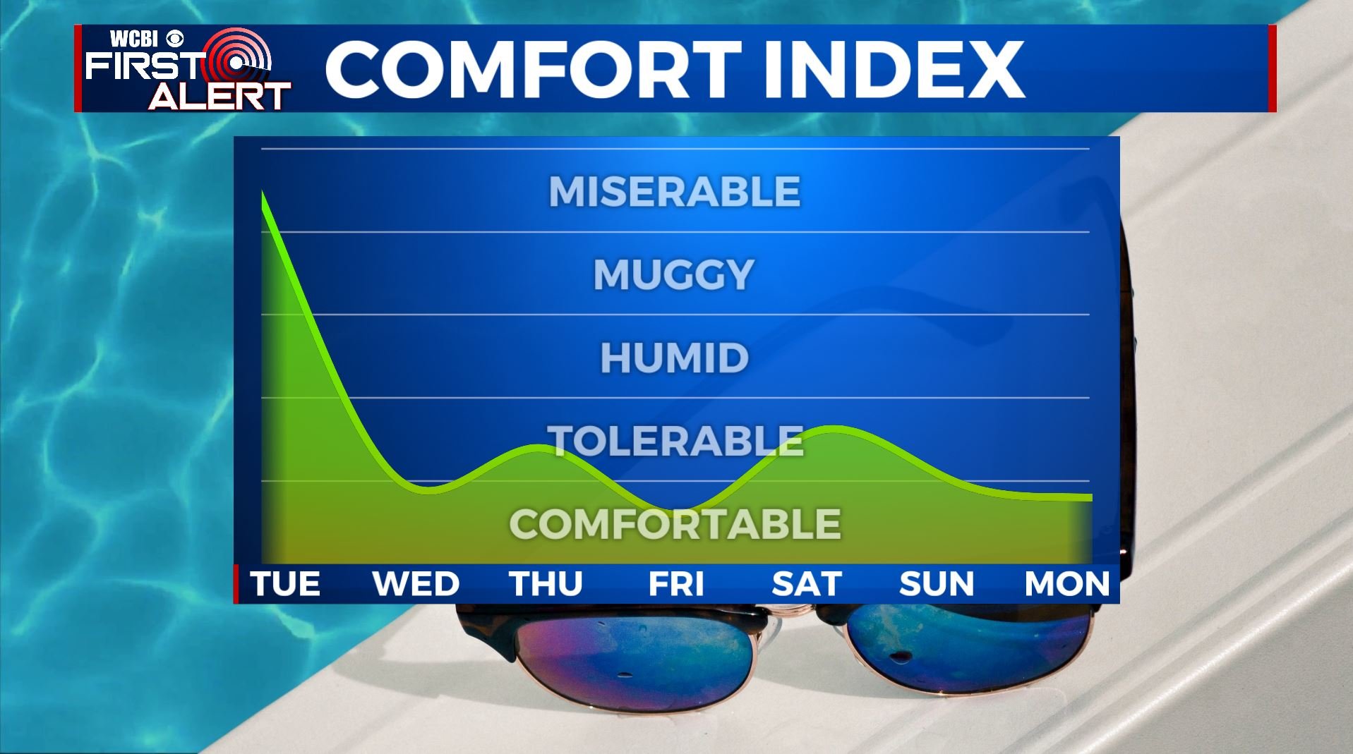
THURSDAY-WEEKEND: Lots of sunshine, dry and staying pleasant for mid June late week and into the weekend. Highs in the mid to upper 80s with overnight lows mainly in the low to mid 60s.
MONDAY: Sunshine mixed in with a few clouds but staying dry to start the new work week. High temperatures remain the the mid 80s.
Stay connected with @WCBIWEATHER on Facebook, Twitter, Instagram, and the WCBI News App


Leave a Reply