Staying warm & spring-like but rain chances returning
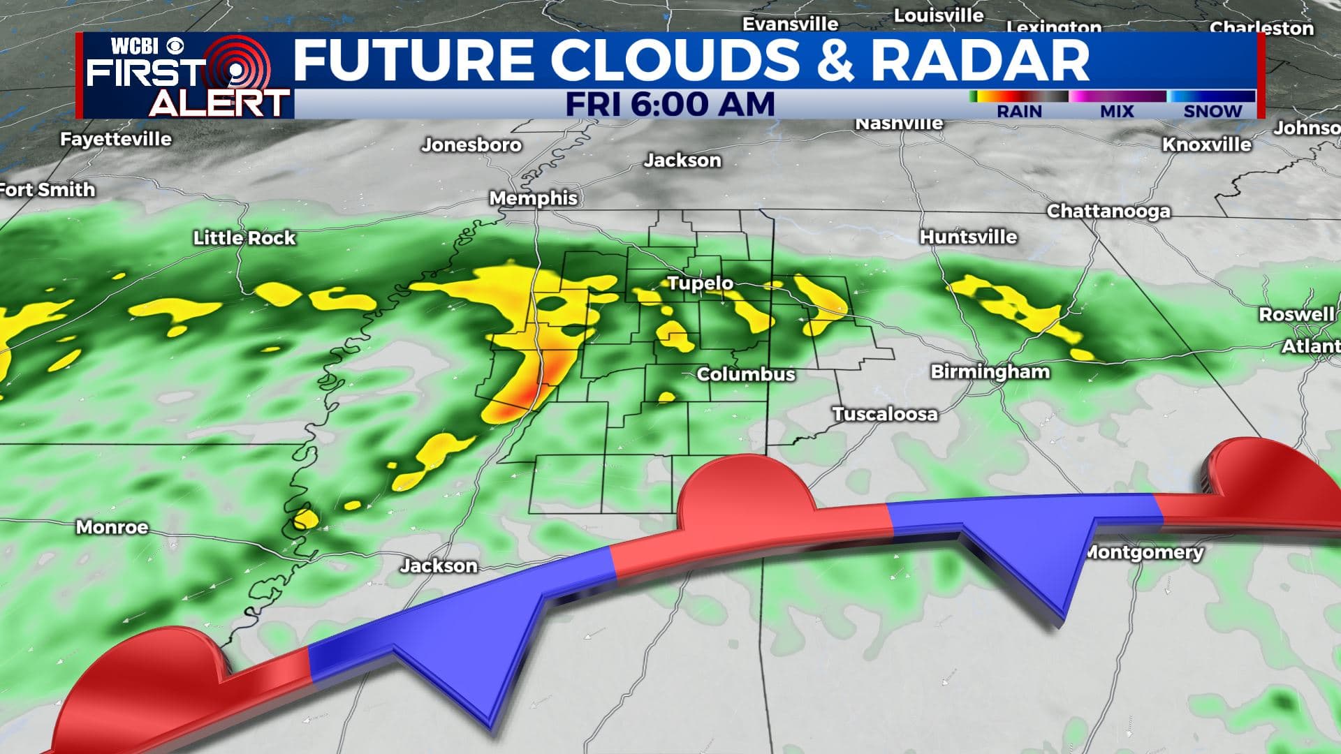
SUMMARY: Enjoy the sunny start to our Wednesday because clouds will increase during the afternoon. Rain chances are returning as we wrap up the week and will continue through next week. Heavier rain is possible Thursday night into Friday. Some thunderstorms can be expected during the weekend and into next week but no severe weather is expected. Anywhere between 2″ and 6″ of rain (or more) could fall between now and next Tuesday.
WEDNESDAY: Sunny skies to start out our day, but clouds will build back in. A few late day showers can’t be totally ruled out. Conditions should generally be alright for the MSU & Ole Miss baseball home openers at 4 p.m. Highs from the upper 60s to lower 70s. Winds SW 5-10 mph.
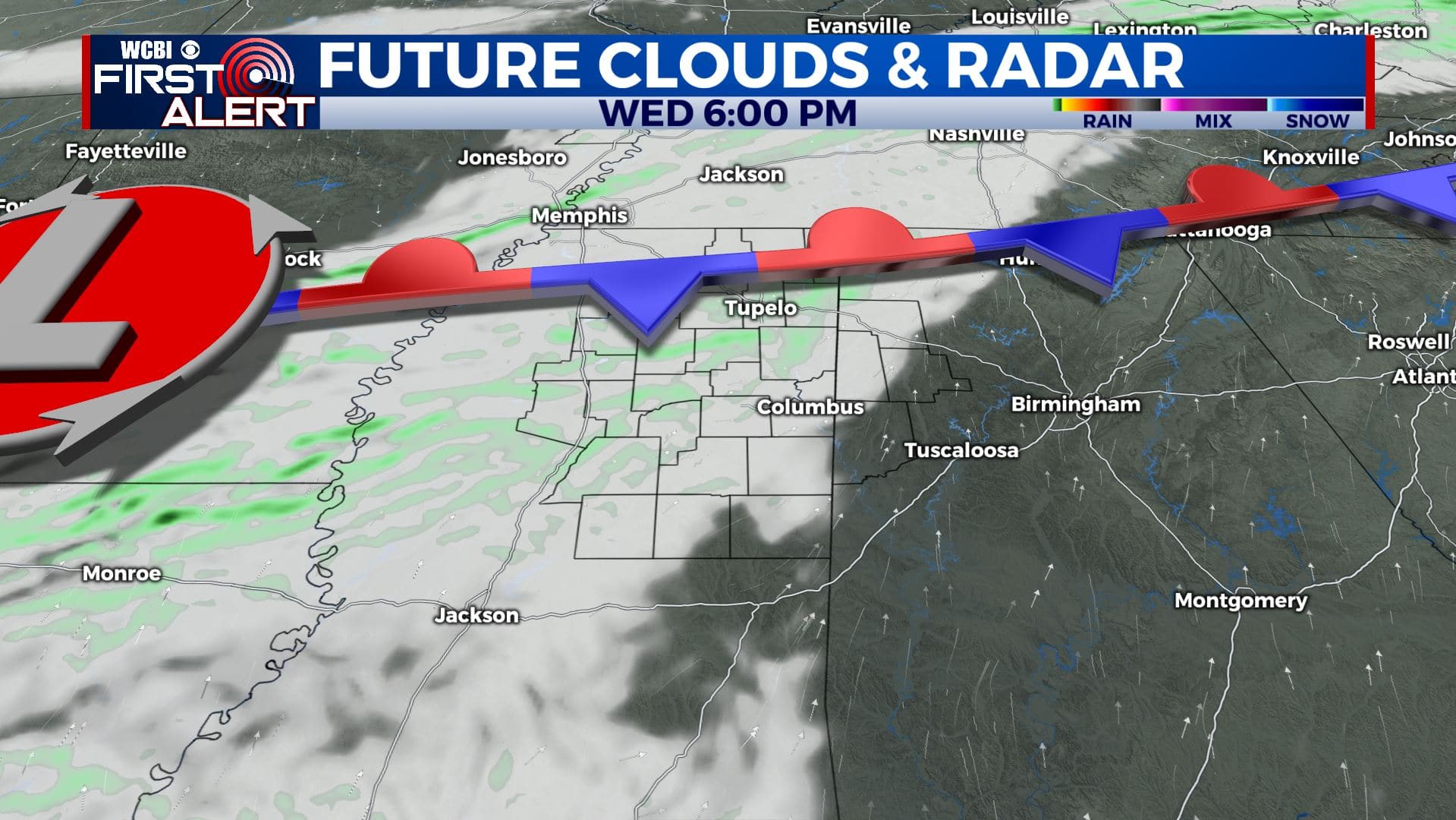
WEDNESDAY NIGHT: Mostly cloudy. Overnight lows in the 40s. A few isolated showers are possible.
THURSDAY: Mostly cloudy skies with a chance of late day showers. Highs in the lower 60s.
THURSDAY NIGHT: Areas of rain developing. Overnight lows in the 40s.
FRIDAY: Cloudy skies with areas of rain likely. Highs a few degrees cooler, but still near average in the upper 50s.
SATURDAY: Mostly cloudy with a chance of rain. Highs in the upper 60s.
SUNDAY: Mostly cloudy. Showers and storms likely. Highs in the lower to mid 70s.
MONDAY – TUESDAY: Mostly cloudy. Areas of rain will remain possible. Highs in the lower 60s.
Stay connected with @WCBIWEATHER on Facebook, Twitter, Instagram, and the WCBI News App


Leave a Reply