Storms early next week bring cold to bear
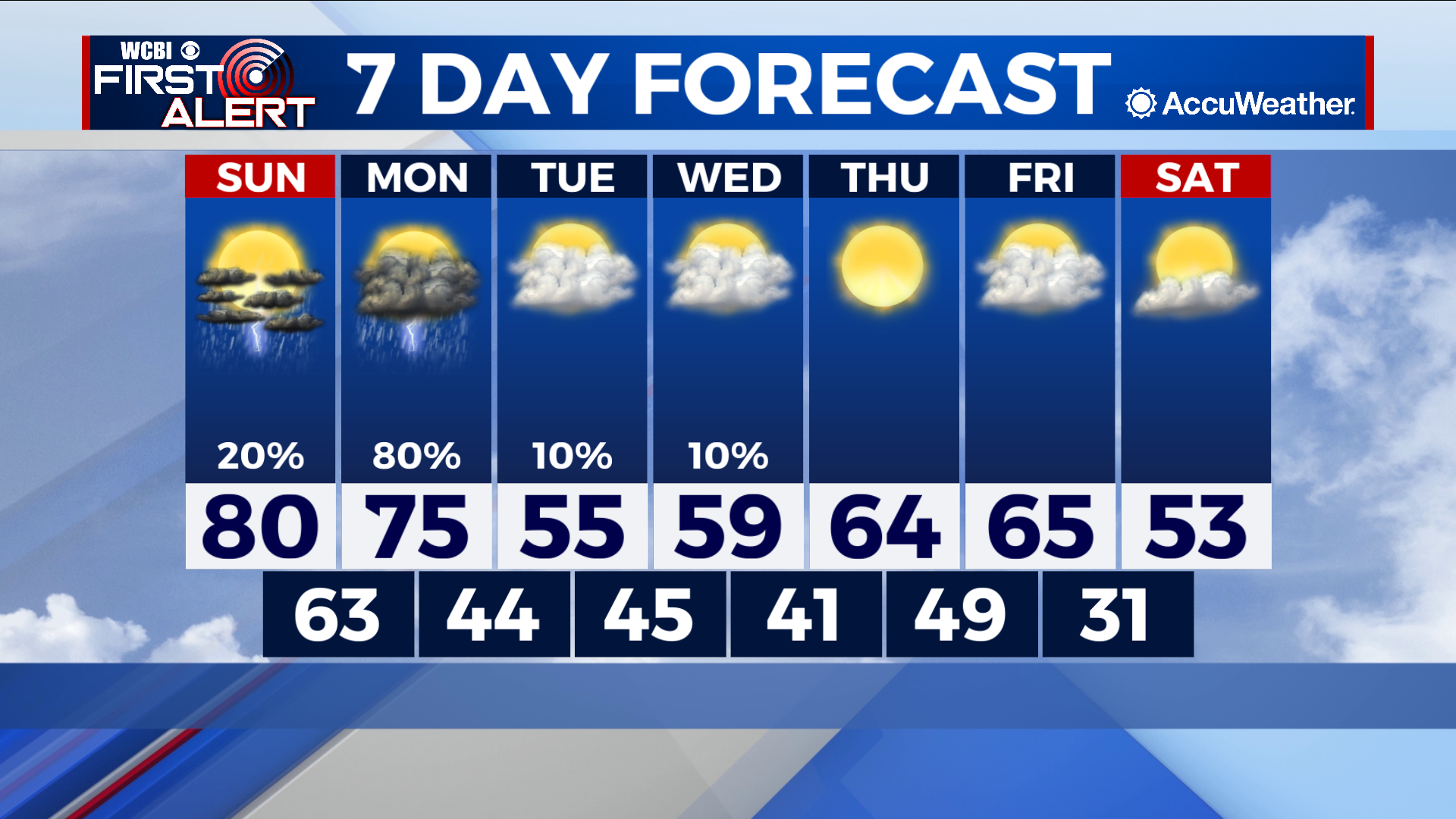
COLUMBUS – SUMMARY: Temperatures will take a major dip Monday with the passing of a strong cold front through the region. Showers and thunderstorms are projected to move through Northeast Mississippi during the midday and afternoon hours Monday before clearing out overnight. Highs will dip down into the 50s and lows into the 40s. Some temperature rebound is expected next week but a second cold front late Friday will return us to the 50s.
SUNDAY: Temperatures in the 80s are once again on deck, as partly cloudy skies allow sunshine to keep warming the region. The chance for the isolated thunderstorm is possible throughout the day but the likelihood for severe weather is low. Overnight temperatures will drop into the low 60s.
NEXT WEEK: A strong cold front Monday will bring highs back into the 50s and bring the chance for some severe weather to boot. The primary threat with the squall line Monday will likely be damaging winds, with the potential for the brief tornado spin-up as well. As always we will continue to update you on the situation as it evolves. Temperatures after Monday slowly warm up, breaking 60 by Thursday before another cold front on Friday drops highs back into the 50s. Lows remain a little more consistent throughout the week, sitting in the 40s before dropping to the low 30s after Friday’s front. Clouds likewise will remain mostly cloudy throughout the week.


Leave a Reply