Storms likely Thursday afternoon, less humid Friday
COLUMBUS, Mississippi (WCBI) – Showers and storms are likely Thursday before drier, less humid air arrives Friday. Summer-like weather quickly returns by Sunday.
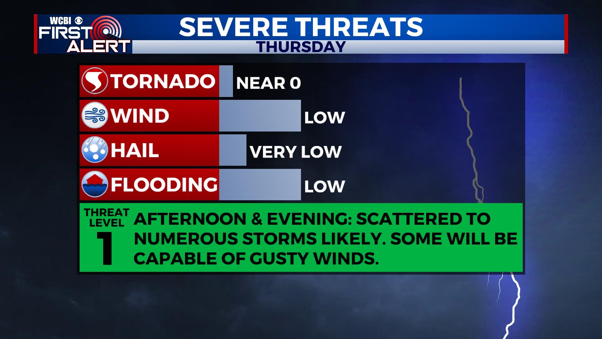
THURSDAY: The afternoon brings a likely chance of showers and storms back to the forecast as a slow-moving front moves through the area. Pockets of torrential rain and gusty winds are possible with the strongest activity, but major severe weather is not expected. Since storms may be slow-moving, localized flooding is also possible. Storms should be most widespread in the afternoon and evening hours before tapering and weakening by midnight.
FRIDAY: The day may start overcast, but gradual clearing is expected as drier air works in from the north. Daytime highs will back off into the lower 80s, feeling much better than previous days!
WEEKEND: The comfortable air sticks around through Saturday before summer-like conditions build back in Sunday. A few showers and storms will become possible by Sunday afternoon.
NEXT WEEK: Increasing heat and humidity will highlight the forecast each day, reaching the lower and middle 90s by next Wednesday. Heat indices could exceed 95 degrees several days next week, so prepare accordingly! Otherwise, expect a few random downpours each afternoon, but no day should have a washout.
TROPICAL UPDATE: Invest 91-L near the Yucatan Peninsula is forecast to gradually develop northeast into the southeast Gulf through Friday. It is expected to be a big rainmaker for southern Florida as it potentially becomes a tropical depression or storm in the next 48 hours.


