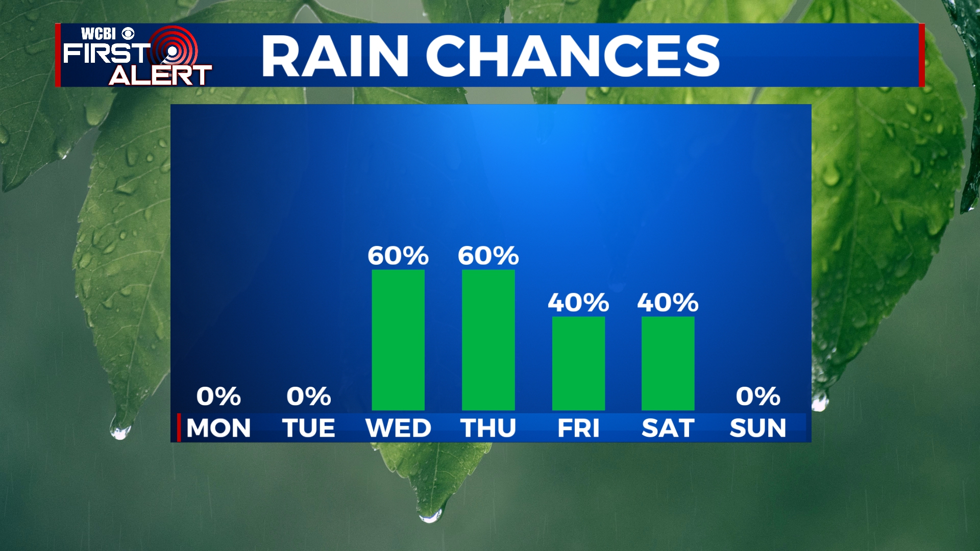
More Storms Likely This Week
While we will be dry to start off this week, there will likely be a couple of more rounds of storms to deal with in the next seven days. We’re watching systems that could impact the area Wednesday night and also on Friday and Saturday.
SUNDAY NIGHT: Rain and some thunder will continue through at least midnight before we start to clear out. Some of these storms could produce some small hail, gusty winds, and heavy rain. Widespread severe weather is not likely after sunset. Lows will be in the mid 50s.
MONDAY-TUESDAY: Clouds will break up, leaving us with some peeks of sunshine on Monday. Tuesday looks to be mostly sunny with just a couple of clouds. Highs will be in the mid to upper 70s with overnight lows in the 50s.
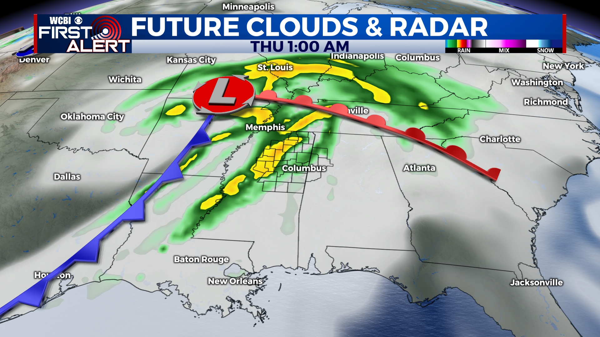
WEDNESDAY-THURSDAY: We’re going to continue to watch the middle portion of the week as another storm system will approach. At this point, it looks like storms will develop late in the day on Wednesday and move across the area overnight into early Thursday morning. Temperatures will top out in the mid 70s in the afternoon.
FRIDAY: We’ll be dry with some peeks of sunshine to start of Friday, but rain and storms will build into the area by the evening. Highs near 80.
SATURDAY-SUNDAY: Some rain and storms could linger into the day on Saturday, but will exit the area by Saturday evening. It looks like most of Sunday will be dry, but we’ll have to continue to monitor to fine-tune timing details.


Leave a Reply