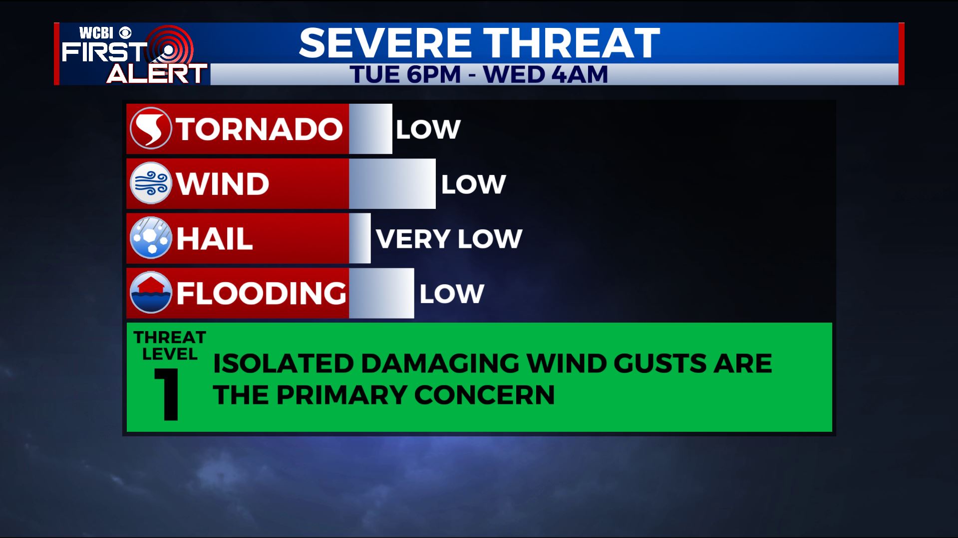
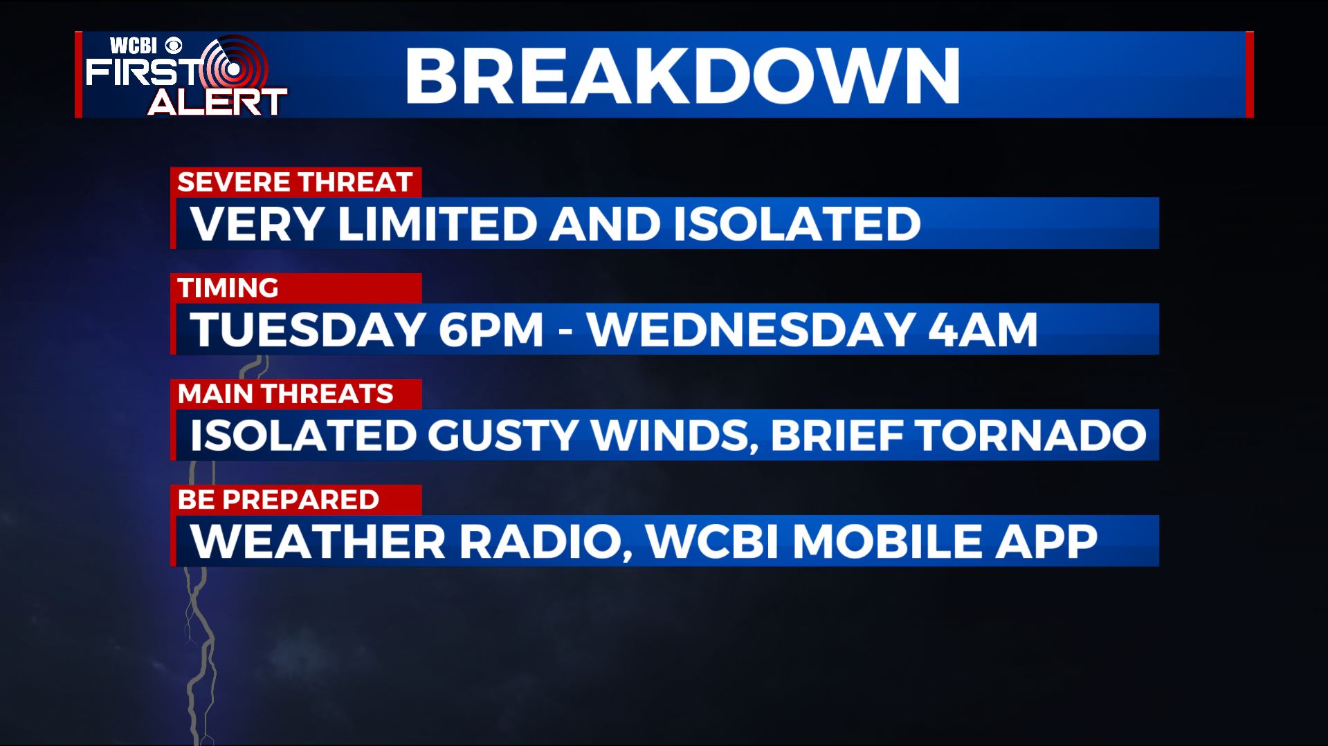
Storms possible Tuesday night, more active weather Saturday
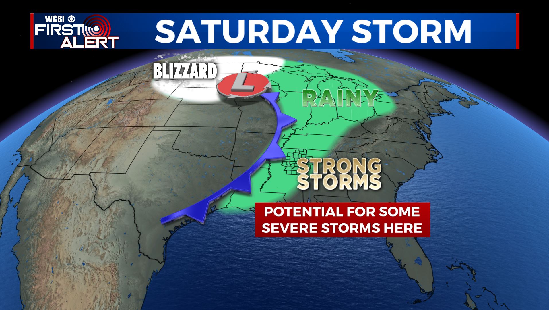
SUMMARY: We’re watching 2 systems that will impact the region on this busy Thanksgiving week. The first will come Tuesday evening/night in the form of showers and storms. Some strong to severe storms are possible. Another potent storm system is expected to drive a cold front through the area sometime Saturday or Saturday night. Yet more strong to severe storms will be possible during that time. Thankfully the weather should remain quiet Wednesday, Thursday, and Friday for folks doing any traveling around the region for the holiday.
MONDAY NIGHT: Clear during the evening with clouds filling back in by sunrise. Lows in the low to mid 40s. SE winds 5-10 mph.
TUESDAY: Mostly cloudy, breezy, and mild. High in the upper 60s to around 70. Winds SSE 10-20 mph. Some showers are possible during the afternoon.
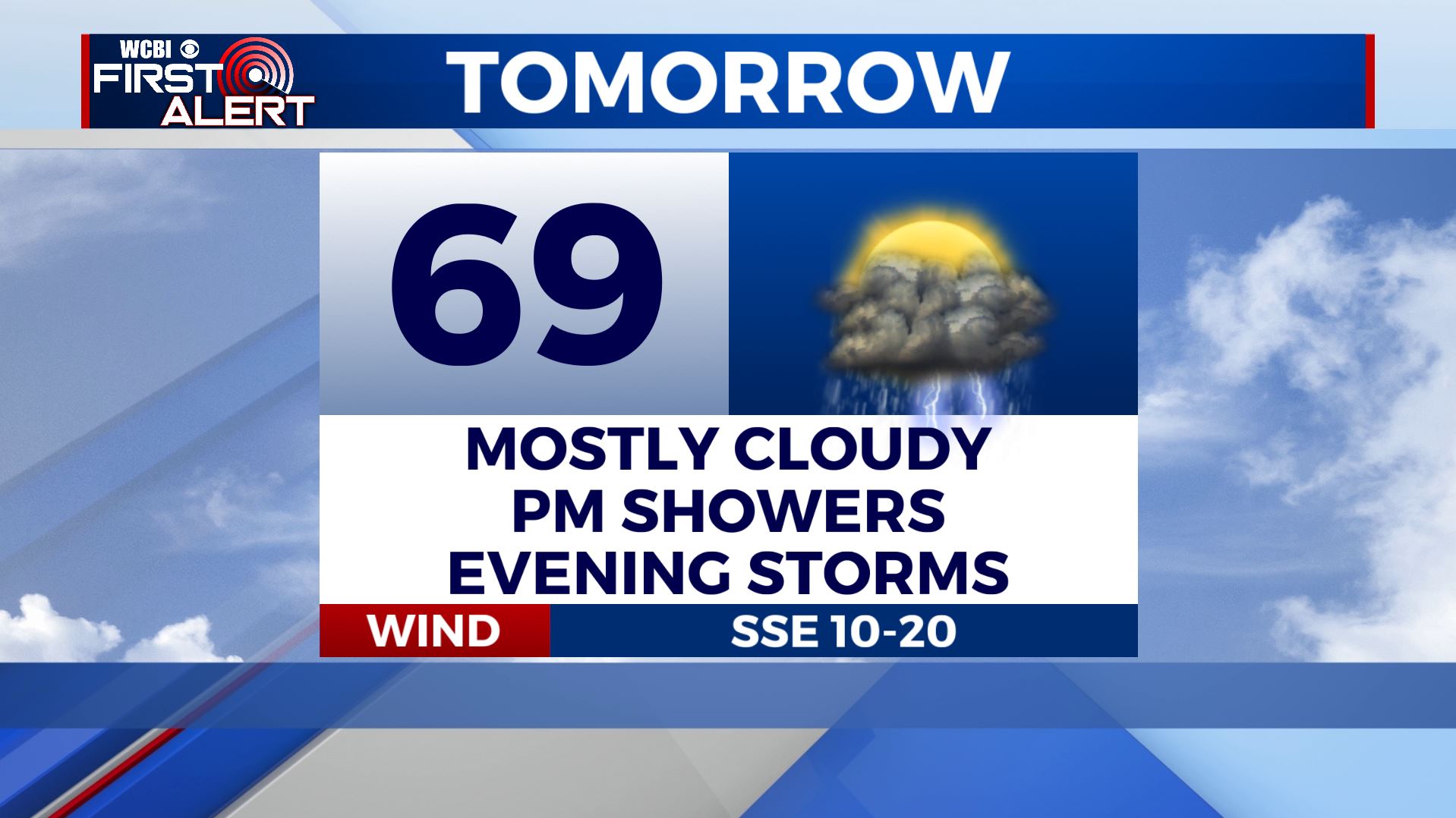
TUESDAY EVENING/NIGHT: Areas of rain and storms. Some storms may be strong to severe with damaging wind the main threat. Fairly steady temperatures in the 60s for most of the night with 50s returning late. Gusty winds from the SSW 10-20 mph.
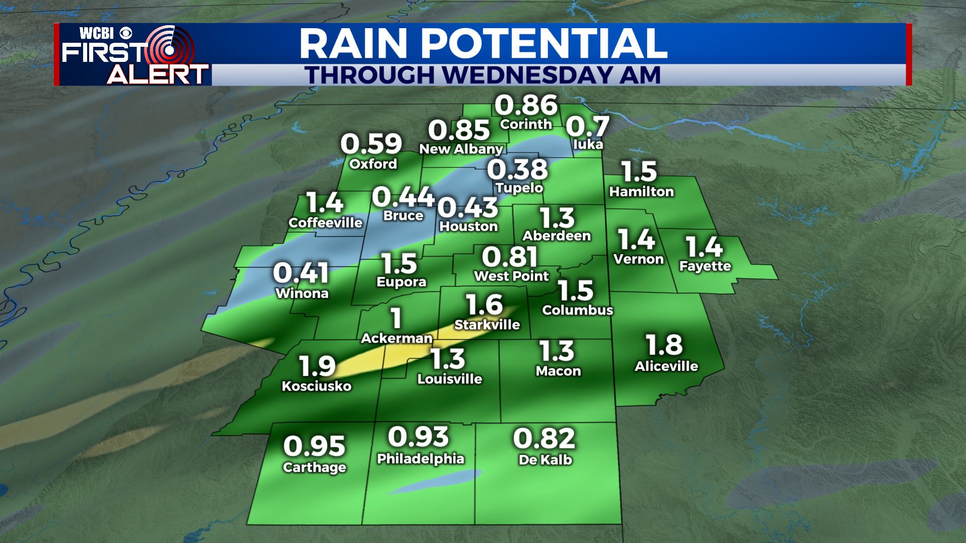
WEDNESDAY: Variably cloudy. Highs in the low 60s. Breezy NW winds 10-20 mph. Travel should be pretty good all around the region as the day wears on.
WEDNESDAY NIGHT: Variably cloudy and chilly. Lows in the upper 30s to around 40.
THANKSGIVING DAY: Mostly cloudy. Seasonable highs the 50s. An isolated shower or two can’t be ruled out but most of that activity should stay just to our northwest.
FRIDAY: Mostly cloudy. Milder highs in the 60s. No major issues are expected for shoppers or travelers in our area but a stray shower or two could occur.
SATURDAY: Rain and storms are likely during the afternoon and evening. Some storms may be strong to severe so stay tuned for updates over the next few days as new data arrive. Highs top out in the 70s.
SUNDAY: Variably cloudy, cool, and breezy. Highs in the 50s.
Stay connected with @WCBIWEATHER on Facebook, Twitter, Instagram, and the WCBI News app


Leave a Reply