Storms Roll In Late Tonight and Tomorrow Morning.
TODAY: Isolated downpours through the day today. Temperatures in the upper 70s and low 80s. A few isolated showers will be possible during trick or treating hours this evening, but it shouldn’t be enough to warrant cancelling outdoor plans.
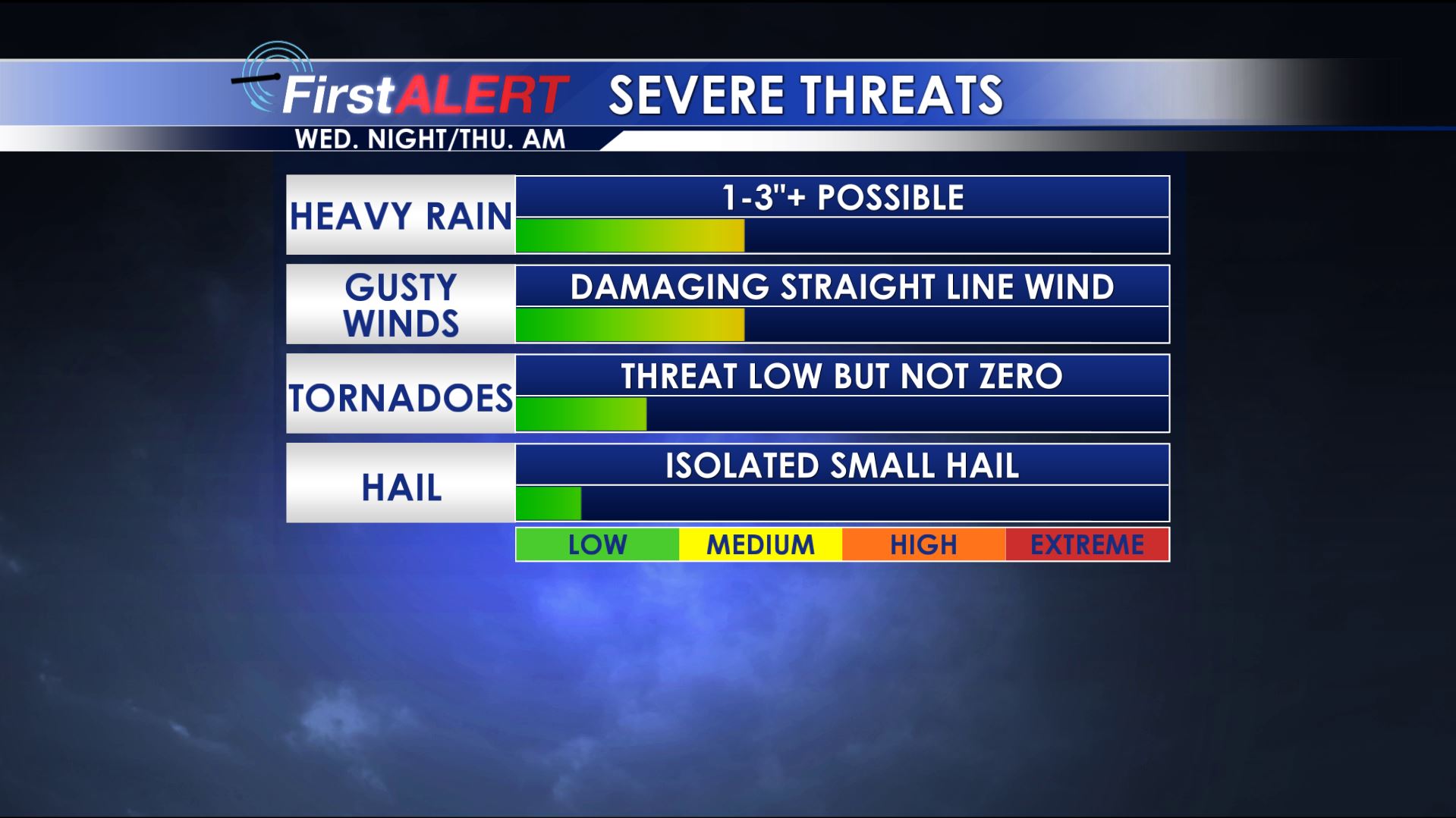
Severe Threats Wednesday Night & Thursday Morning
TONIGHT/THURSDAY AM: A line of thunderstorms will begin to move into our area by around Midnight, moving from northwest to southeast, ultimately pushing out of our area by about 8-9 AM Thursday morning. Some of these storms could be strong to severe, with damaging straight line winds and heavy rainfall. An isolated tornado cannot be ruled out as well. Lows in the 60s.
THURSDAY: Lingering showers and storms through the day. Highs in the low 70s.
FRI/SAT/SUN: Upper 50s with an isolated shower possible on Friday, then drier weather this weekend, with highs in the mid 60s Saturday and upper 60s Sunday, with a mix of clouds and sunshine through the weekend.
EARLY NEXT WEEK: Another potent round of storms looks possible for the beginning of next week. For now, details on timing and threats are still a bit tough to nail down, but we will bring you more details as the forecast becomes a bit more clear.


Leave a Reply