Storms Tuesday and Wednesday, Cooler Midweek
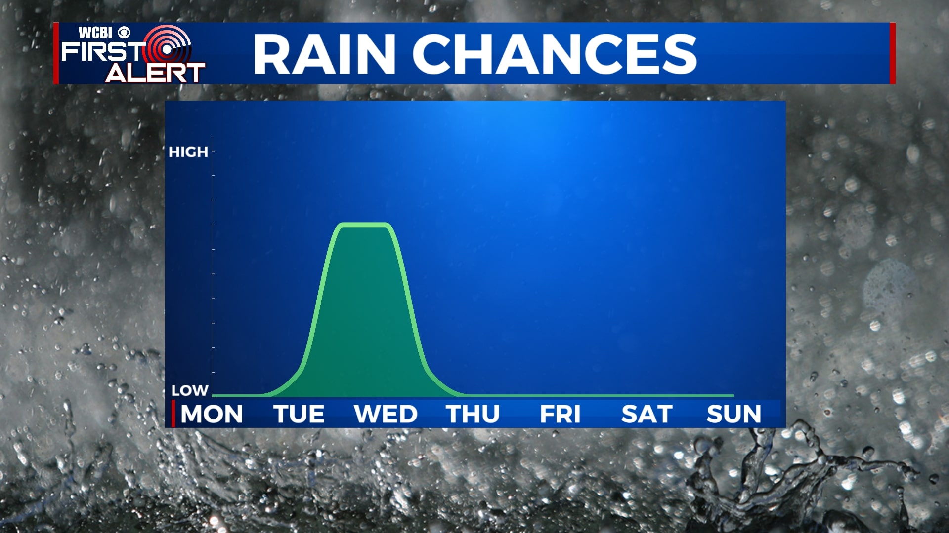
SUMMARY: Stormy weather remains out of the forecast from now until Tuesday and Wednesday. Some storms could be strong or severe. Looking cooler for Thursday but a pleasant end of the week with warming temperatures through the weekend.
SUNDAY NIGHT: Clouds will be on the decrease tonight leaving us with partly cloudy skies overnight. Cooler and breezy with low temperatures in the upper 30s. Winds will be out of the north around 5-15 MPH gusting 20 MPH.
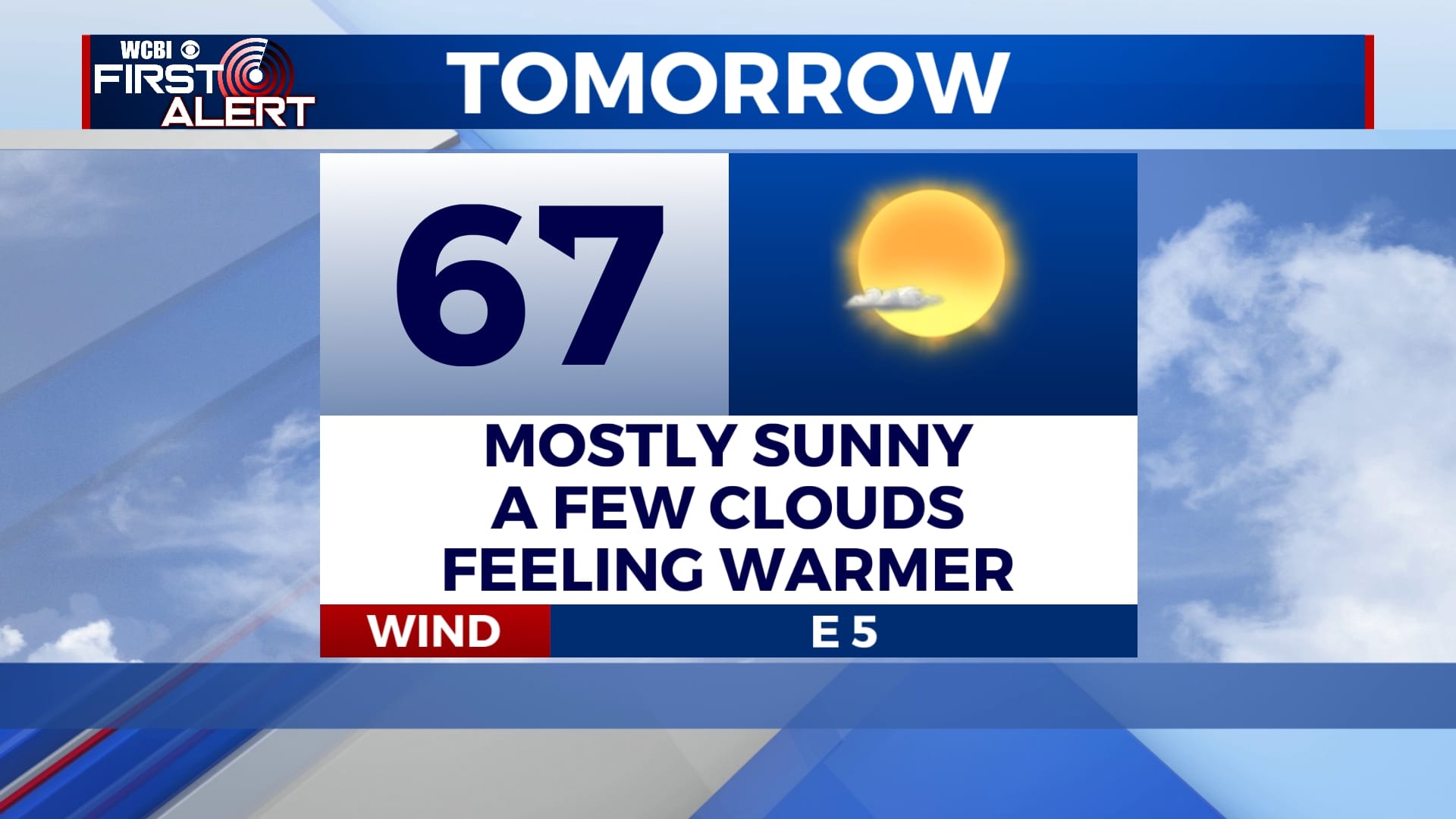
MONDAY: A nice day with plenty of sunshine. Warming temperatures into the upper 60s and lows will remain in the mid 40s.
TUESDAY: The sun returns for the morning hours but our next chance of showers and thunderstorms arrives late Tuesday afternoon into the overnight. These storms could have the potential to be strong or severe. High temperatures in the lower 70s and lows in the upper 50s.
WEDNESDAY: Breezy and rainy. Showers and thunderstorms expected to continue through Wednesday morning but will move out of the area by the afternoon leaving us with overcast skies. High temperatures will reach the lower 60s. Winds will be out of the N between 15-20 MPH gusting 25 MPH.
THURSDAY – SUNDAY: Sunshine sticks around Thursday through the weekend. A bit cooler but will see a warming trend into the weekend. Overnight lows will be in the 30s and 40s.


Leave a Reply