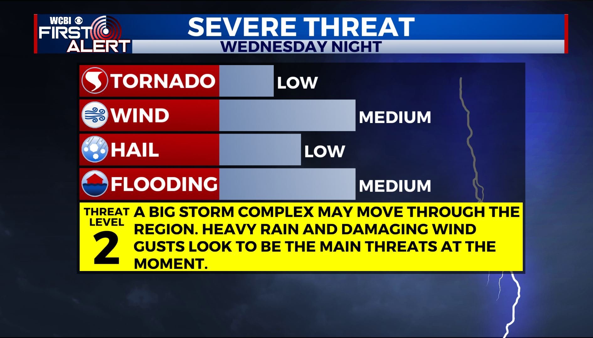
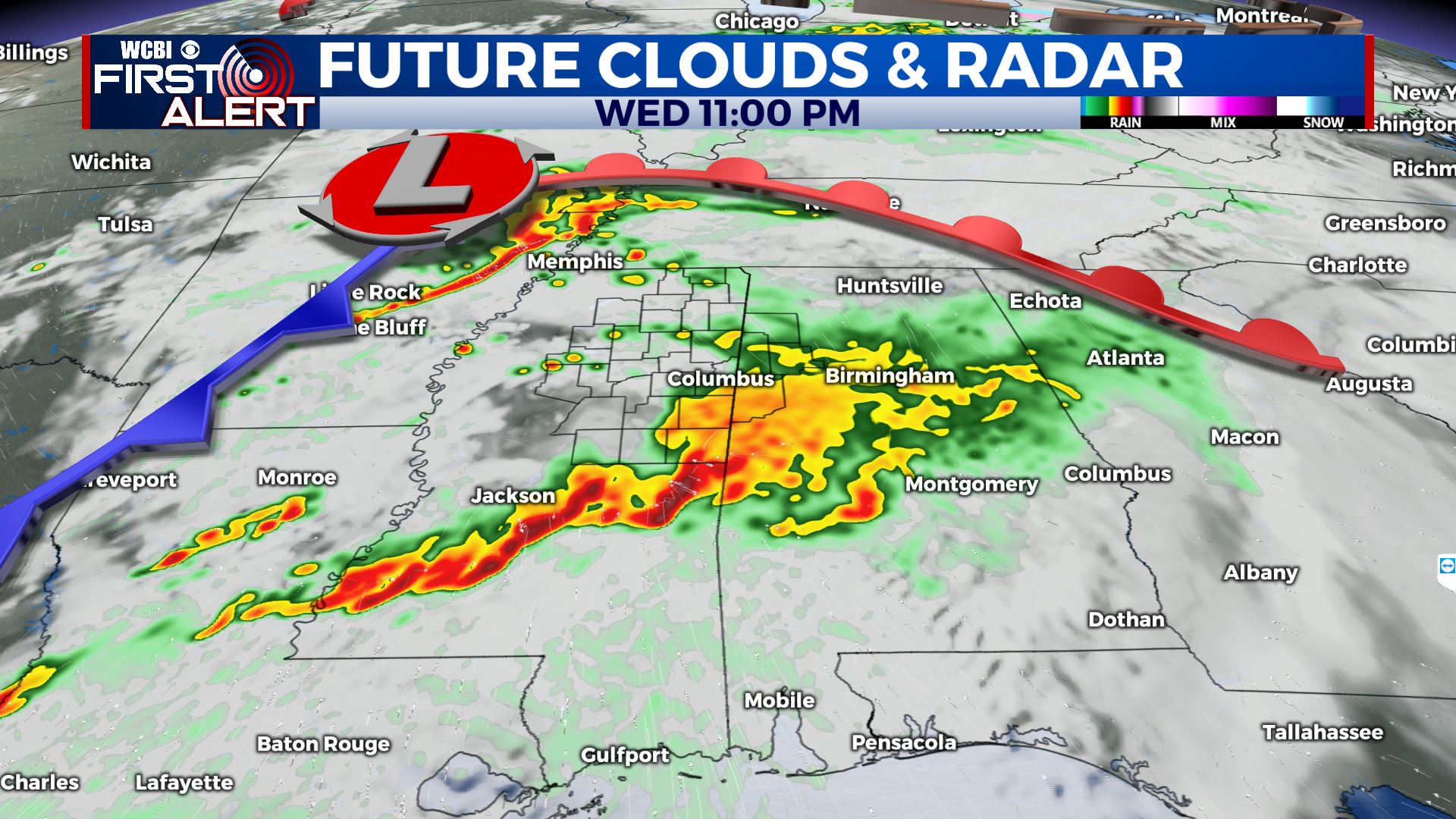
More storms Wednesday night
SUMMARY: Several wet and stormy systems are possible over the next week. The first will be late Wednesday into Wednesday night. A second front may move through late Friday into Friday night. We’ll have to watch each one for potential strong to severe storms and heavy rain.
MONDAY NIGHT: Mainly clear to partly cloudy. Areas of fog are possible. Lows near 50.
TUESDAY: Becoming mostly sunny. Highs in the mid to upper 70s. Winds NNW 5-15 mph.
TUESDAY NIGHT: Variably cloudy and quiet. Lows around 50.
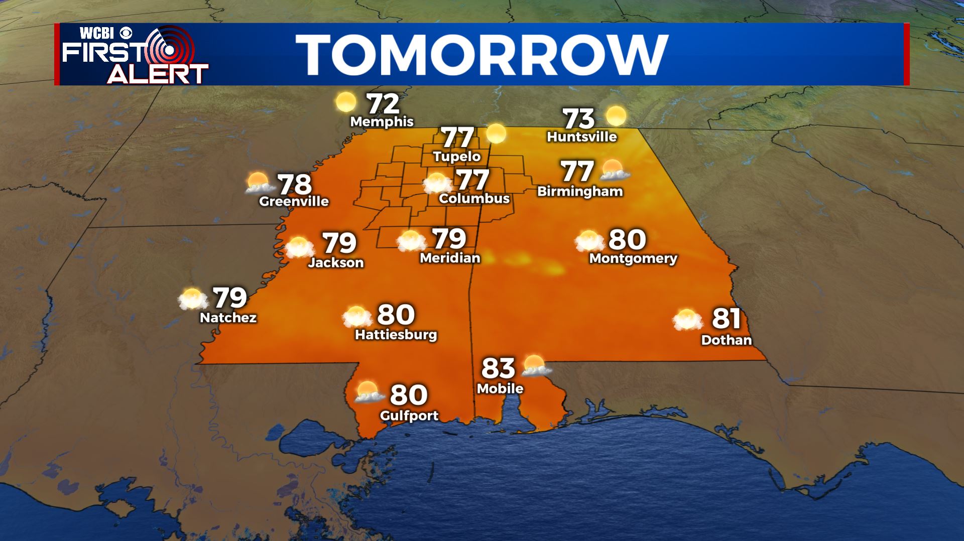
WEDNESDAY: Sun & clouds with highs in the 70s. Stronger SE winds 10-20 mph. While a few showers could develop early in the day the highest odds of rain and storms look to be during the evening and overnight hours. Heavy rain and damaging wind gusts are the main severe threats at this time but we’ll continue to monitor things as new data arrive.
THURSDAY: Morning clouds and showers will linger initially but partly cloudy skies should develop during the afternoon. Highs will be in the 70s.
FRIDAY: Most of the day is looking pretty good with partly cloudy skies and warmer highs in the upper 70s.
FRIDAY NIGHT: Rain and storms are possible. Some could be strong but it’s still uncertain. Lows in the upper 50s.
SATURDAY: Some clouds and showers around early with a mix of sun and clouds by afternoon. Highs in the low to mid 70s.
SUNDAY: Mostly sunny and pleasant. Highs around 70 with lows in the 40s.
Follow @WCBIWEATHER on Facebook, Twitter, Instagram and the WCBI News App


Leave a Reply