Storms Wednesday Night
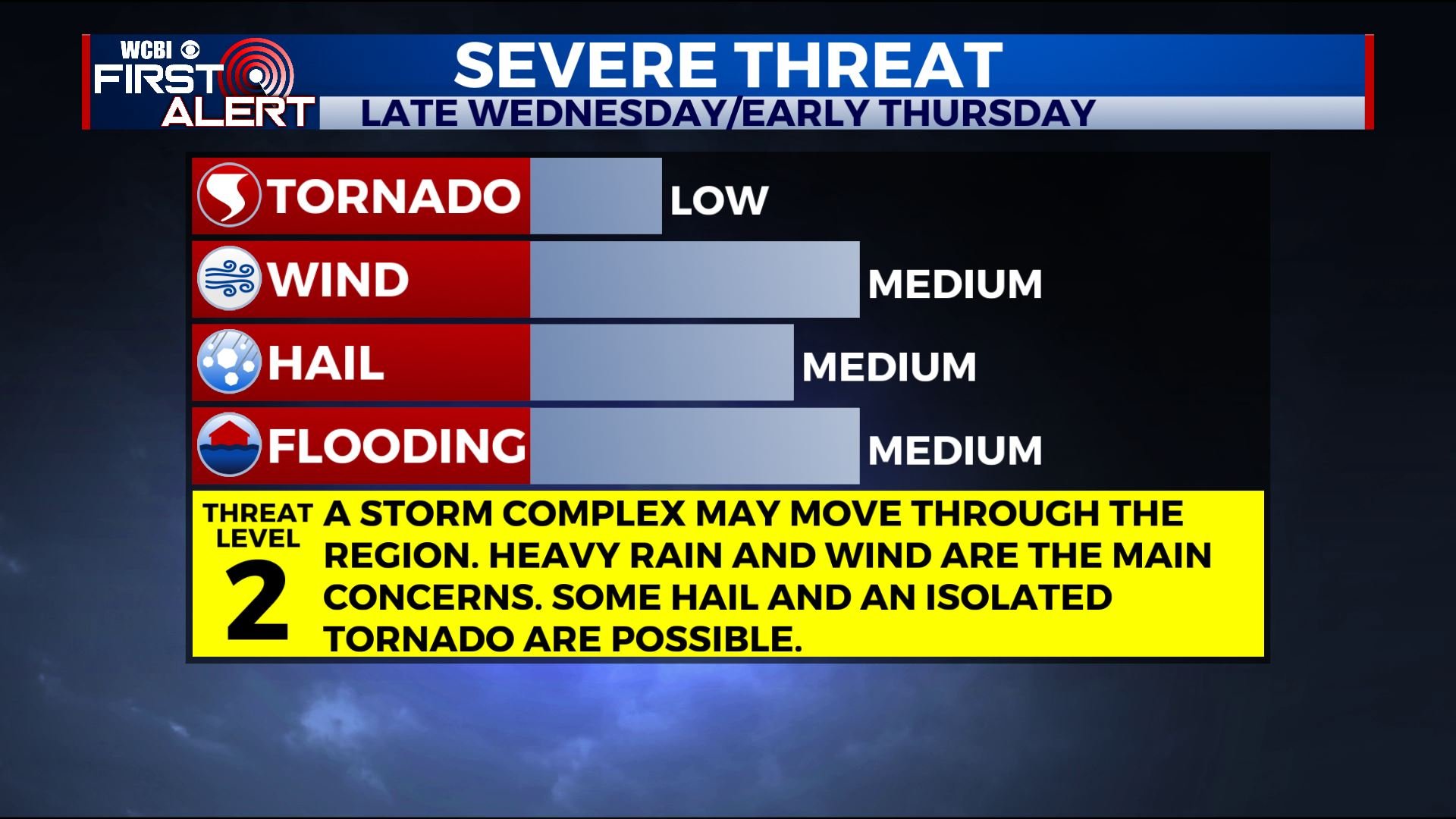
STRONG/SEVERE STORMS POSSIBLE WEDNESDAY NIGHT
SUMMARY: Another batch of strong storms and heavy rain is coming our way Wednesday evening/night. Damaging wind gusts and flooding are the main concerns but hail and and isolated tornado or two are also possible.
TUESDAY NIGHT: Mainly clear during the evening with clouds increasing late. Lows around 50. Winds remain light.
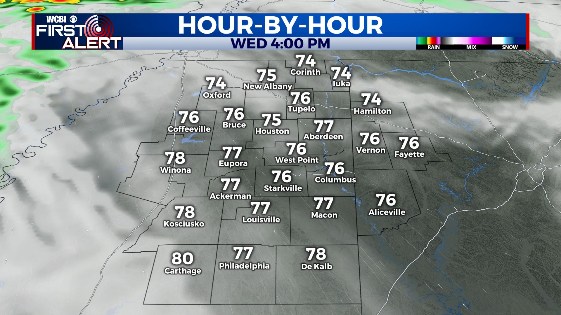
WEDNESDAY: A mix of sun and clouds along with highs in the 70s. Winds increase from the SE between 10 & 20 mph. Some gusts may approach 25 mph. Most of the daylight hours should remain dry.
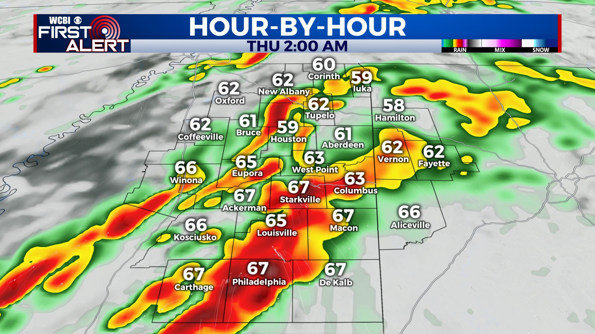
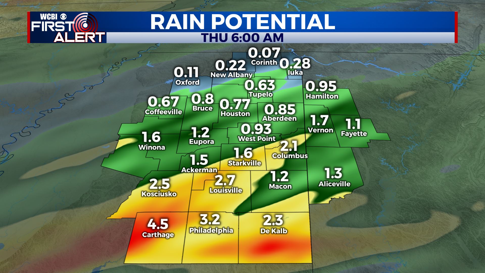
WEDNESDAY EVENING & NIGHT: Heavy rain and strong storms move from west to east across the region. Damaging wind gusts are the main concerns but hail and an isolated tornado or two are also possible. Another 1-3” of rain (or more) may lead to more flooding. Lows will be around 60.
THURSDAY: Mostly cloudy with lingering showers during the morning. Variably cloudy in the afternoon with a small chance of a shower or storm. Bigger storms may develop JUST to our east Thursday afternoon in central Alabama so we’re going to have to watch it. Breezy westerly winds 10-25 mph with higher gusts possible. Highs in the mid 70s.
THURSDAY NIGHT: Partly cloudy and quiet. Lows in the 50s.
FRIDAY: Mostly sunny to partly cloudy. Highs in the upper 70s to around 80.
FRIDAY NIGHT – SATURDAY AM: Showers and storms possible. A few could be on the strong side once again. Lows in the upper 50s.
SATURDAY AFTERNOON: Turning partly cloudy. Cooler highs in the lower 70s.
SATURDAY NIGHT: Mainly clear and cooler. Lows in the upper 40s.
SUNDAY: Sunny. Highs near 70.
Follow @WCBIWEATHER on Facebook, Twitter, Instagram, and on the WCBI News App


Leave a Reply