Stormy End to the Week
COLUMBUS, Mississippi (WCBI) – Severe storms are possible as we end the week. Temperatures will drop into the 40’s by the end of the weekend.
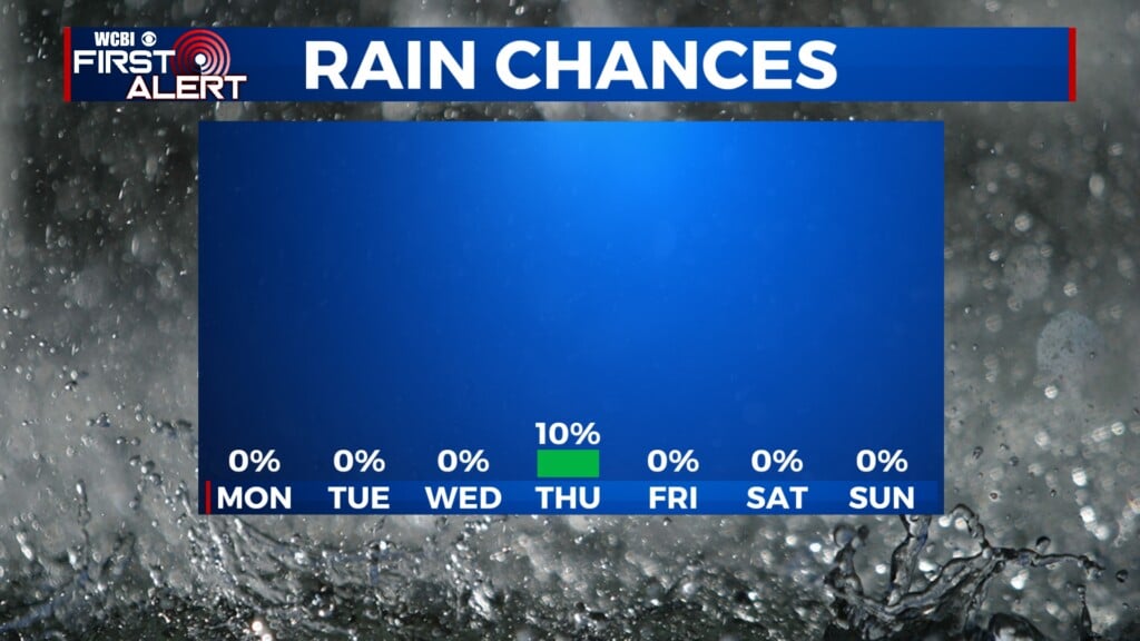
THURSDAY: We’ll stay dry and cloudy for most of Thursday, with high temperatures in the lower-70’s. Rain and storm potential will kick in on Thursday night, with a couple of isolated storms possible. Overnight Thursday, heavy rainfall along with some embedded thunderstorms will move into our area.

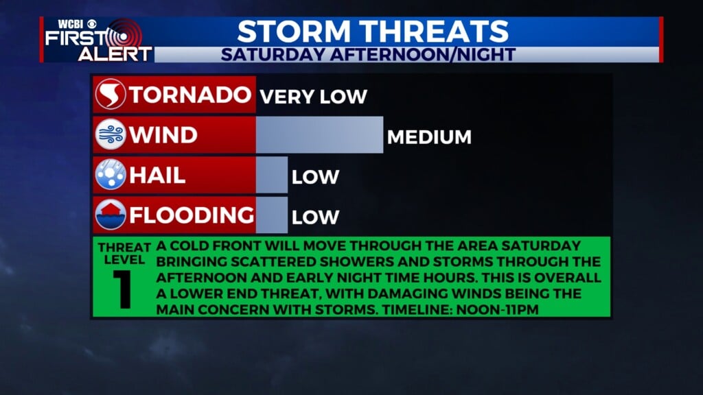
FRIDAY-SATURDAY: Right now, our entire area is under a Level 2 out of 5 risk for severe weather early Friday morning through early Saturday morning. There looks to be two windows where we could see severe storms: Friday morning, and then again Friday afternoon-early Saturday morning. Currently, strong winds are the main concern. There is a low-end chance for a couple isolated tornadoes, but hail does not appear to be a big threat. Stay with WCBI for updates as we near this event.

SUNDAY: We’ll have a dry day to end the weekend, but it will be much cooler outside. High temperatures will only be in the upper-40’s on Sunday afternoon.