Stormy Pattern Through Sunday
SUMMARY: Unsettled weather will continue from tonight all the way through Sunday. Several rounds of storms (some strong/severe) are possible in addition to more heavy rain. Some locations may pick up another 2-5” between now and the end of the weekend.
WEDNESDAY EVENING/NIGHT: We’re going to watch a batch of strong showers and storms approach from the west. It’s expected to weaken as it gets east of I-55 but there is still the potential for some wind damage, heavy rain, and lightning. Lows will generally be in the mid to upper 60s. Southerly winds continue between 5 and 15 mph.
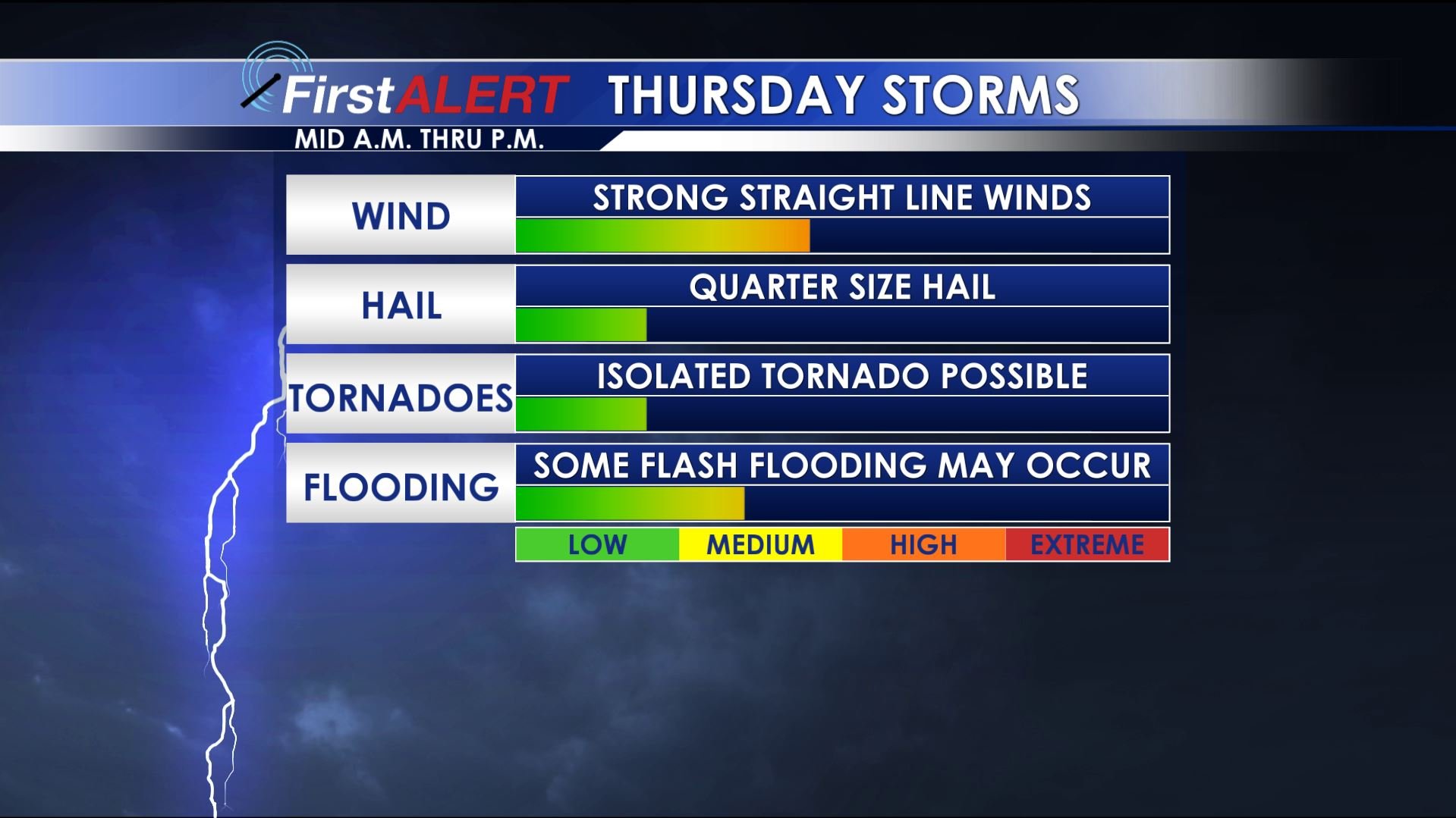
THURSDAY: Some rain and storm activity may be around for the morning commute but a stronger wave of storms is expected to cross the area anytime from mid to late morning through the afternoon. If this round of storms verifies you can expect the potential for damaging wind, quarter size hail, frequent lightning, and torrential rainfall. While a tornado can never be ruled out the odds of that appear to be on the low side right now. Daytime temperatures will range from the upper 70s to lower 80s. Strong southerly winds between 10 and 20 mph should continue until the wave of storms passes on by your location.
Thursday Storm Threat
THURSDAY NIGHT: A mild and muggy night is on track with lows in the 60s. Some lingering showers and perhaps even a storm are possible.
FRIDAY-SUNDAY: Several round of showers and storms are expected to cross our area. They will be hard to time out exactly so each day may not end up being a washout; however, we’re going to keep the daily rain chance in the 50-70% range. Each complex may produce heavy rainfall, gusty winds, and frequent lightning. Additional severe weather is possible so stay tuned. Temperatures should generally top out in the 70s while overnight lows remain in the 60s.
MONDAY-TUESDAY: Drier air is on track to return and that means more sunshine and comfortable conditions. Upper 70s to around 80 degree temperatures are likely while overnight lows tumble back into the 50s.
Follow @WCBIWEATHER on Facebook, Twitter, and Instagram


Leave a Reply