Strong Storms Possible Tonight
Severe Threat
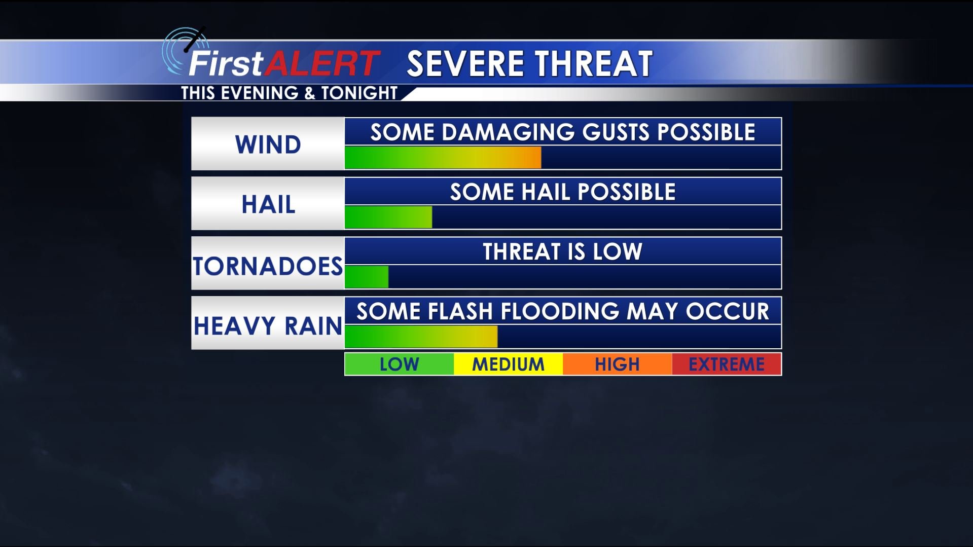
WEDNESDAY NIGHT: A wave of strong/severe storms is expected to cross the area. Damaging wind gusts, hail, torrential rainfall, and frequent lightning would be the main concerns if this activity does indeed develop and pass on by during the night. Temperatures will settle into the low 70s by sunrise. Have a way to get warning information tonight in case a severe storm finds your location.
THURSDAY: There is a 40-50% chance of showers and storms around the area. Once again there may be a few strong/gusty storms with heavy downpours. Highs stay in the upper 80s with heat index values in the 90s.
THURSDAY NIGHT: Partly cloudy and humid. Lows in the low 70s.
FRIDAY: While a few showers and storms are possible the rain chance lowers to about 30%. Temperatures warm into the low 90s with heat index values pushing into the upper 90s and low 100s.
WEEKEND: It’s looking like a hot, humid, and downright steamy stretch of weather for us. While each day will have a 20% chance of a shower or storm most spots will get no relief from Mother Nature. Actual temperatures should climb into the low to mid 90s with heat index values pushing well into the 100s. Muggy overnight lows in the low to mid 70s can be expected.
EARLY NEXT WEEK: We’re keeping a 30-40% chance of scattered storms going Monday through Wednesday. Seasonably warm and humid conditions hang around with highs in the upper 80s to low 90s and overnight lows in the low 70s.
Follow @WCBIWEATHER on Facebook, Twitter, and Instagram


Leave a Reply