Strong Storms Possible Tonight
A line of strong thunderstorms will move through the area overnight Saturday into Sunday. These storms are capable of producing gusty winds, lightning, quick downpours, and a brief tornado. Storms are most likely between 10pm Saturday and 3am Sunday.
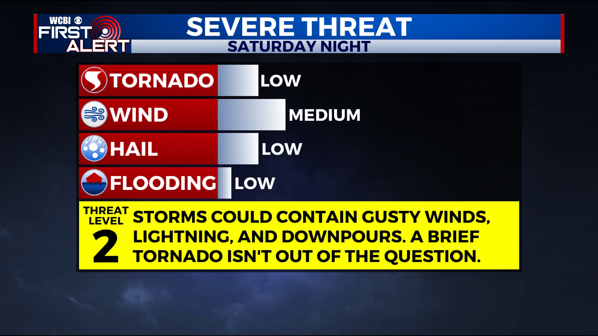
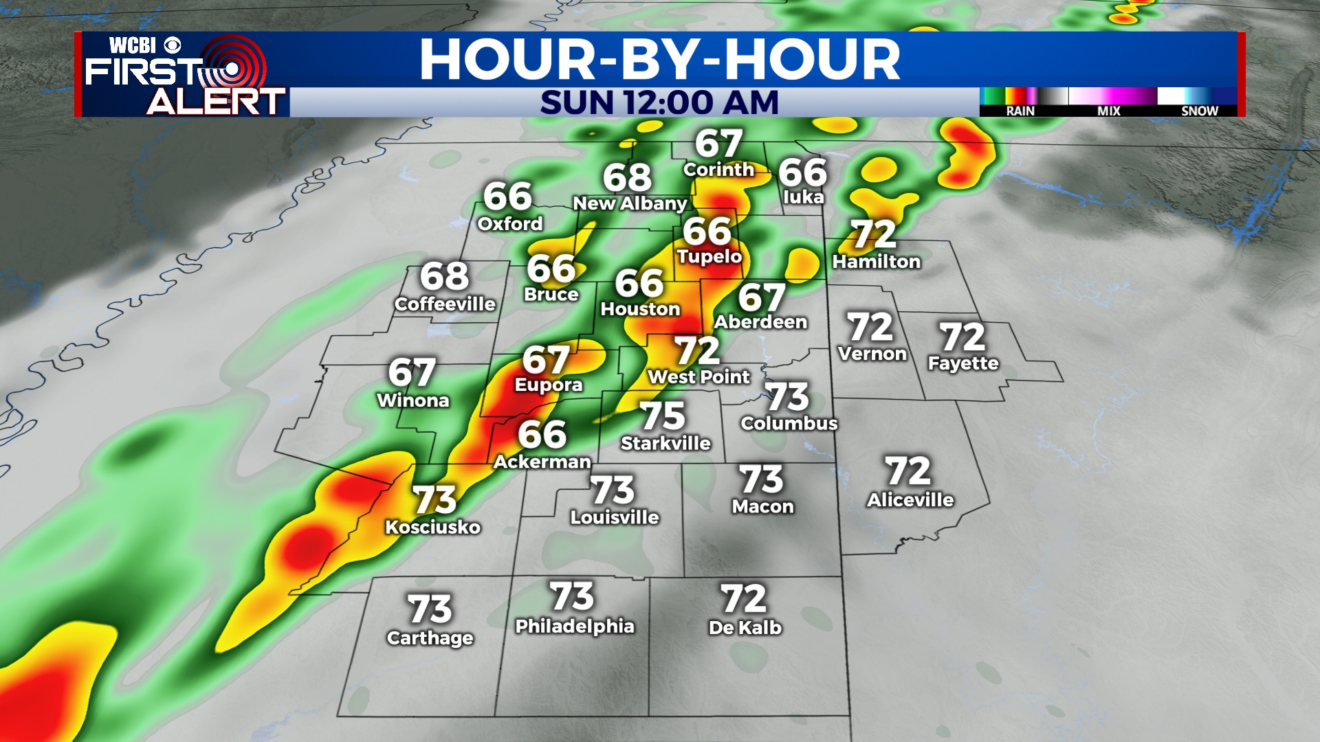
SATURDAY NIGHT: Strong storms developing after 10pm. Not everyone will see severe weather, but a few storms are capable of producing gusty winds, heavy rain, and even a brief tornado. Storms will exit by 3am Sunday, leaving us slightly cooler with lows in the upper 50s. Winds will be gusty out of the south from 10 to 25 mph. Again, widespread severe weather isn’t likely, but a few storms could be strong to severe. Be sure to have a way to receive weather alerts overnight just in case.
SUNDAY: We’ll see a mix of sun and clouds through the morning with clouds increasing through the day. Temperatures will be slightly cooler than they have been with afternoon highs in the mid to upper 70s.
SUNDAY NIGHT: Mostly cloudy and fairly dry aside from a sprinkle or two. Lows will be in the mid 50s with a light northerly wind.
MONDAY: A few peeks of sun in the morning before clouds build in by the afternoon. Showers will also become possible as we get into the evening as another weather system approaches. Highs will be near 70.
TUESDAY: Rain and storms likely, especially before noon. At this point, severe weather is not a major concern, but we’ll continue to monitor. Temperatures increasing to the mid 70s in the morning, cooling down by the afternoon.
WEDNESDAY-THURSDAY: Mostly sunny and cooler. Highs in the mid 60s to near 70 with overnight lows in the 40s.
FRIDAY-SATURDAY: Showers will return to the forecast for Friday, but Saturday looks to be mostly dry with a few peeks of sun. Highs in the 70s on Friday and back into the 60s for Saturday.


Leave a Reply