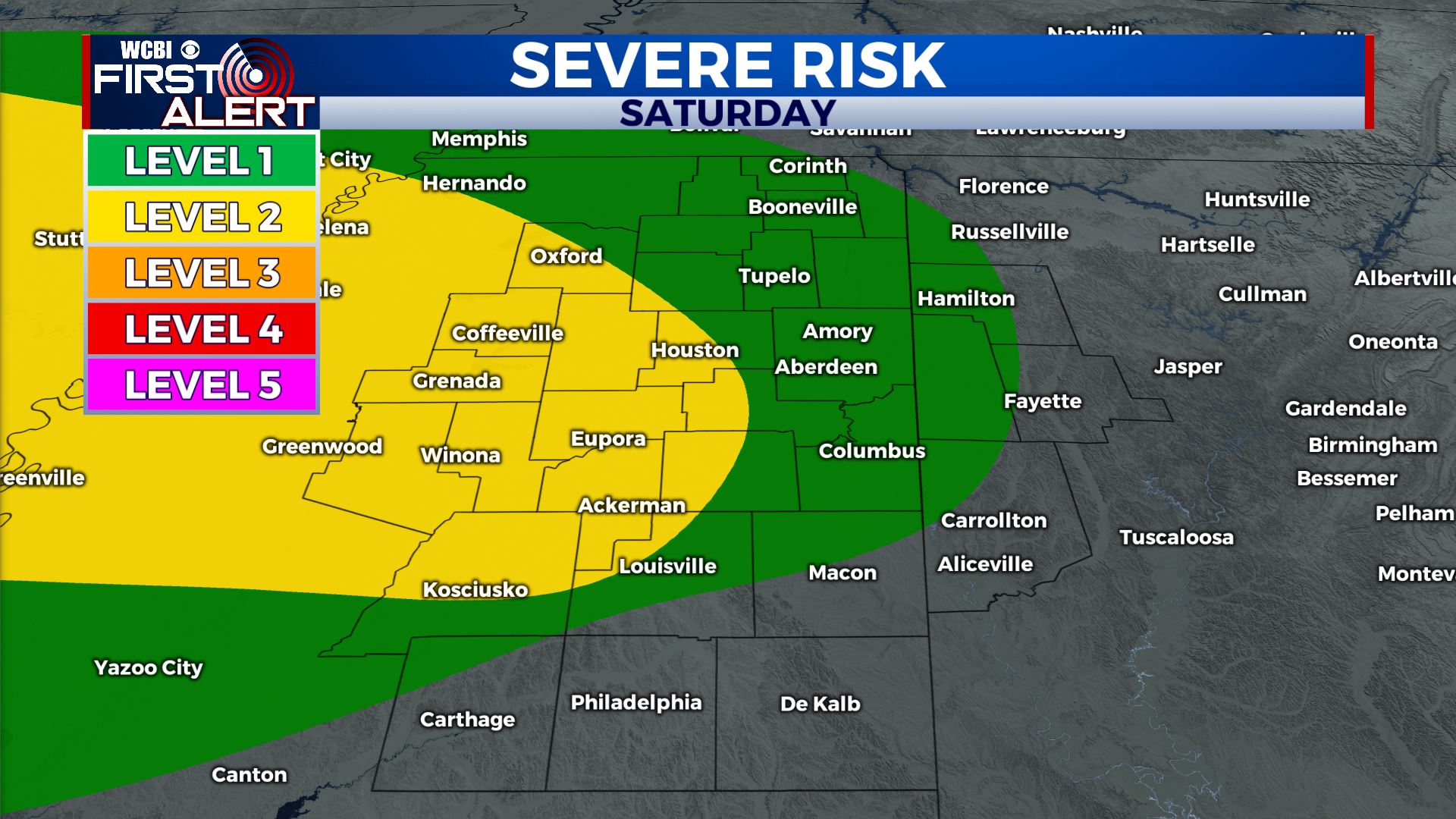
Strong Storms Saturday Night Into Sunday Morning
COLUMBUS, Mississippi (WCBI) – Strong to severe storms will roll through the area overnight. Cooler and drier air arrives by Monday.
TONIGHT: Strong to severe storms are likely, mainly between 11 PM Saturday and 6 AM Sunday. It could get noisy! We’re mainly going to be dealing with heavy rain, strong to possibly damaging wind gusts, and hail up to quarter size. The tornado threat is quite low, but not low enough to completely rule out. Chance of rain: 90%. Low near 55°, but temperatures will slowly creep up overnight, especially for our southern communities.
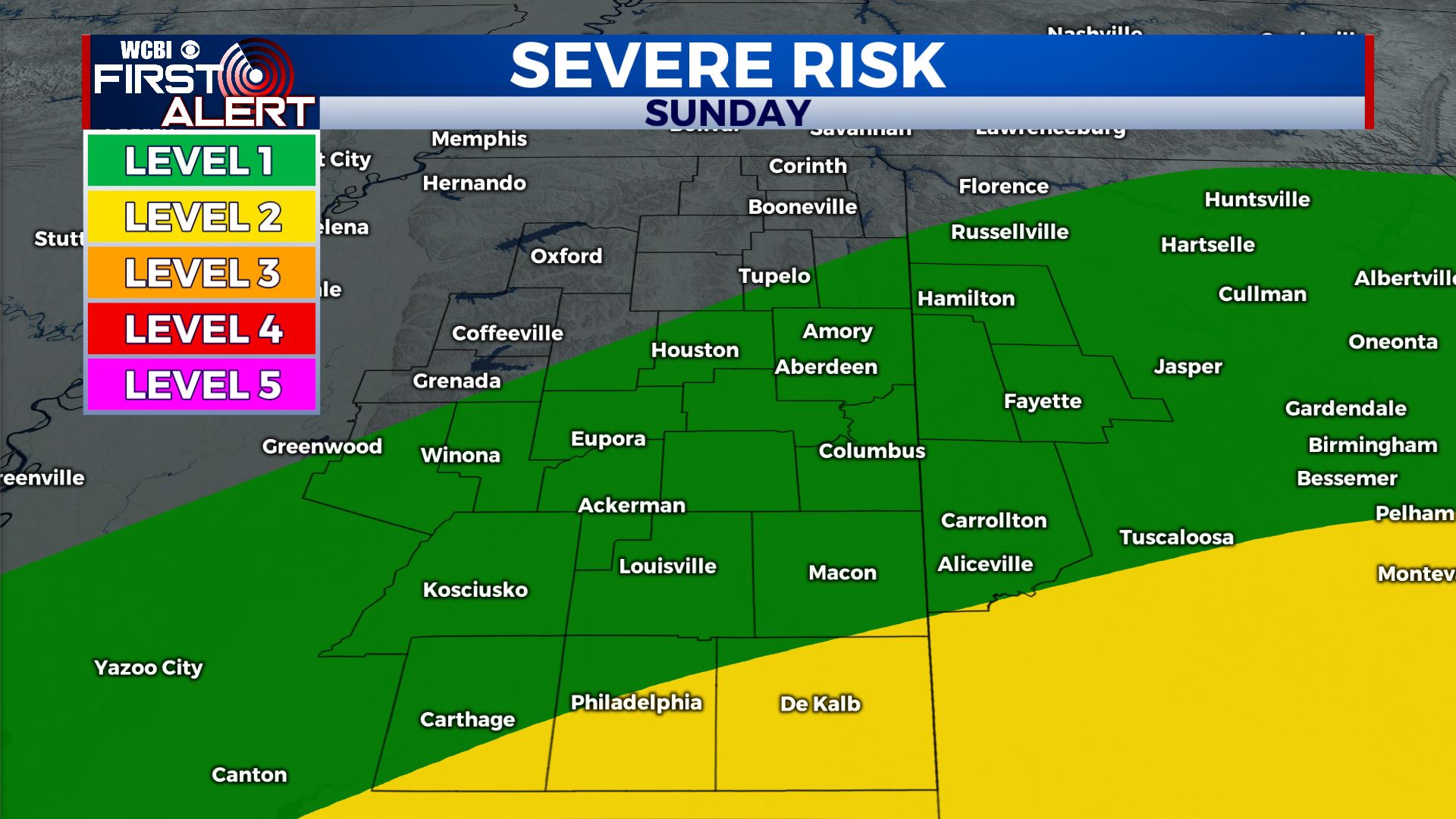
SUNDAY: Showers and storms will linger through the morning, with rain ending for most of us by early afternoon. High near 65°, with temperatures slowly falling during the afternoon. It will be quite breezy as well!
MONDAY: Much cooler and dry. Mostly sunny skies with temperatures in the mid to upper 50s. High near 57°.
NEXT WEEK: Tuesday and Wednesday morning will likely start off below freezing, so a light frost is possible! Cool temperatures stick around on Tuesday, and we’ll gradually warm up on Wednesday before returning to the 70s on Thursday. Rain returns to the forecast on Friday (St. Patrick’s Day).
Have a great night!


