Strong Storms Tonight, Breezy Tomorrow
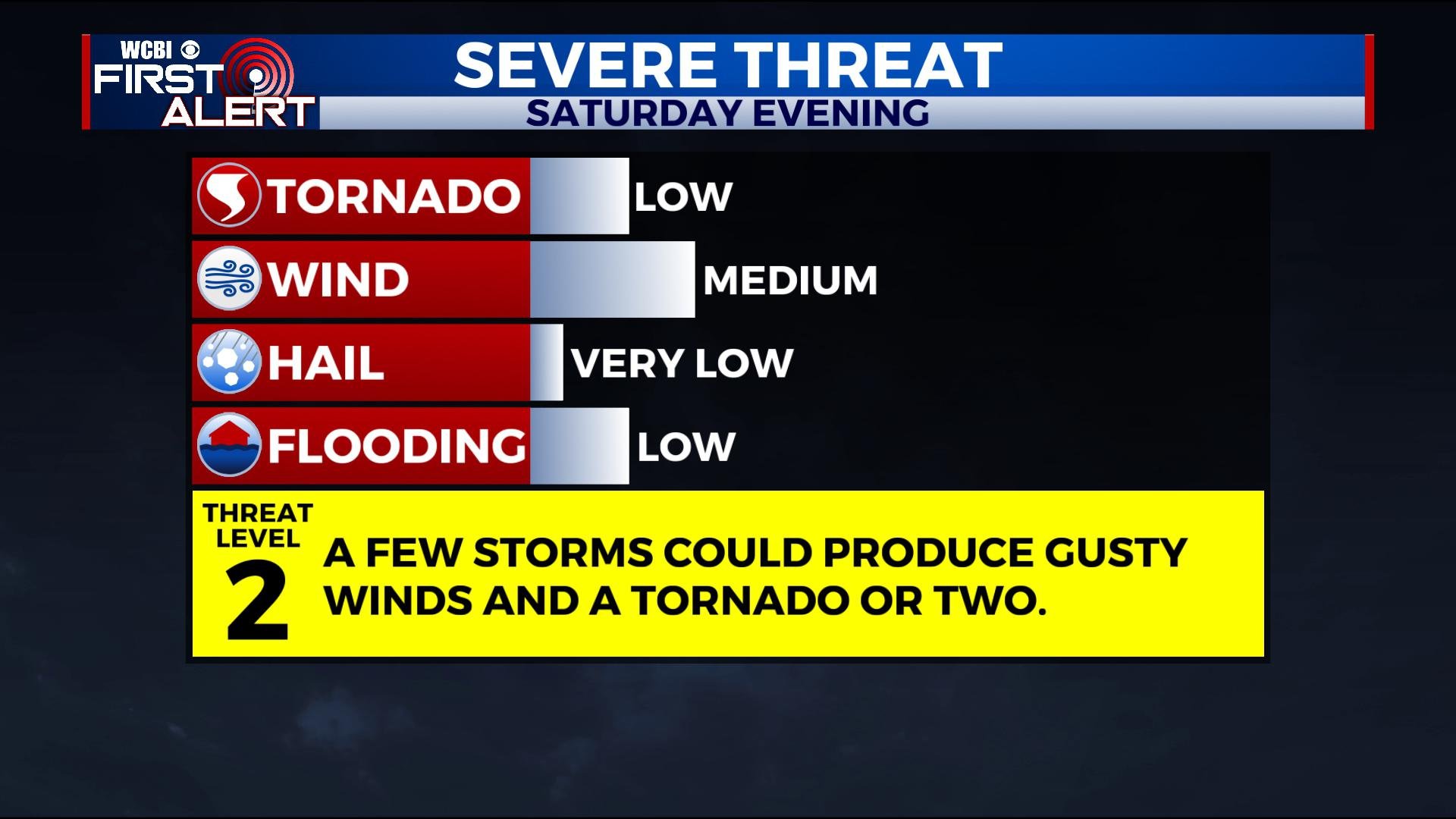
Strong to severe storms are possible through Saturday evening. Things will start to clear out by midnight as cooler air and gusty winds rush in. We’ll be dry and sunny for most of the week before rain chances return by Friday.
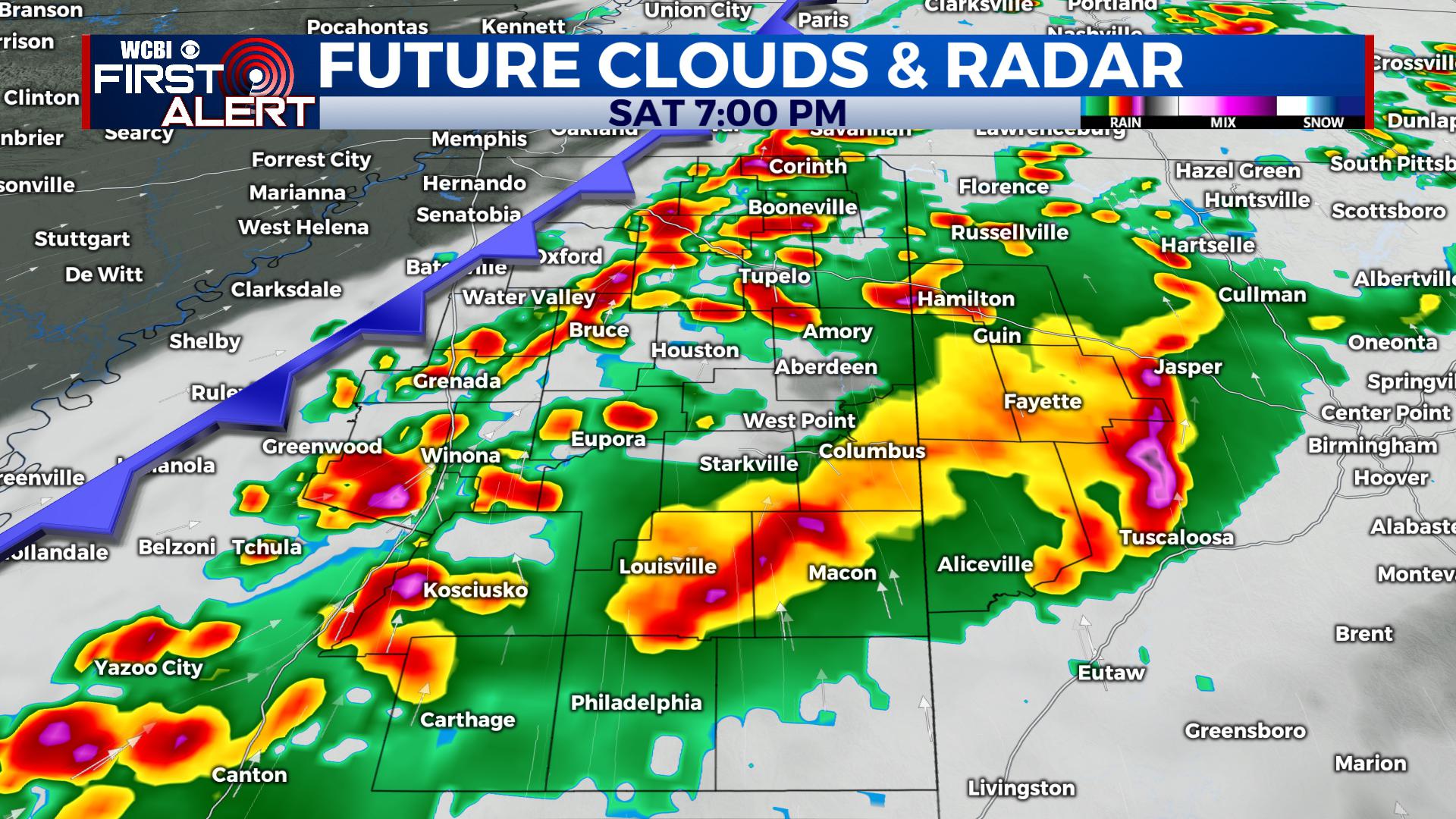
SATURDAY NIGHT: Strong storms in the evening will give way to clearing skies after midnight. Some storms could produce gusty winds, heavy rain, and an isolated tornado. Lows will be in the upper 40s with winds gusting out of the south and west between 25 and 30 mph. For the most up-to-date severe weather updates and information, follow WCBI Weather on Facebook and Twitter, and watch our live stream during newscasts.
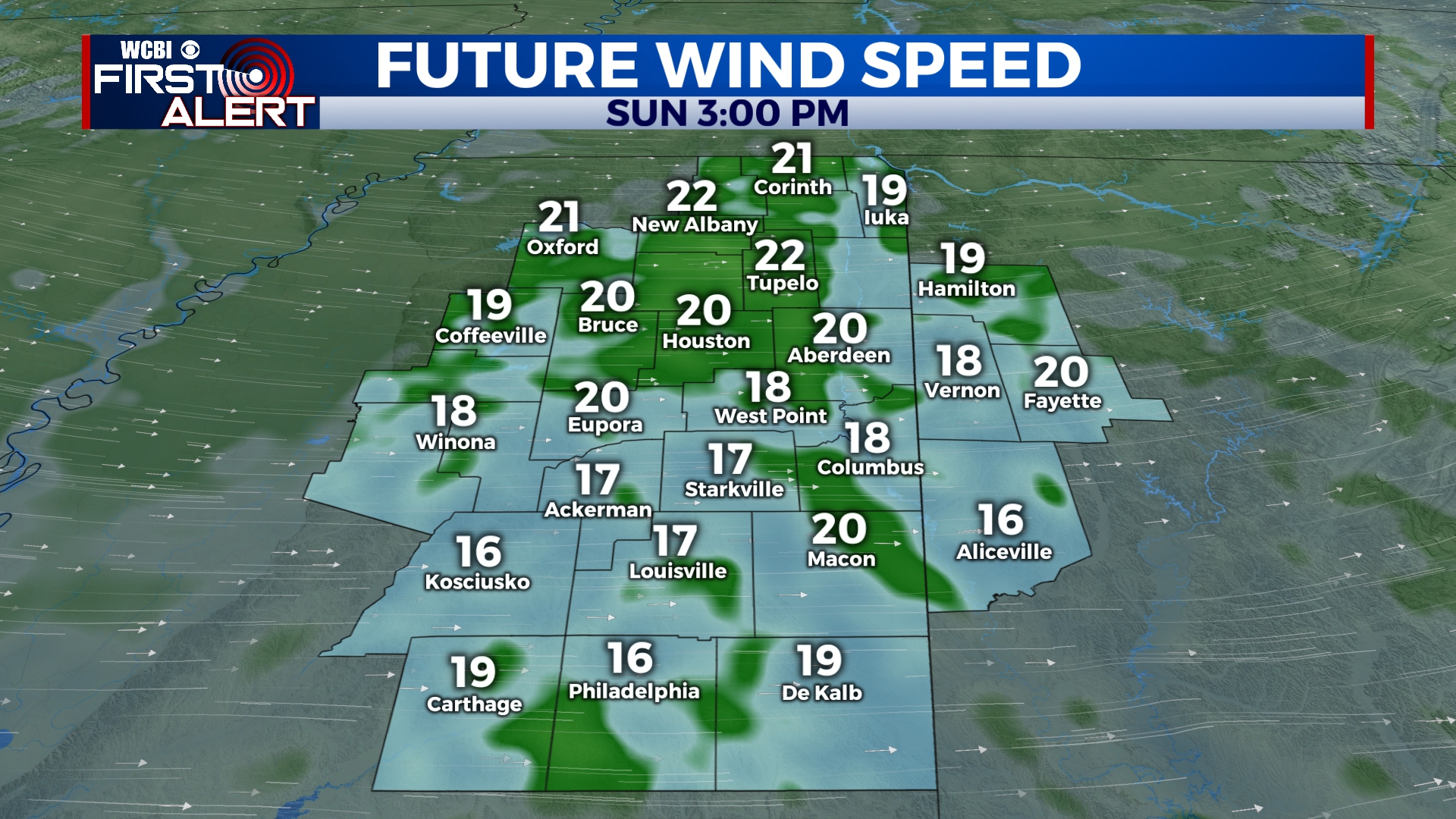
SUNDAY: Temperatures will be cooler with highs only in the upper 50s. We will see plenty of sunshine through the day, but it will be breezy. Winds will be sustained out of the west over 15 mph and could gust to near 30 mph at times.
SUNDAY NIGHT: A cold night is in store with many areas getting close to or just below freezing. Mostly clear with winds gusting to near 25 mph out of the northwest.
MONDAY-WEDNESDAY: We’ll see a few clouds to start the week, but many of us will stay mostly sunny. Highs will be in the upper 40s on Monday, but will climb back to near 60 for Wednesday. A freeze is likely early Tuesday morning with overnight lows in the upper 20s. Overall, we’re in for a few days of great weather.
THURSDAY-FRIDAY: Another system will bring the chance for some isolated showers to end the week. Highs will be near 60 with morning lows in the 30s and 40s.


Leave a Reply