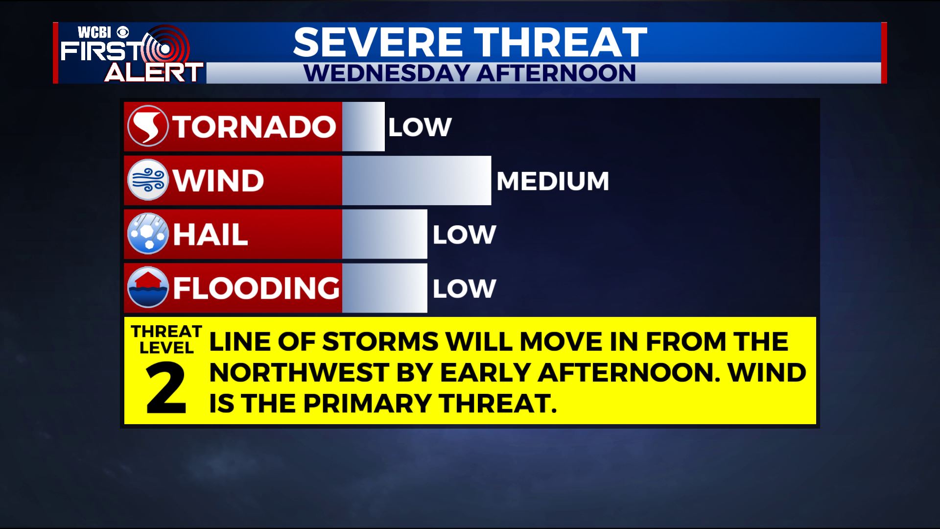
Strong storms Wednesday
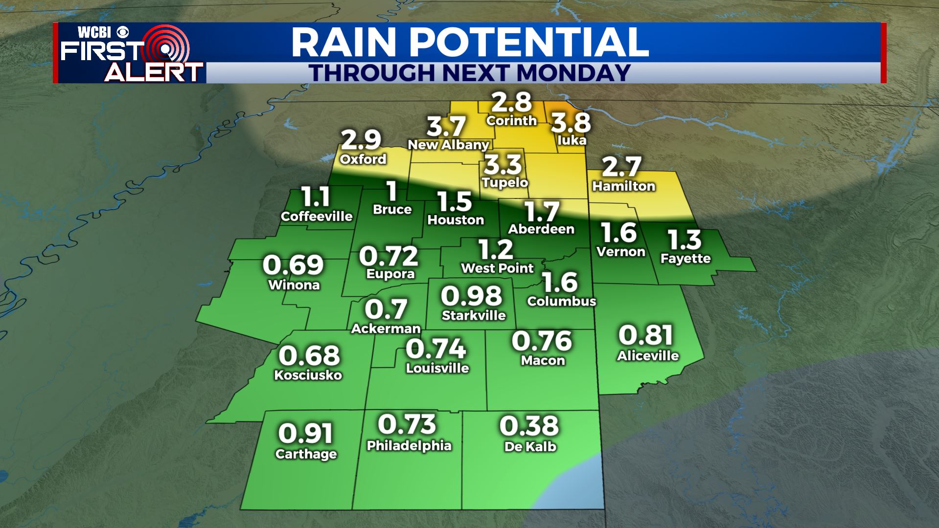
SUMMARY: Several rounds of storms will affect the region during the coming days. The first will be Wednesday afternoon with another batch possible Thursday evening and/or night. Unsettled weather is going to stick around through the weekend into next week as well.
TUESDAY NIGHT: Partly cloudy during the evening with clouds filling back in during the night. Lows in the 50s but a few upper 40s can’t be ruled out in the far north. Winds become light and variable.
WEDNESDAY: Mostly cloudy and mild with highs in the 70s. A batch of strong to severe storms with damaging wind is possible from about noon through the afternoon. We’ll continue to monitor the latest trends as they develop.
WEDNESDAY NIGHT: Mostly cloudy with the chance of a few more showers and storms. Lows around 60.
THURSDAY: Partly to mostly cloudy and mild. Highs in the upper 70s. While a few showers and storms are possible during the day the highest odds will likely wait until the evening and overnight hours going into Friday morning. Once again there could be strong to severe storms that we’ll have to watch.
FRIDAY: Mostly cloudy with areas of rain likely. Highs in the mid to upper 60s.
WEEKEND: A continuing chance for some showers and storms both Saturday and Sunday. Highs look to remain in the 70s.
Follow @WCBIWEATHER on Facebook, Twitter, Instagram, and the WCBI News App


Leave a Reply