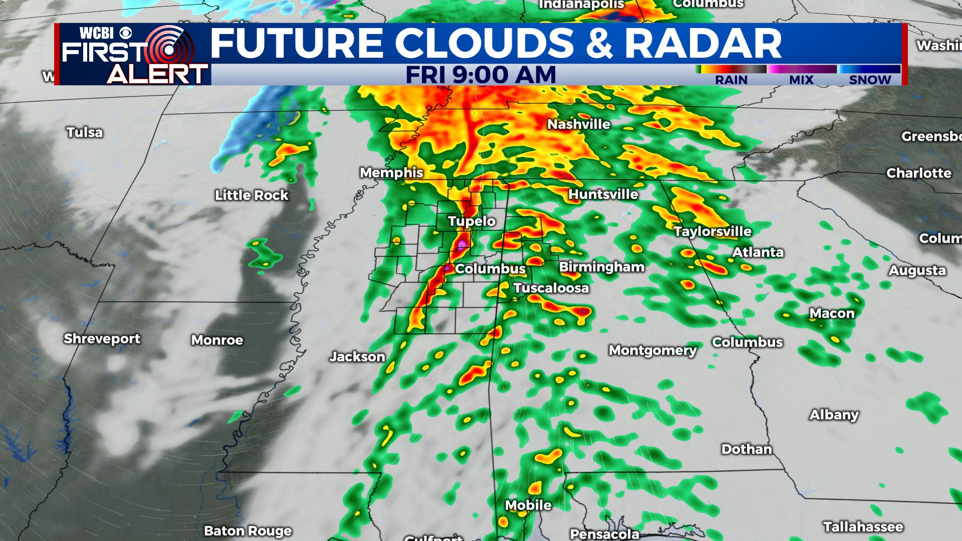
Strong to severe storms possible Friday morning
COLUMBUS, Mississippi (WCBI) – Active weather continues over the next 5 days, with severe weather concerns Friday and winter weather concerns next week.
FRIDAY MORNING: Showers and locally strong to severe storms will be possible during the morning hours, clearing by lunchtime to the east. Damaging wind gusts over 50-60 mph will be the primary concern, but a tornado or two will remain possible as well. Outside any storms, gusty south to southeast winds up to 30-40 mph will precede the storms.
FRIDAY AFTERNOON: Almost immediate clearing will occur behind the storms, leaving the afternoon at least partially sunny and breezy as winds shift to the west. Wind gusts up to 30-35 mph will still be possible well behind the storms.
FRIDAY NIGHT: Some wind will stick around overnight, but with a clear sky at least, temperatures will likely drop into the upper 20s.
WEEKEND: Saturday looks increasingly pleasant with highs in the low 50s and plenty of sunshine. Sunday starts cold in the lower to middle 20s, but the day will stay dry and chilly as highs struggle to reach 40 degrees!
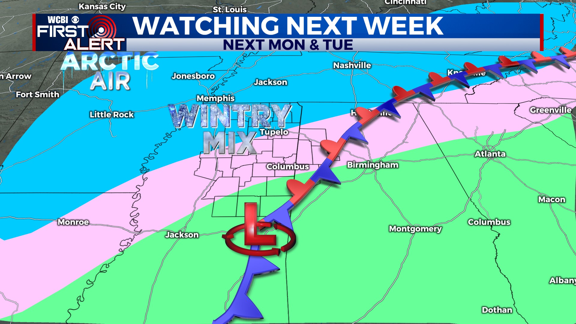
NEXT WEEK: Behind an Arctic front, a mixed back of wintry precipitation remains possible Monday into Monday night across most of northern MS. Exact placement of who gets what (snow vs. sleet vs. freezing rain) and any totals remains uncertain, but confidence on some accumulations of all three types has increased somewhat…especially for areas north of US 82. It’s important to remember we’re still 3 days out, and these kinds of things will continue changing/waffling around in our models…and it’s still possible things could still trend drier. We’ll keep you posted. Dangerous cold still looks LIKELY by Tuesday into Wednesday, where single digit temperatures & wind chills remain on the table. We’re likely to stay below freezing for some areas at least 48 hours, so use the weekend to prepare for the longer-lasting cold!