Summery feel to stick around
SUMMARY: Summer-like weather will continue Friday through the weekend. Daily chances of showers and storms stick around, especially Friday and Sunday. A cutoff low could develop in the Southeast during the middle of next week giving the region a little bit of a cool down.
THURSDAY NIGHT: Isolated showers and storms will fade away by 9 p.m. or so. Variably cloudy during the night with lows in the 60s. Winds SSE 5-10 mph.
FRIDAY: A 40-50% chance of scattered showers and storms. Some storms could produce locally heavy downpours. Highs in the low to mid 80s. Winds S 5-15 mph.
FRIDAY NIGHT: Turning partly cloudy. Mild lows in the mid 60s.
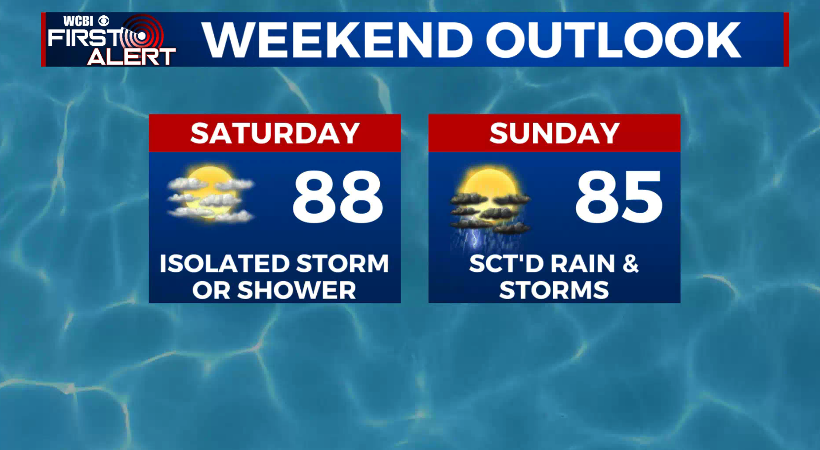
SATURDAY: Partly cloudy and warm. Highs in the upper 80s. A small 20% chance of a stray shower or storm.
SATURDAY NIGHT: Variably cloudy. Lows in the mid 60s.
SUNDAY: Partly to mostly cloudy with a 40-50% chance of scattered showers and storms. Highs top out in the low to mid 80s.
MONDAY: Scattered showers and storms remain possible. Highs in the upper 70s.
TUESDAY-THURSDAY: Recent data suggest a cutoff low in the atmosphere may meander slowly across the Deep South. Cooler 70s would be more likely than not in this regime along with a continuation of rain chances, depending on the track of the system.
Follow @WCBIWEATHER on Facebook, Twitter, Instagram, and the WCBI News App


Leave a Reply