Some Sun Monday, Rain Tuesday
An unsettled weather pattern will set up across the area this week, bringing us several chances for showers and even a few storms. Temperatures will remain above average with highs in the 70s and 80s before we cool down slightly by the end of the week and weekend.
SUNDAY NIGHT: Calm and quiet. Temperatures will fall to near 60 by morning with a few clouds. Winds will remain light.
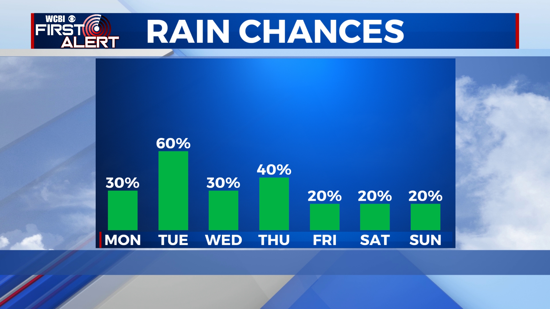
MONDAY: While most of the day looks dry, a few isolated showers are possible especially by the afternoon and evening. Otherwise, we’ll remain partly sunny. Temperatures will be in the low 80s by the afternoon.
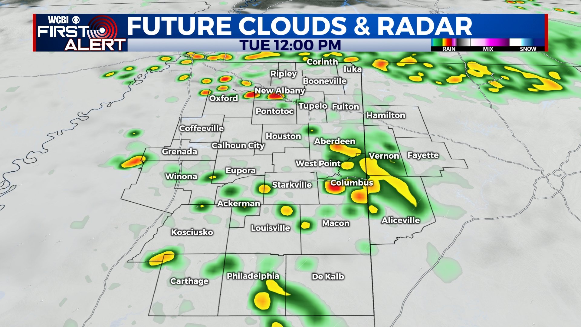
TUESDAY: Our best chance for rain this week will come on Tuesday when widespread showers and storms are anticipated. It won’t be a total washout all day, but it’s likely that everyone will see at least a little bit of rain. Strong or severe storms are not anticipated, but some thunder is possible. Highs will be in the upper 70s.
WEDNESDAY-THURSDAY: Chances for scattered showers and storms continue for the middle portion of the week, but any rain won’t be as widespread as what we will see on Tuesday. Temperatures will peak in the mid 80s on Wednesday with highs back to the upper 70s for Thursday.
FRIDAY-SUNDAY: As we get into the end of the week and the weekend, the uncertainty in the forecast grows. While most models have us dry and sunny, one or two models have another round of rainfall. For now, we’re going to keep rain chances slim for Friday, Saturday, and Sunday, as the drier scenario is most likely. We’re expecting sunshine and slightly cooler temperatures with highs in the upper 60s to near 70. Of course, as we get closer, we’ll update the forecast as needed.


Leave a Reply