Sunday Evening Weather Update
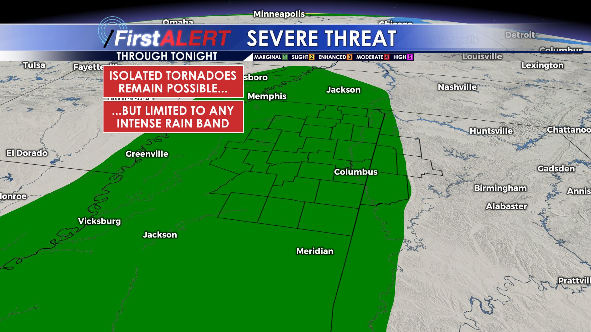
Severe Threat Sunday Night
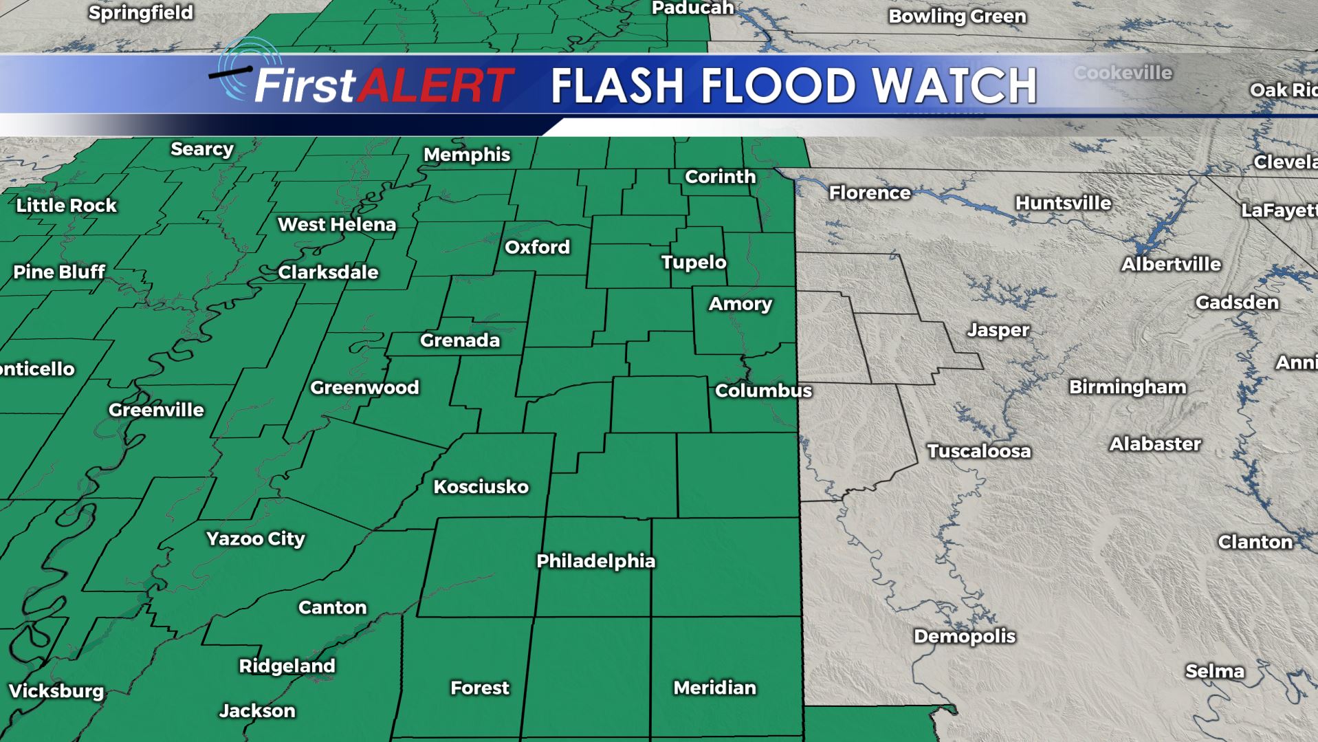
TONIGHT: Areas of rain will continue. The threat of an isolated tornado remains low but not zero. It all depends on where those narrow intense bands of rain end up going. There is some potential that most of that fall back west of I-55 but it’s too early to tell. Temperatures hover in the low 70s. SE winds 10-15 mph.
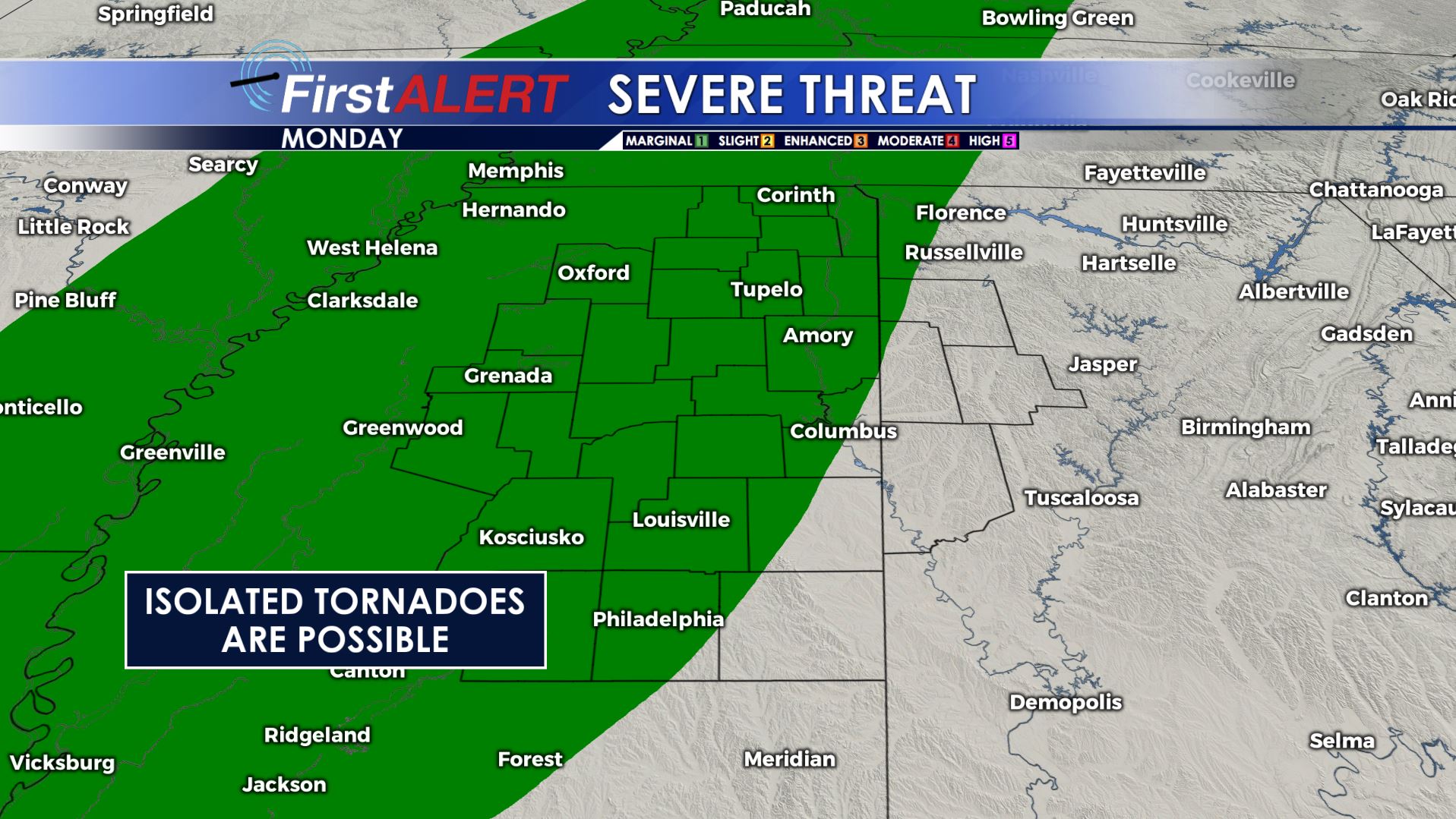
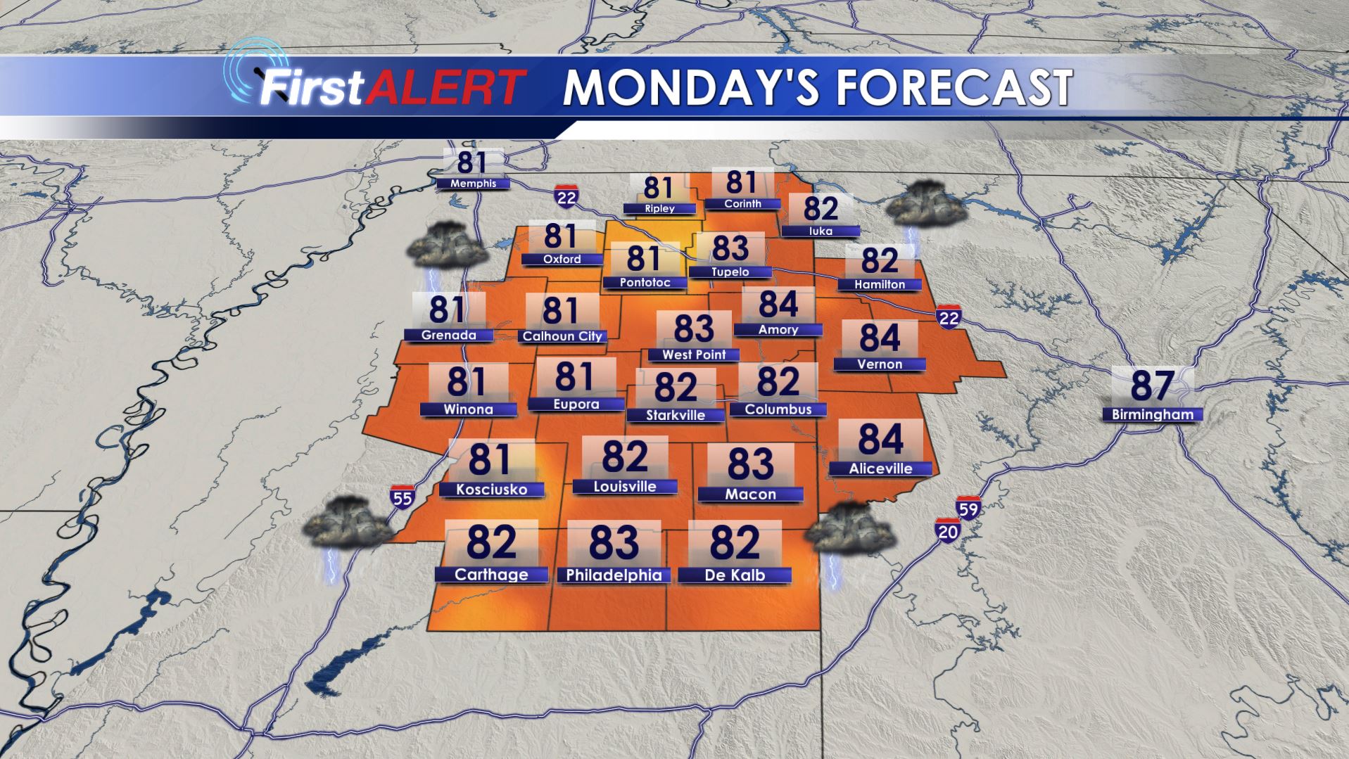
MONDAY: Additional showers and storms are likely with the rain chance 80%. Once again there is a threat of a few isolated tornadoes somewhere here in north Mississippi, especially from late morning into the afternoon and early evening. Highs top out in the low 80s with SSE winds between 10 and 25 mph.
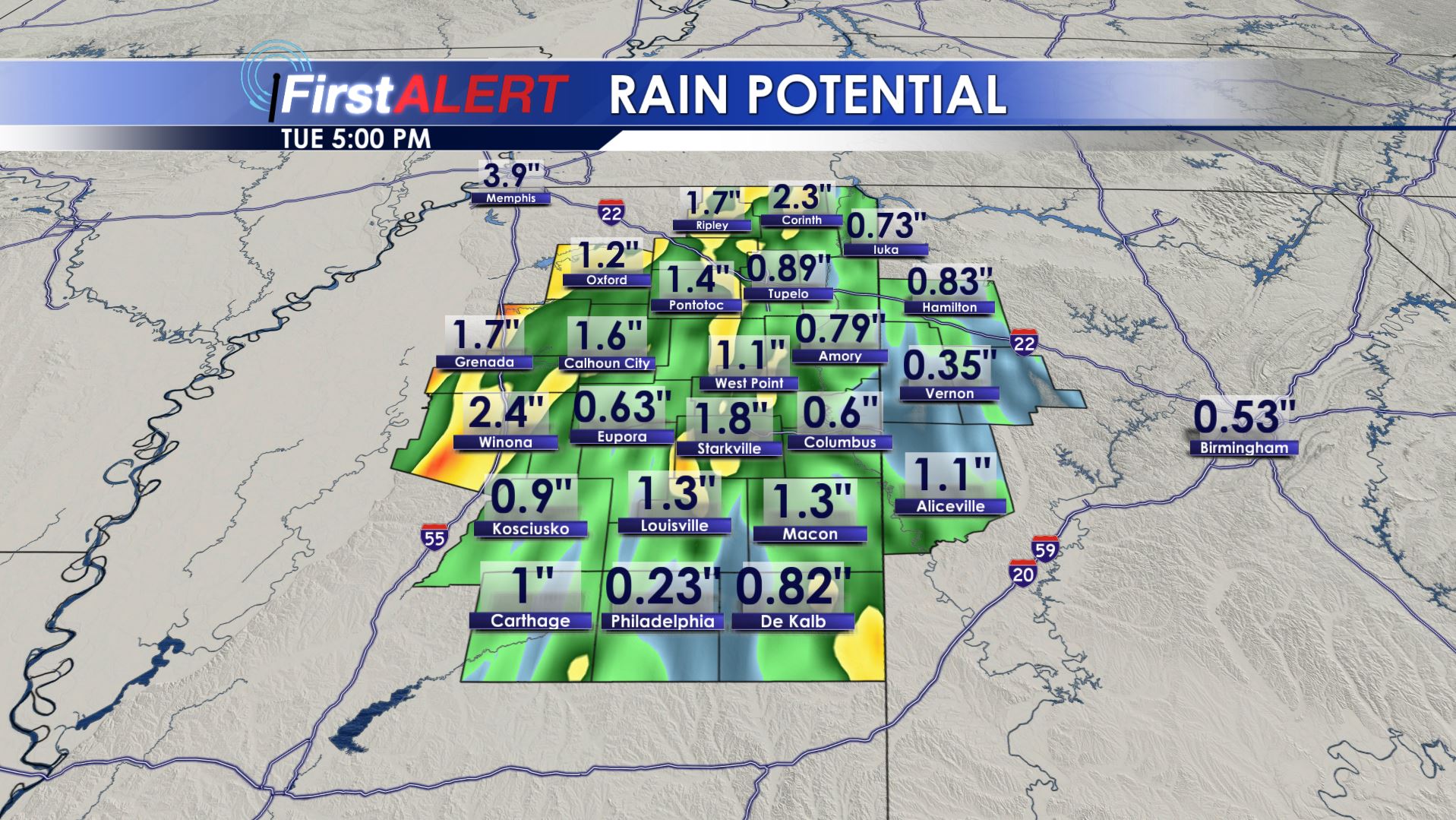
TUESDAY: The remnants of Barry pull away but scattered showers and storms are likely in the wake of the tropical system. We’re going to expect a 60% chance of rain as of now. Highs should punch back into the upper 80s.
WEDNESDAY-SUNDAY: More typical summer weather for us builds back into the region. Look for highs in the low to mid 90s, heat indices in the 100s, and overnight lows in the 70s. Daily 20-30% storm coverage is a fair bet.
Follow @WCBIWEATHER on Facebook, Twitter, and Instagram


Leave a Reply