Sunny, Cold Weather Returning
We’ll enter into a more winter-like pattern with sunny skies and below average temperatures. Our next chance for rain will be on Friday as temperatures get back into the low 60s.
SATURDAY NIGHT: Rain will exit the area by 6pm and leave us mostly cloudy through midnight. Clouds will slowly exit after that, leaving us with temperatures near freezing by Sunday morning.
SUNDAY: Sunny and chilly. Highs will be in the mid 40s, but with a breezy northerly wind, that could feel more like the mid 30s.
SUNDAY NIGHT: Temperatures will fall into the low to mid 20s overnight with gusty winds continuing. Skies will remain mostly clear.
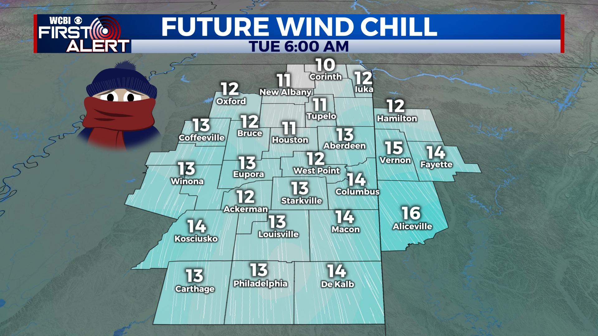
MONDAY-TUESDAY: Cold and sunny weather will continue with highs in the upper 30s on Monday and morning lows on Tuesday in the upper teens across the area. Gusty winds could make it feel 10-15 degrees colder than the actual temperature at times. Highs on Tuesday will be just a touch higher as we get into the low 40s in the afternoon.
WEDNESDAY-THURSDAY: Clouds will increase across the area with afternoon highs in the upper 40s on Wednesday and mid 50s on Thursday. We could see some showers and possibly even a storm late on Thursday, but most of that will hold off until Friday.
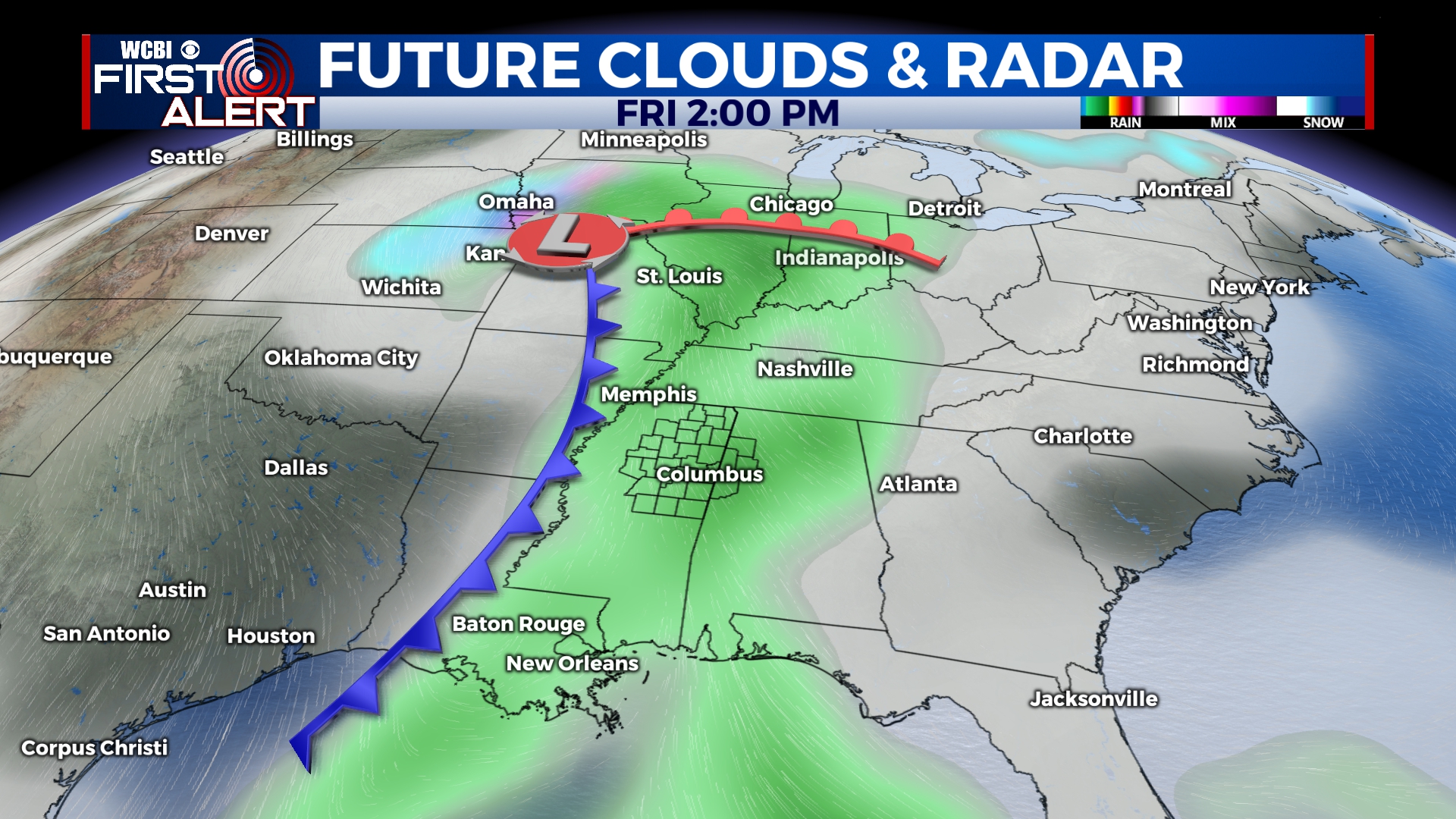
FRIDAY: Another system will approach the area, bringing the chance for some showers and storms to end the week. Temperatures will be in the 60s by the afternoon.
SATURDAY: As of now, it looks like any rain and storm activity will exit by the weekend, but a few clouds could linger. Temperatures will be near average with highs in the 50s and lows in the 30s.


Leave a Reply