Sunny & cooler end to the work week
 WEDNESDAY NIGHT: Variably cloudy skies during the evening will yield to clear conditions by sunrise. Lows will be in the upper 40s.
THURSDAY: Bright sunshine can be expected but highs are only going to be in the low to mid 60s in most spots. Breezy NW winds between 10 and 20 mph will make it feel cool all day long.
THURSDAY NIGHT: Clear and chilly weather sets up up shop again. Look for lows in the upper 30s. Some patchy frost can’t be ruled out, especially in low lying and shelter spots near the Tennessee River Valley.
FRIDAY: Afternoon highs are going to be in the upper 60s to around 70 under sunny skies. A cool northeasterly breeze remains in place.
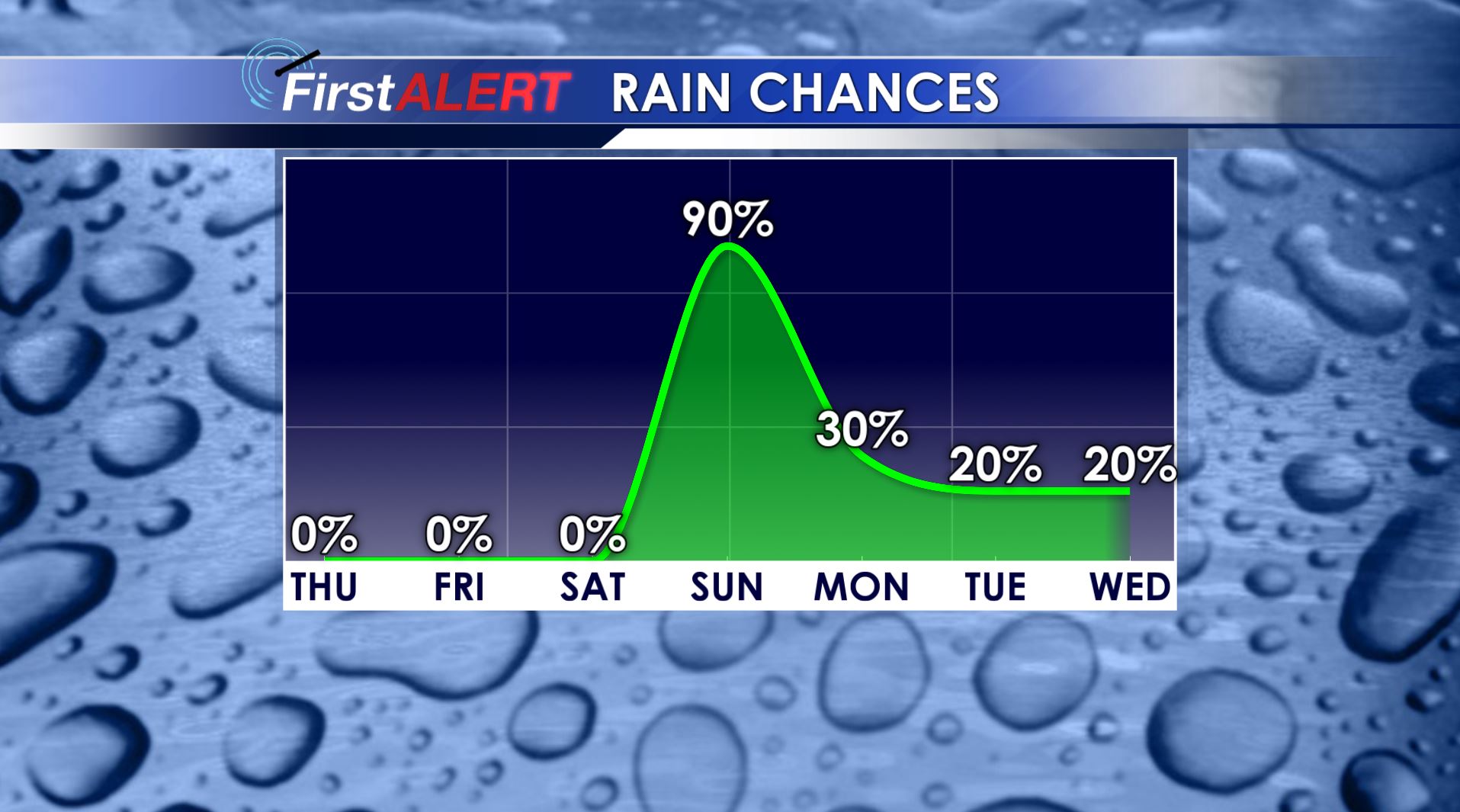
SATURDAY: Clouds are going to be on the increase but we’ll stay dry. This bodes well for the air show at CAFB and the many other events scheduled across the region. Highs should get back into the low 70s.
SUNDAY: A wet day is likely along with highs in the mid 60s. While a few storms can’t be ruled out this far north the better chance of strong storms remains across central and southern Mississippi. We’ll keep watching it.
Follow @WCBIWEATHER on Facebook, Twitter, Instagram, and Snapchat


Leave a Reply