Sunny Saturday, stormy next week
SUMMARY: Seasonable and sunny weather is in store for Saturday. Some showers may redevelop by late Sunday with even more rain Monday through Wednesday. A batch of heavy rain and strong to severe storms is still possible Tuesday into Wednesday.
FRIDAY NIGHT: Partly cloudy. A few isolated showers are possible across far northeast Mississippi and north Alabama. We’re going to keep the rain chance less than 20%. Lows in the mid to low 30s.
SATURDAY: Mostly sunny. Highs the 50s to low 60s. Variable winds about 5 mph.
SATURDAY NIGHT: Mainly clear. Lows in the upper 30s to lower 40s.
SUNDAY: Increasing clouds. Some showers are possible by late afternoon and evening. Highs top out in the upper 60s. Breezy southerly winds between 10 and 20 mph develop.
MONDAY: Mostly cloudy with areas of rain showers. The chance of rain is 60%. Highs look to be in the low 70s.
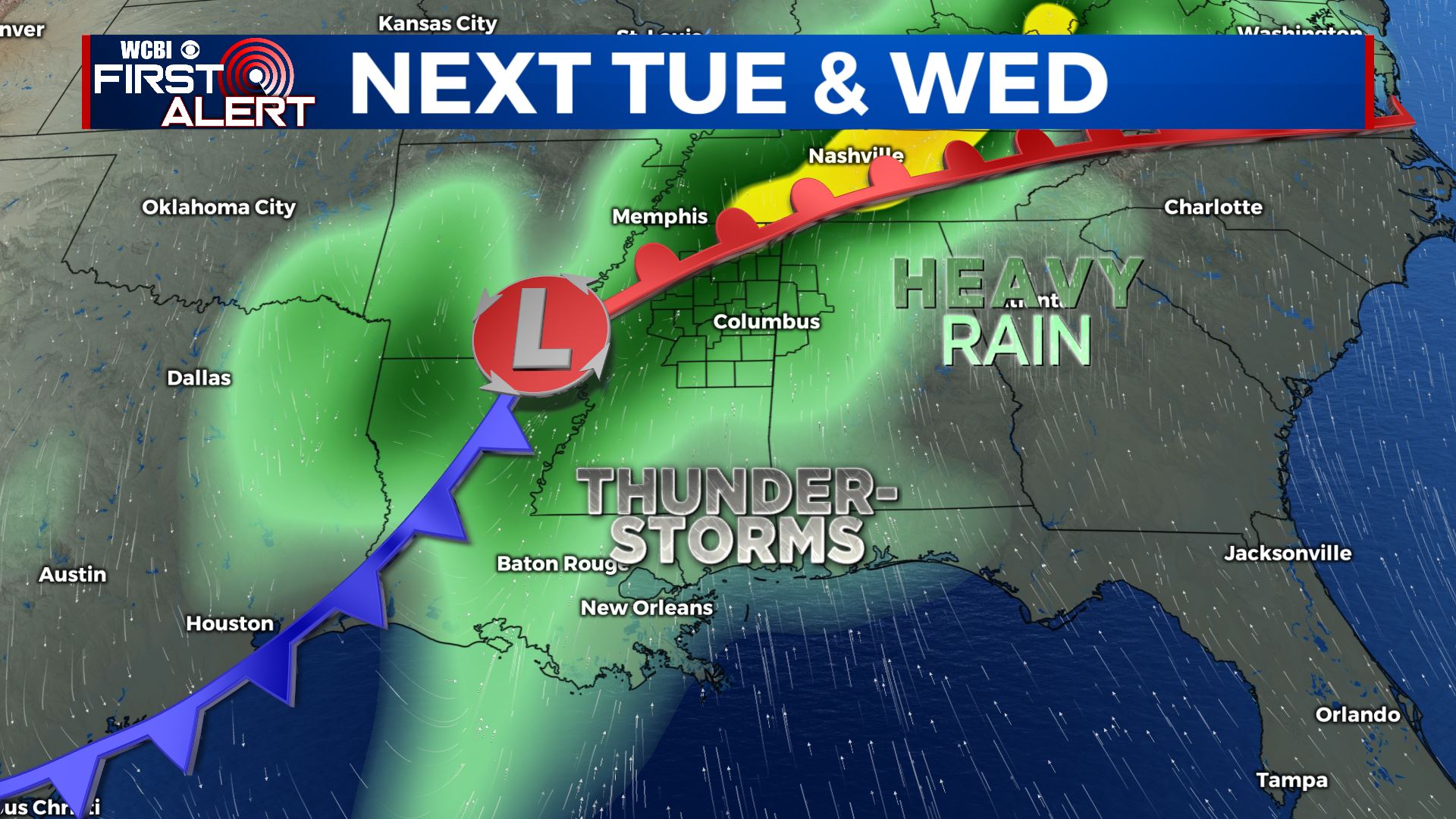
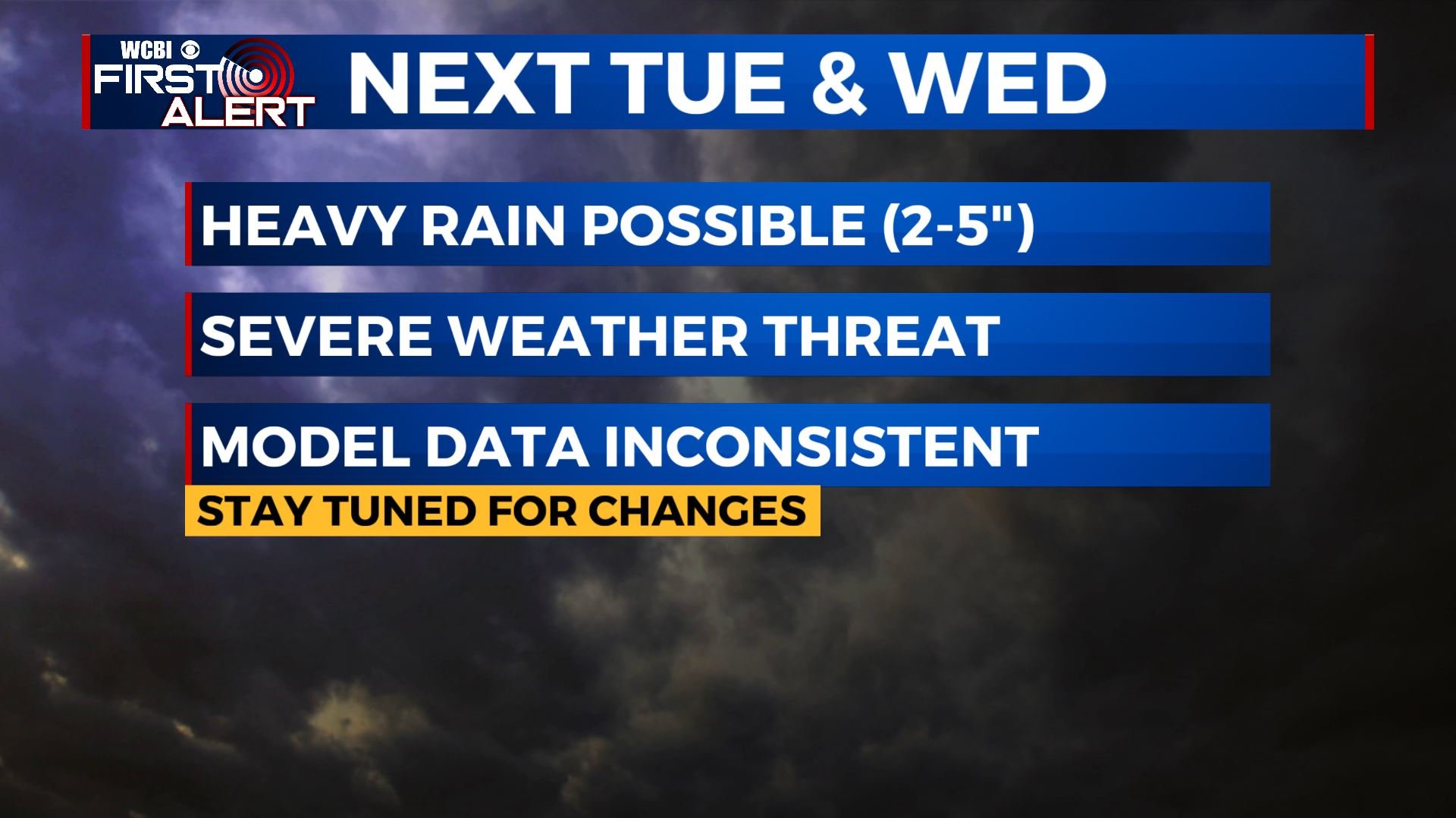
TUESDAY-WEDNESDAY: Data suggest that a big weather system will move through the region. Model consistency is not has high as it had been but we’re going to keep the potential of 2 to 5 inches of rain going in addition to the threat of strong to severe storms. We urge you to check back with us during the weekend for updates regarding impacts and more specific timing because changes will be made to the forecast.
Follow @WCBIWEATHER on Facebook, Twitter, Instagram, and on the WCBI News App


Leave a Reply