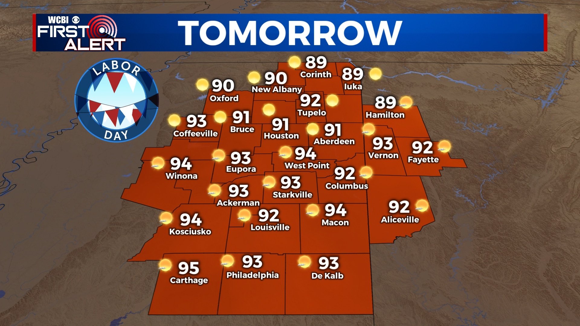
Sunny and warm Labor Day, humidity increases
We’ve been enjoying some less-muggy air through the weekend, but humidity values will slowly increase through the week. Rain chances will remain minimal until at least Wednesday or Thursday as a cold front approaches the area. We could see some slightly cooler air by next weekend as a result of the front.
SUNDAY NIGHT: Another nice and cool night in store with a few clouds passing through. Lows in the mid 60s with a calm wind.
MONDAY: Labor Day will feature tons of sunshine and slightly warmer temperatures. You may also notice the humidity slowly starting to creep back up. Highs will be in the low 90s with no chance for rain.
TUESDAY: Pretty nice weather continues for Tuesday, but there is a slight chance of an isolated shower or storm. We’ll remain partly cloudy with highs in the low 90s.
WEDNESDAY-FRIDAY: Chances for some showers and storms will increase for the second half of the week as a cold front approaches the area. Not everyone will see rain every day, but scattered downpours are possible. Temperatures will top out in the upper 80s to near 90 with overnight lows in the 60s.
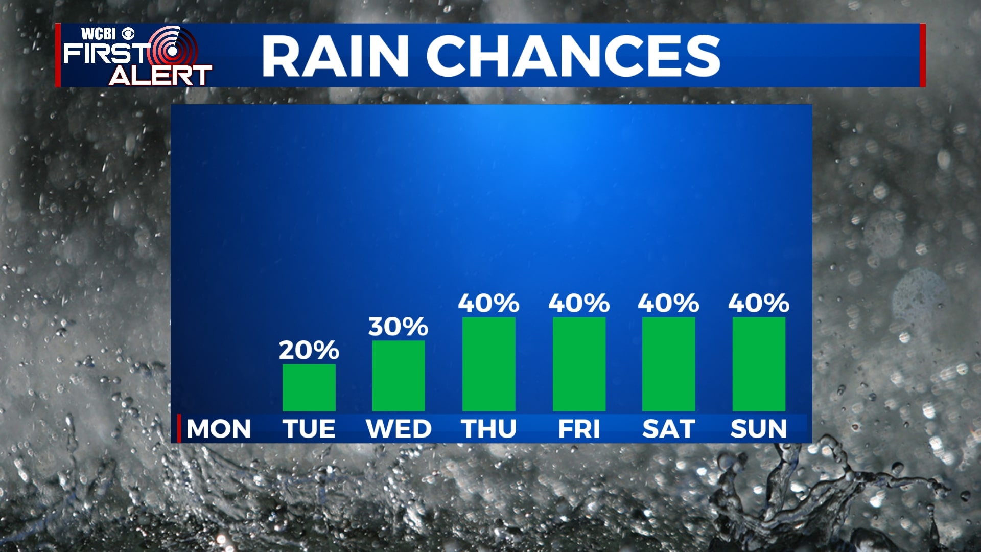
SATURDAY-SUNDAY: The forecast for next weekend remains up in the air as we aren’t really sure what this cold front is going to do. If it stays to our north and west, we’ll see showers and storms along with warmer temperatures. If it manages to make it through the area, we’ll see drier and cooler air filter in. For now, until things become a little more clear, we’re going to split it down the middle. We’ll go with highs in the low to mid 80s and overnight lows in the 60s, along with a 40% chance of showers and storms. This forecast can and will change, so check back for updates!


Leave a Reply