Sunny Weather Now, Rain Returns Later
We’ll have a mix of sun and clouds for the beginning of the week with highs back into the upper 60s and low 70s. Rain returns by the end of the week before our next big cool down.
SUNDAY NIGHT: A few clouds will build in across the area, but we’ll generally stay clear. Lows will be in the low to mid 30s with patchy frost.
MONDAY-WEDNESDAY: We’ll see off and on cloud cover to start the week, but we’ll still see plenty of sunshine. Highs will be in the upper 60s to near 70 as we get into Wednesday. We will remain dry through Wednesday night.
THURSDAY: Thursday will start off dry before rain slowly moves in through the afternoon. Thursday evening looks pretty wet and showers will likely stick around into the overnight hours. We’re not expecting much in the way of storms, but some areas could pick up an inch or two of rain.
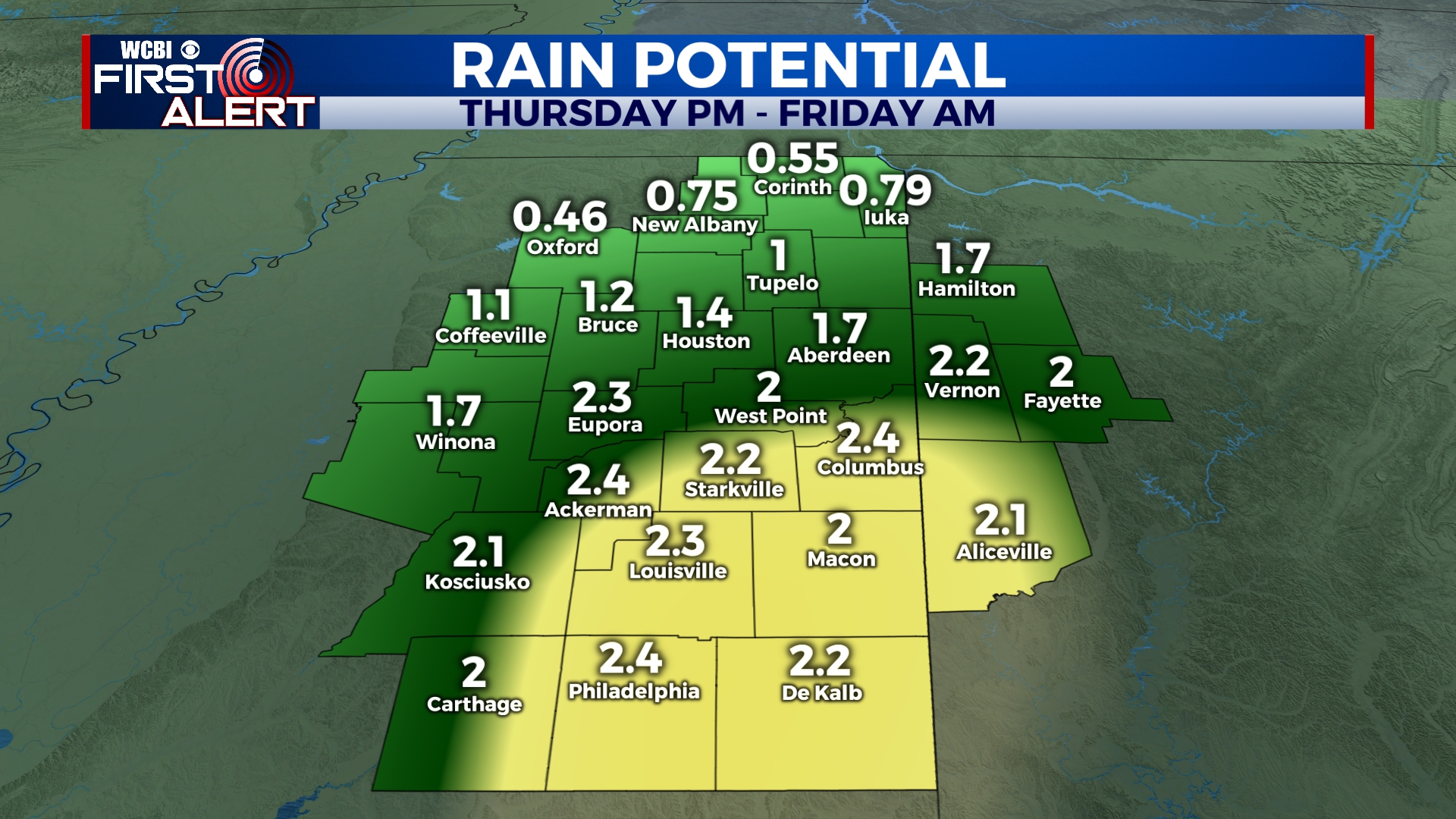
Heavy rain is possible Thursday evening into early Friday
FRIDAY-SUNDAY: Rain could stick around into the early morning hours of Friday, but should be clear by lunchtime or shortly thereafter. Cloud cover will clear the area as cold air rushes back into the area. It looks like we’ll be in for another nice weekend with highs will be back into the 50s and lots of sunshine. Morning lows will be in the low to mid 30s.


Leave a Reply