Sunny Wed & Thurs, all eyes on the tropics
SUMMARY: Dry air for Wednesday and Thursday should make for a more comfortable feel in the air, highs in the upper 80s to around 90. Lows will be quite comfortable as well. By Friday, the humidity will be making a comeback as our eyes will be focused on the tropical threat in the gulf. The National Hurricane Center now has given this disturbance a 90% chance of formation, so we are almost guaranteed tropical impacts this weekend and early next week. The question is, how big will the impacts be? Rainfall totals could be hefty across the area, with scattered storms for Saturday and widespread, potentially heavy tropical rains Sunday to Tuesday. It all depends on the track of the system, a more westerly landfall in Texas or western Louisiana could mean more impacts here, since it would have more time to move to our more northerly latitude from the gulf coast. A landfall further East will allow it to move East a bit faster, keeping the brunt of the impacts to our South. As always, we will be watching closely.
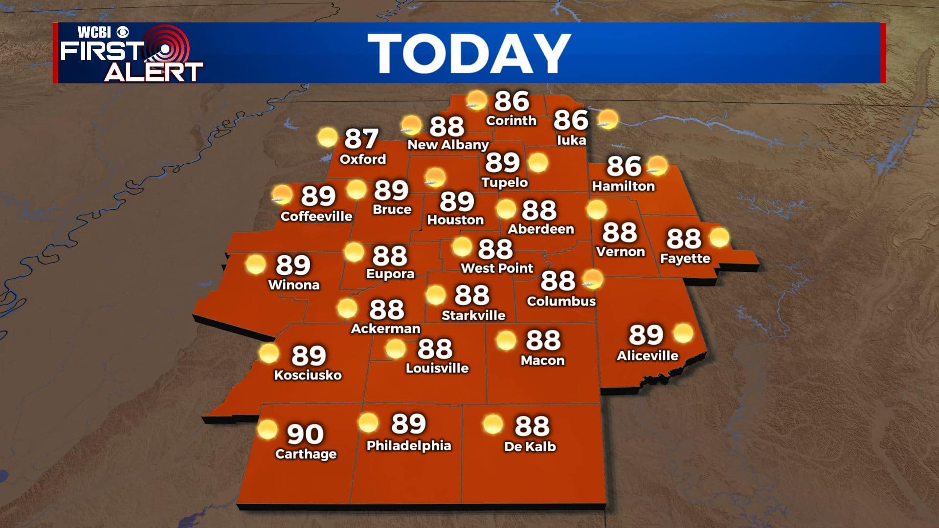
WEDNESDAY: Dry air and sunny skies in Control for Wednesday. I would expect hardly a cloud in the sky for most of the day. Highs in the upper 80s to near 90.
WEDNESDAY NIGHT: A cool and comfortable night in store, with lows in the low 60s for many of us. Skies will remain clear, but with calm winds dense fog could be an issue in some areas tomorrow morning.
THURSDAY: A bit warmer for Thursday, but drier air and sunny skies stick around. Highs will be right around the 90 degree mark.
THURSDAY NIGHT: Slightly warmer than Tuesday and Wednesday nights, but still pretty comfortable in the mid to upper 60s. Humidity will be on the increase through the night.
FRIDAY: Friday looks to be the last of the dry days this week. The humidity will be returning and more clouds will be streaming into the area ahead of the tropical system. A few late day showers in southern areas is not out of the question. Highs in the low 90s.
SATURDAY TO TUESDAY: Saturday, rain chances ramp up in the afternoon as we begin to be affected by the tropical system, likely will be named ‘Claudette’. Highs a bit cooler in the mid 80s. Sunday, the entire area looks to get in on widespread heavy rain, and with already saturated soils from last week’s flooding, flash flooding could again become a major problem. 5-10″ of rain is not out of the question for someone in the viewing area. Gusty winds and spin up tornadoes could be a concern as well. Staying wet for Monday and Tuesday, as tropical moisture will be staying in the region, Highs in the low to mid 80s due to cloud cover and rain. Lows will stay around the 70 degree mark from Friday onward.


Leave a Reply