Temperatures warming back up this week, some showers possible
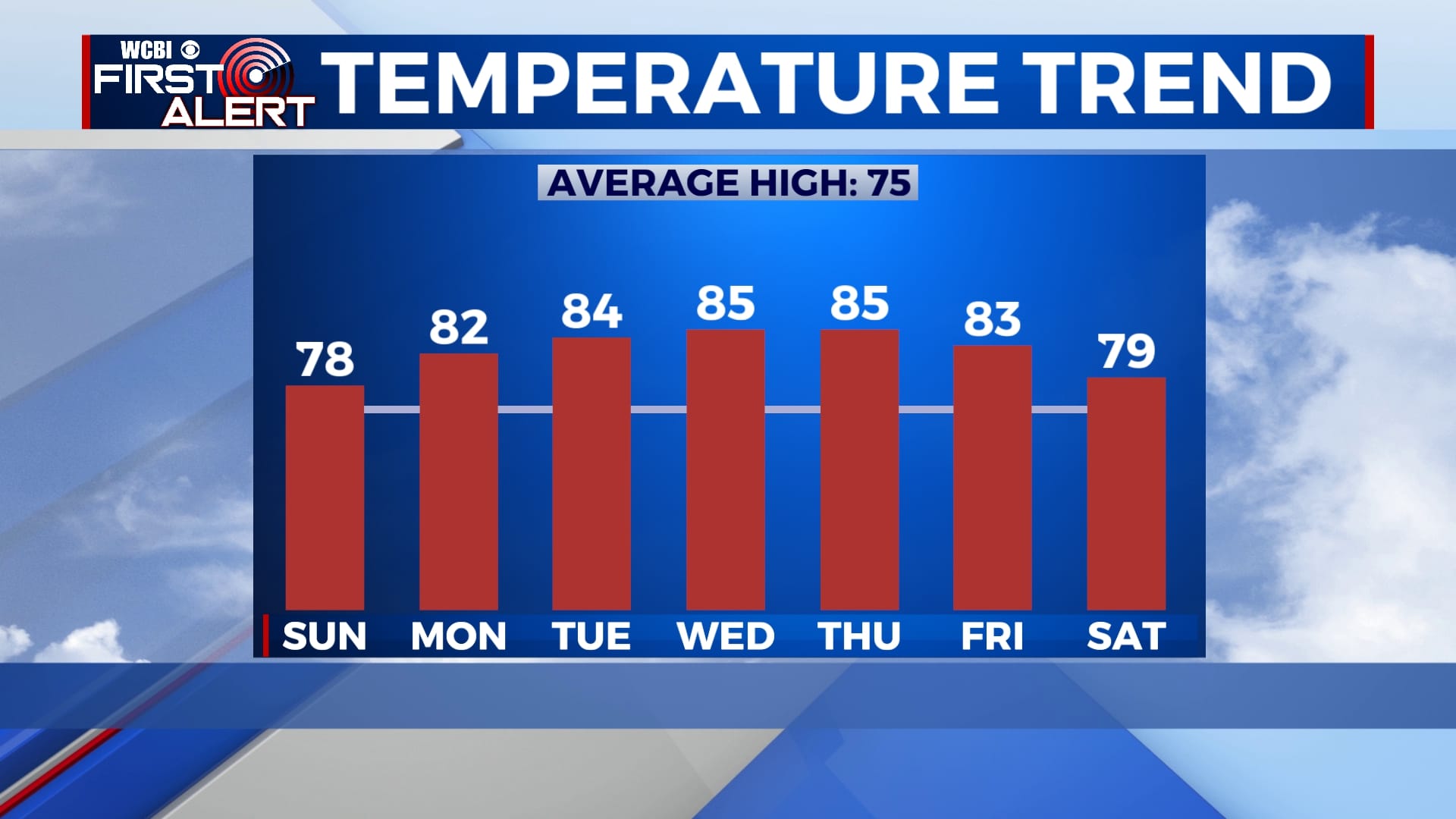
Our taste of cooler air will be short-lived as temperatures are expected to gradually rise back into the 80s this week. Rain chances will remain minimal for the next couple of days, but some sprinkles are possible through the week. Our best chance for rain will be Friday as another cold front approaches.
SATURDAY NIGHT: We won’t be quite as cold tonight, but it’ll still be chilly. Lows will be in the mid to upper 40s under a mostly clear sky. A few clouds could move in late.
SUNDAY-MONDAY: Temperatures will continue to rise over the next several days with highs near 80 and plenty of sunshine on both Sunday and Monday. A cold front will try to move through Monday, but it won’t quite make it to us. This means we’ll continue to warm through the week.
TUESDAY-THURSDAY: There will be a chance for some hit-or-miss sprinkles through the middle of the week, but widespread rain is unlikely. Most of us will see a mix of sun and clouds as highs reach the mid 80s each afternoon. Morning lows will remain in the low to mid 60s.
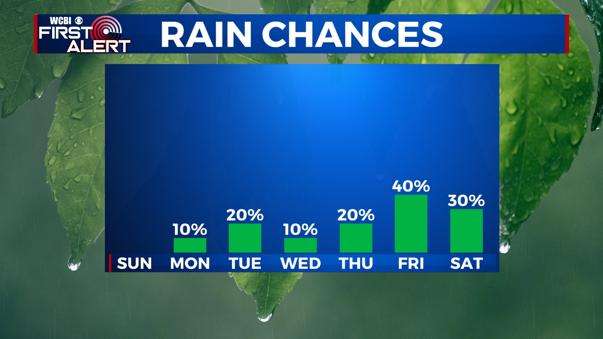
FRIDAY-SATURDAY: A cold front will approach the area late Thursday night, meaning we’ll see some off-and-on showers on Friday. These could last into Saturday morning and, depending on how slowly the front moves, possibly into Sunday as well. This front will bring our high temperatures from the low 80s on Friday to the mid and upper 70s on Saturday with overnight lows back into the low 60s.
Follow WCBI Weather on Facebook, Twitter, and Instagram


Leave a Reply