The return of typical summertime weather as we end the workweek
SUMMARY: A very typical summertime weather pattern is back for the rest of the workweek. Shower and storms chances will be isolated to very scattered. Highs will be warmer & humid in the lower 90s. A cold front will approach then stall out to the north beginning Sunday and continuing into next week that will increase our chances for showers & storms in the forecast.
WEDNESDAY: Looking to be a bit drier with more of a mix of sun & clouds. Still can’t rule out the chance for afternoon isolated showers & storms. Staying warm & humid with highs in the upper 80s to lower 90s.
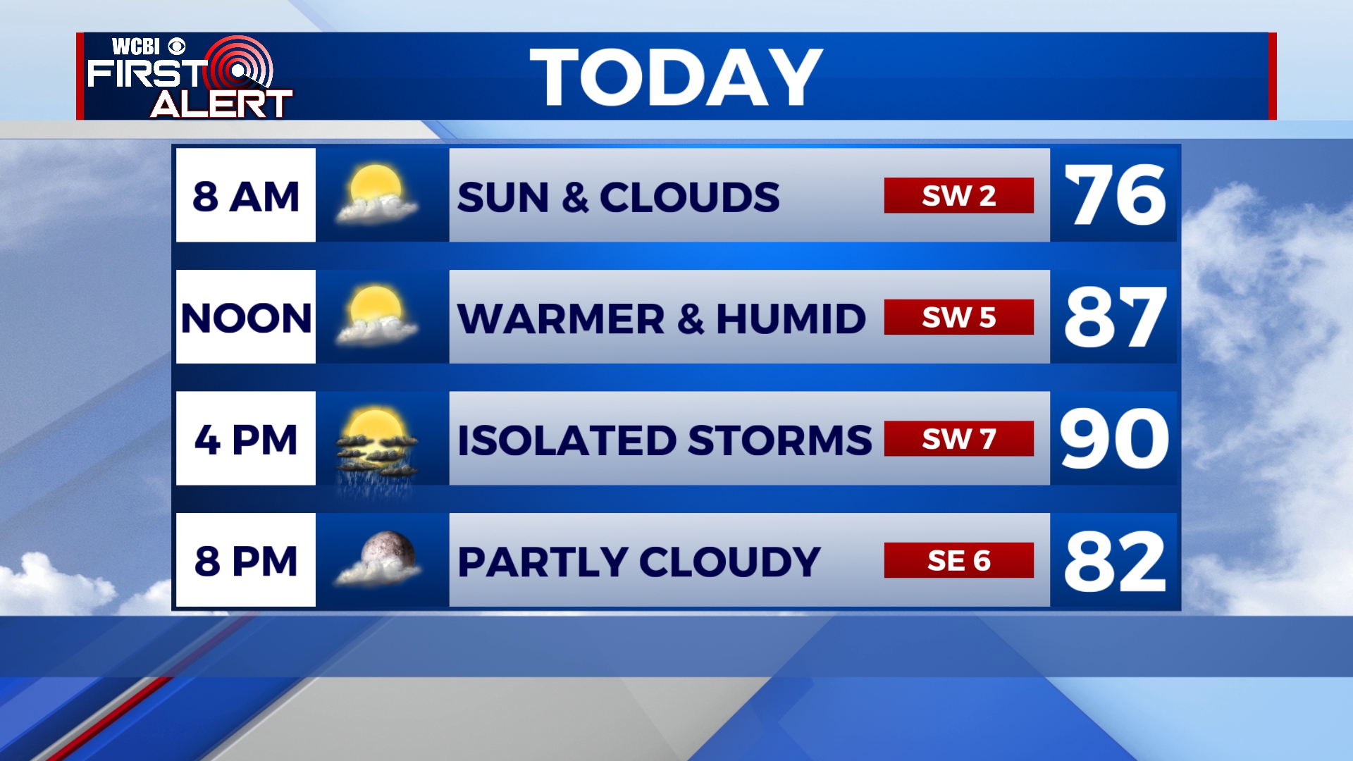
WEDNESDAY NIGHT: any lingering storms will quickly dissipate into the overnight hours. Partly cloudy skies prevail with lows in the low 70s.
THURSDAY: A mix of sun and clouds with highs back up to near average in the lower 90s. Some isolated to scattered afternoon showers and storms are possible.
FRIDAY-SATURDAY: Chances of those afternoon summertime showers & storms stick around. Staying warm & humid overall with a mix of sun & clouds. Highs in the upper 80s to lower 90s. Overnight lows in the lower 70s.
SUNDAY-TUESDAY: A cold front will stall out on Sunday, bringing us more widespread chances showers and storms as we head into the new workweek. The cloud cover will keep those high temperatures a bit cooler in the mid to upper 80s. Overnight lows will be right around the 70 degree mark.
Stay connected with @WCBIWEATHER on Facebook, Twitter, Instagram and the WCBI News App


Leave a Reply