The summer warmth & muggy conditions lasting into the weekend
SUMMARY: Scattered shower & storm chances remain in the forecast for the rest of the workweek and the coming weekend. It will be getting warmer & steamy outside as high temperatures will get up into the lower to mid 90s. Heat indices may be in the 100-105+ range throughout the weekend outside of any storms that pop up so make sure you take the proper precautions to stay cool & hydrated.
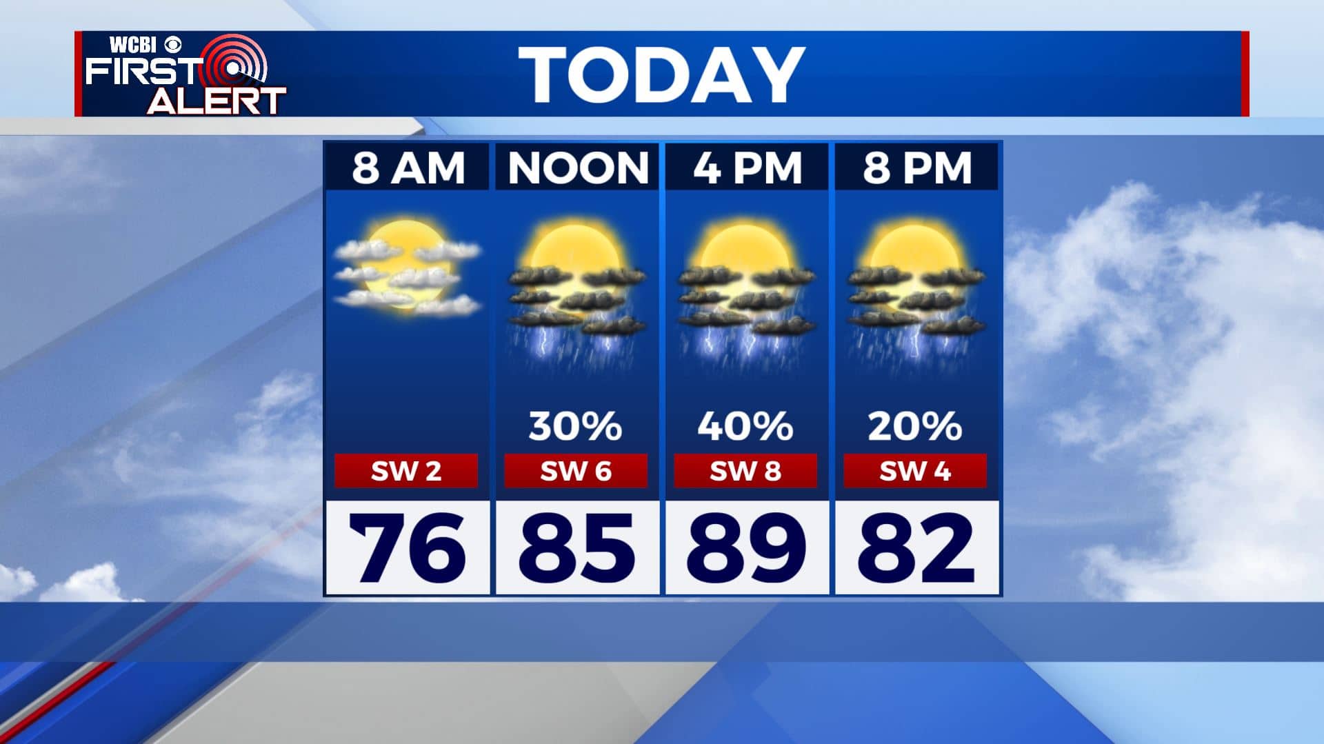
THURSDAY: We’re dealing with a few isolated showers/thundershowers this Thursday morning. We’re basically pressing the repeat button for your weather today. A mix of sun & clouds with a scattered chance of showers and storms, especially in the afternoon with the daytime heating. Highs warm & humid in the upper 80s to around 90.
THURSDAY NIGHT: Partly cloudy with a chance of a few showers and storms. Overnight lows in the mid 70s.
FRIDAY-SUNDAY: Partly sunny, warm, and humid. Highs in the lower to mid 90s with heat indices in the 100-105+ range during the peak daytime heating outside of any storms that develop. A daily scattered chance of showers and storms. We could have a few storm complexes that roll down from the Plains from time to time. Those could be wind and rain producers if they do pan out. It’s sometime we’ll be watching.
EARLY NEXT WEEK: Rain & storm chances dwindle to an isolated chance as the region looks to dry out a bit. Highs remain in the low to mid 90s with overnight lows in the lower to mid 70s. Triple digit heat indices continue as high pressure is set to build in to the region.
Stay connected with @WCBIWEATHER on Facebook, Twitter, Instagram, and the WCBI News App


Leave a Reply